

The Most Beautiful Day Hike from the Grand Canyon South Rim
Purchases made through some links on this page may provide The Detour Effect with commissions (at no extra cost to you). Thank you!
I have hiked all of the main Corridor trails in Grand Canyon National Park in Arizona plus some of the Threshold trails. I have backpacked Rim to River, Rim to Rim, Rim to Rim to Rim, and Hermit Trail, taking each of these all the way to the bottom of the canyon on overnight trips. I lived and worked onsite at the South Rim of the Grand Canyon for a few seasons, during which time I tried to experience as much of the canyon as I possibly could. Nothing has ever changed my opinion that Plateau Point is the most beautiful day hike from the Grand Canyon South Rim.
Obviously beauty is subjective and in the eye of the beholder, but on this particular topic I will not hear any counterarguments. Plateau Point is definitely the most spectacular viewpoint that is accessible from the South Rim without having to backpack and camp overnight, or climb.
I am not saying it’s the most beautiful viewpoint in the whole of the Grand Canyon, which is 277 river miles long. We’re not talking about the Havasupai Reservation here, nor the North Rim. We’re talking about day hikes from the South Rim. For a refresher to orient yourself on the different sections of the Grand Canyon, check out my Ultimate Grand Canyon Trip-Planning Guide and my Ultimate Grand Canyon Hiking Guide. If you’re looking for a few day hikes to do in addition to Plateau Point, check out my 3 Day Grand Canyon South Rim Itinerary for Hikers.
Remember to check Grand Canyon National Park’s Alerts and Conditions and Critical Backcountry Updates pages. Plateau Point Trail has some upcoming closures.
It costs $35 per vehicle to enter Grand Canyon National Park. This allows you 7 days of entry. Alternatively, you can show your America the Beautiful Annual Parks Pass. If you don’t order a pass in advance, they can be purchased from a ranger at the entrance station.
Plateau Point Day Hike Stats
Mileage: 12 miles roundtrip
Style: Out-and-back
Trailhead: Bright Angel Trailhead
What is Plateau Point at the Grand Canyon South Rim?

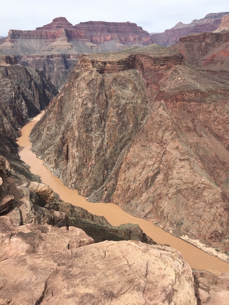

Plateau Point is a gorgeous viewpoint overlooking the Colorado River. The top of the South Rim is at about 7500-7000ft and the Colorado River is at about 2500-2000ft, with Plateau Point sitting almost halfway between them at ~4000ft.
When standing at Plateau Point, hikers will have 360° views of canyon walls rising around and above them. The Colorado River looks massive and close from Plateau Point in comparison to the distant view of the river you’d have at Skeleton Point on South Kaibab Trail. Endangered California Condors are often spotted at Plateau Point.
Plateau Point is visible from various viewpoints at the top of the South Rim. When you’re at the Geology Museum, for instance, look down on a faint trail traversing a large flat plateau to your left.
How Long Does it Take to Hike to Plateau Point in the Grand Canyon?

To get to Plateau Point from the South Rim requires a 6 mile one-way hike, or 12 miles roundtrip. The amount of time this will take you depends on your individual pace and the current weather and trail conditions.
The first 4.5 miles of the hike involve a descent from the South Rim to Havasupai Gardens, which is a popular campground and hiker rest stop. The last 1.5 miles are totally flat as you cross the plateau.
The descent and flat portion of the hike may go by quickly, but don’t forget you have to retrace your steps back up. The last 3 miles or so of that ascent are the steepest and will have you breathing hard. You need to make sure you still have legs and lungs by the time you get to this final stage of the hike. A common piece of wisdom is to predict that the ascent out of the canyon could take you the amount of time the descent took x1.5. If it took you 3 hours to descend, it could take 4.5 hours to ascend.
How to Hike to Plateau Point at the Grand Canyon South Rim

To day hike to Plateau Point, the most popular and direct route involves beginning from Bright Angel Trailhead. This trailhead is located in Grand Canyon Village just behind and to the west of Bright Angel Lodge.

You can park for free at Bright Angel Lodge or parallel park on Village Loop Drive in front of the lodge, although these spots fill up very quickly. The next best bet is to park for free at the Backcountry Information Center, which is only about a 10 minute walk from Bright Angel Trailhead. I have never had trouble parking there, but worst case scenario, you could park at the massive parking lot at the main Visitor Center and then take the free Village Shuttle/Blue Shuttle line to Bright Angel Lodge.
As you descend Bright Angel Trail, you will pass a few noteworthy landmarks. First you’ll cross underneath two separate rock arches or “tunnels”. Just after the first tunnel, look high up on the canyon wall to your left for Native American pictograph drawings depicting animals!
Switchbacks form most of the upper 3 miles of Bright Angel Trail. Soon you’ll arrive at 1.5 Mile Resthouse, where you can refill your water bottle(s) from the potable pumps or use the pit toilets. There is also an emergency telephone at 1.5 Mile Resthouse.
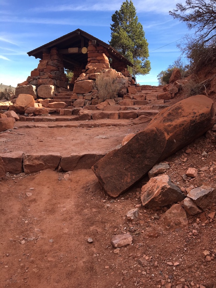
Next up is 3 Mile Resthouse, which features all the same amenities as 1.5 Mile Resthouse. From here, Bright Angel Trail begins to open up with more expansive views. You are no longer zig-zagging along the canyon walls, but are now making your way further out into the inner canyon to approach Havasupai Gardens.
If you have a fear of heights and the idea of having the canyon wall to one side of you was reassuring, don’t worry about this change after 3 Mile Resthouse. The trail is no longer narrow and does not have deep drop-offs to the side, so from 3 Mile Resthouse to Havasupai Gardens is actually quite relaxing.
As you near Havasupai Gardens, the landscape becomes flat as you follow along Garden Creek. The creek encourages vegetation, so depending on the time of year, you may encounter a lot of lush green trees and foliage. I usually see mule deer grazing at Havasupai Gardens!
There are more potable water pumps and pit toilets at Havasupai Gardens. There is also a Ranger Station, picnic tables, a campground which requires a permit, and a corral for the mule train.
Look for signs directing you towards Plateau Point Trail. You’ll now be splitting off from Bright Angel Trail; be careful not to continue on Bright Angel by accident.
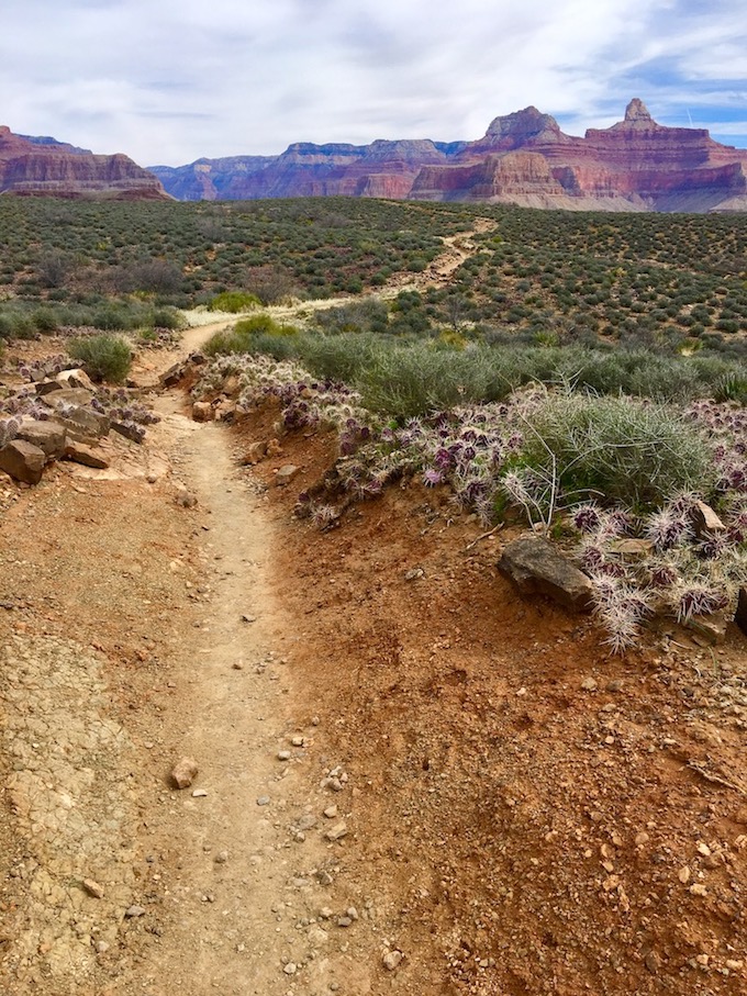
First you’ll cross over the shallow and trickling Garden Creek through tall reeds, which eventually spit you out onto the expansive plateau. There will be very little shade from this point forward and you’ll have unobstructed views of rock formations across the canyon. This last 1.5 miles is flat, easy walking.


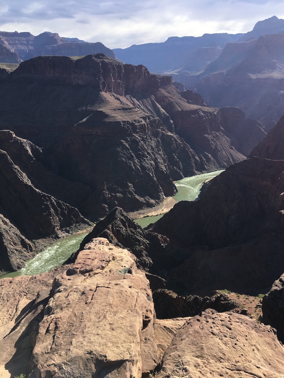
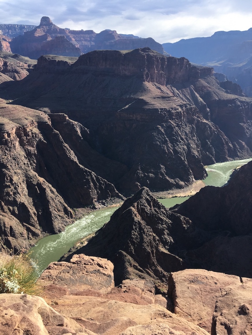
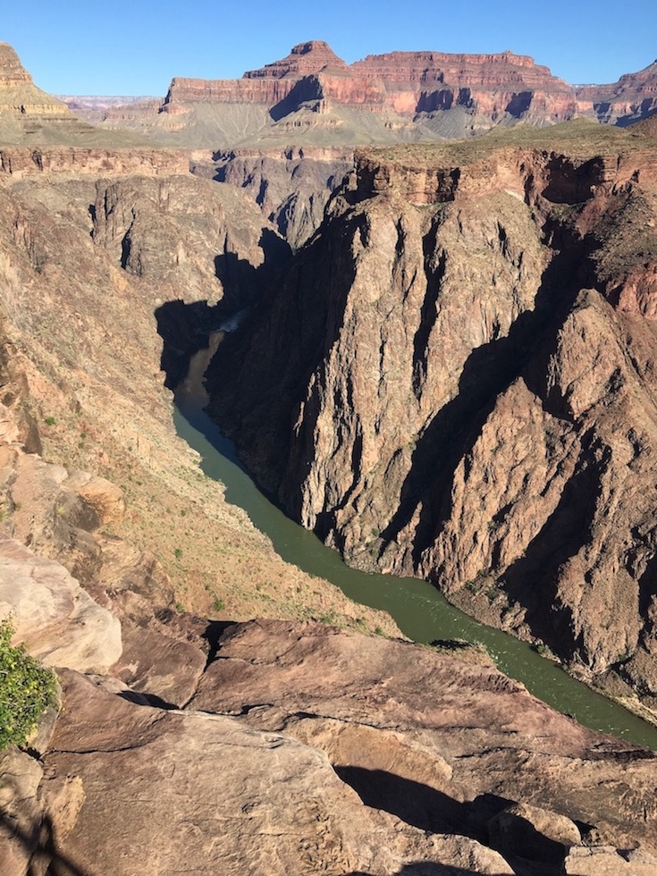
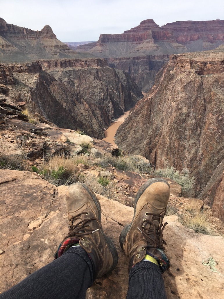
There will be very little doubt once you’ve reached the dead end of Plateau Point. The plateau literally forms a point, a rocky outcrop from which to gaze down at the Colorado River rushing, twisting, and turning below. The water may appear blue-green, or if it’s been churned up by recent storms, it could appear brown.

The plateau provides multiple vantage points to view the river towards both the west and the east, so you’ll want to wander across the rocks to gain all of these perspectives. It’s easy to stay far back from any ledges. Pick your favorite spot to sit down and have a well-earned lunch! Just be sure to keep your food away from the very brave and precocious squirrels who are guaranteed to approach you. There are signs everywhere in the canyon warning that the number one cause of Grand Canyon visitor injuries comes from squirrel bites; do not feed them! They are too habituated to human sources of food and some of them carry disease, including plague.
It’s impossible to satisfy oneself with the view, so I won’t say “when you’re ready,” but when it’s time to begin your return to the South Rim, retrace your steps the 1.5 miles along Plateau Point trail until you reach Havasupai Gardens. Then retrace your steps along Bright Angel Trail up to the South Rim. The last 3 miles or so, where the switchbacks return, will be the steepest and hardest part of the day hike. Take your time, have as many breaks as you need, and remember to keep hydrated and fed.
You’ll know you’re getting close to the end when Kolb Studio comes into view. When you emerge onto the South Rim, take a celebratory photo with the huge Bright Angel Trailhead sign and perhaps grab an ice cream from the Bright Angel Fountain!

Alternative Routes to Plateau Point from the South Rim

Bright Angel Trail is the most popular and crowded trail in the Grand Canyon because it’s extremely accessible. The trailhead is right there in Grand Canyon Village. Especially for the first mile and a half to reach 1.5 Mile Resthouse, but also as you descend to 3 Mile Resthouse and to a lesser extent Havasupai Gardens, you will be sharing the trail with many other hikers. The crowds do thin out the further you go. I have rarely shared Plateau Point Trail with anyone, although eventually some hikers do tend to join up with me while I’m resting and taking in the view at Plateau Point.
You do not have to take Bright Angel Trail to reach Plateau Point, although any other starting point will involve extra mileage and turn this adventure into a longer overnight backpacking trip. If you descend via Hermit Trail, you could turn off onto Tonto Trail at the Monument Creek junction and make your way east to hit Havasupai Gardens, then take Plateau Point Trail from there. If you descend via South Kaibab Trail, you could turn off onto the Tonto Trail junction at Tip-Off Point and head west until you reach Havasupai Gardens.
Safety Considerations for a Day Hike to Plateau Point
Remember that the potable water pumps at 1.5 Mile Resthouse, 3 Mile Resthouse, and Havasupai Gardens are only in service seasonally. Even when they are supposed to be working, there could be a construction project or other issue that puts a pump out of service. Check the Critical Backcountry Updates page from the National Park Service to see which water pumps are currently working. You may need to pack extra water in or filter water from Garden Creek.
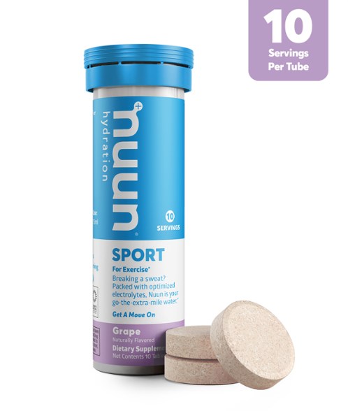
Hyponatremia is just as dangerous as dehydration! If you are drinking water but not replenishing salts and electrolytes you can become disoriented and delirious. Eat salty snacks and consider dropping electrolyte tablets in at least one of your water bottles.
I would advise carrying at least 3 liters of water on a day hike to Plateau Point in spring or fall, even if you expect all the potable pumps to be working. You may only really need two liters and have no trouble refilling your bottles or hydration reservoir, but the third liter is a “just in case.” In summer you should pack as much water as you can carry, at least four liters.
Read my Grand Canyon Hiking Guide for information about the best times of year to hike in the Grand Canyon. Summer temperatures are extreme, winter and spring may require microspikes, and there is a monsoon season. I would not advise doing this hike in the summer between late-May and early-September. I only once did a day hike to Plateau Point in the summer in late June, but only because it was for sunrise and I felt very confident about my pace and ability to return to the South Rim in time for my morning work shift. I would not want to get caught below rim during a summer afternoon.
I would advise carrying an emergency satellite communication device such as a Garmin InReach Mini and downloading offline maps via GAIA or another navigation app. You will likely not have cell service below the South Rim (or sometimes above the South Rim, either).
Mule riders and the mule duffel service use Bright Angel Trail. If a mule train is approaching during your day hike to Plateau Point, stop and get over to the wall side of the trail, not the canyon side, to let the mules pass. Do not make any sudden movements or noises to spook them.
Bright Angel Trail has to be at least wide enough for the mules to walk down with their round bellies, which is something to keep in mind if you have concerns about the trail being more narrow than you’re comfortable with. I personally don’t enjoy super skinny trails with steep drop-offs to the side, and I feel very comfortable on Bright Angel. You may have seen online that Bright Angel is one of the most dangerous hiking trails in the United States, but that’s because it’s very accessible. Tourists who have not done the proper research and aren’t wearing appropriate clothing or carrying any water can easily make their way down the trail from the village.
If you’re not comfortable hiking solo or prefer all the logistics to be taken care of for you, Wildland Trekking offers guided day hikes and overnight camping and lodge-based trips in the Grand Canyon.
What to Pack for a Day Hike to Plateau Point
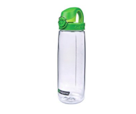
- At least 3 liters of water (I prefer Nalgene bottles; if you’re not sure about bottles vs. a hydration reservoir, check out my Common Hiking Gear Questions and No-Nonsense Answers post)
- Nuun electrolyte tablets
- Garmin InReach Mini
- Hat with a brim for sun protection
- Sunscreen
- Shoes with good traction on the bottom, such as Oboz Sawtooths, Merrell Moabs, or Altra Lone Peaks
- Liner socks to prevent blisters plus regular hiking socks (or socks that are already double-layered)
- Sweat-wicking base layer shirt made of polypropylene, nylon, polyester, or merino wool
- A mid-weight jacket layer such as a nanopuff or fleece
- Hiking pants or shorts
- Salty snacks
- Lunch
- Hair tie or clip if you have long hair
- GAIA or other navigation app on your phone with pre-downloaded offline maps
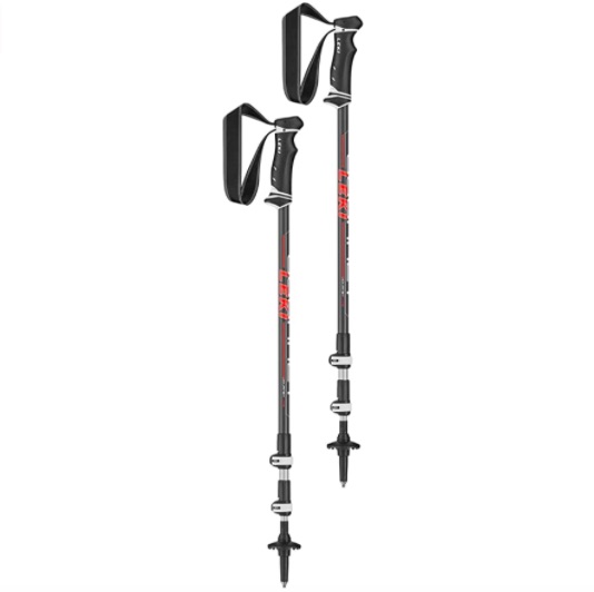
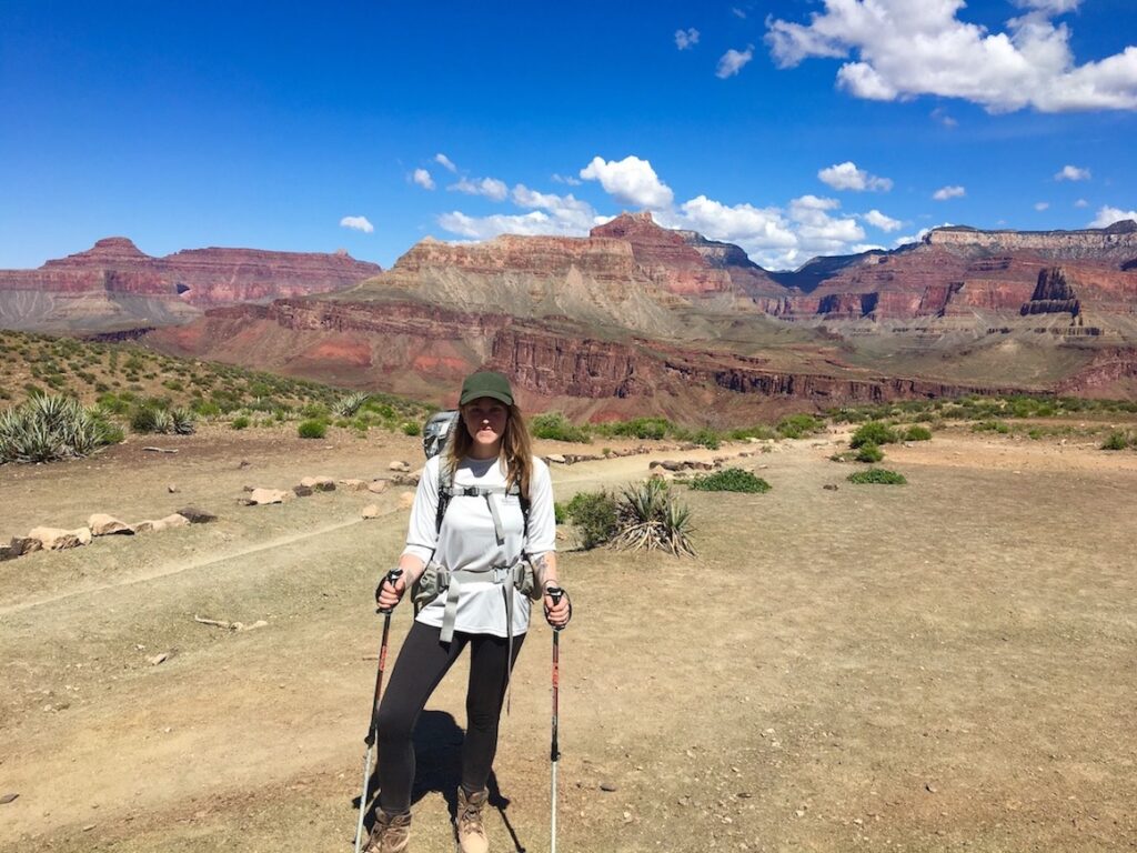
- Trekking poles (I like Leki). This is not a “must” but out of anywhere in the world, the Grand Canyon is the place I most like to have them because of the steep descents.
- You might like to have energy gels or energy chews to replenish carbs if you find it difficult to digest regular snacks during strenuous activity, but these should not be relied on entirely. You need real food.
- Headlamp (even if you’re not hiking in the dark, this is one of the ten essentials)
- First aid (most hikers are not willing to commit to hauling around a heavy full-service first aid kit, but bringing a few essentials such as band-aids could come in handy for things like blisters, at least)
- Rain gear such as a rain jacket or poncho and pack cover, depending on the forecast
- Microspikes if there is lingering ice or snow
You do not need bug spray in the canyon or any kind of bear protectant such as bear spray.
🏨 Are all the in-park hotels already booked out? Find budget hostels near the Grand Canyon or standard hotels in Tusayan.
✈️ Coming to Arizona from further afield? Use an Airalo eSIM for affordable international cell data and don’t forget to protect your investment with travel insurance.
Related:


Pin It:

My dream is to write travel and hiking content full-time. All of my guides and itineraries are free and my travels are self-funded. If you enjoy my site and would like to support, you can donate any amount to my Ko-fi page. Thank you!!
Your pics are beautiful! I can’t believe how green some of them are! We did a short portion of Bright Angel Trail in late May 2005. It’s been on my list to go back, just haven’t made it yet…
Thank you! It’s hard not to get a good picture at Plateau Point, it’s so dramatic.