
The Ultimate Grand Canyon Hiking Guide
Purchases made through some links on this page may provide The Detour Effect with commissions (at no extra cost to you). Thank you!
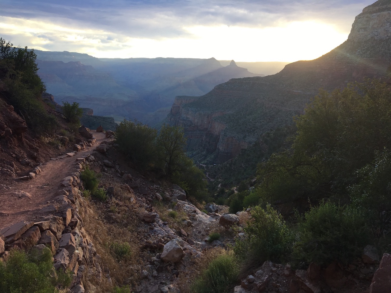
My fondest memories are of living, working, and hiking on the South Rim of Grand Canyon National Park. Since that time, I have travelled nomadically and hiked in many national parks around the country and the world, but I left my heart in Arizona. On my days off or in the mornings before work, I had the privilege of hiking below rim again and again. I also currently work for a guided hiking company that runs trips in the Grand Canyon, so I answer questions about it every single day. This hiking guide to the Grand Canyon includes all the most pertinent information you’ll need to know when planning an outdoor adventure in the national park, whether it’s your first trip and you’re simply aiming to familiarize yourself with the best day hikes on the South Rim, or perhaps you’re ready to level up to an overnight backpacking trip in the Grand Canyon.
This post is a companion piece to my Ultimate Grand Canyon Trip-Planning Guide, which includes information about tours, accommodations, parking, and transportation on the South Rim. If you’d like advice on how to condense the information below into a step-by-step itinerary, check out my 3 Day Grand Canyon South Rim Itinerary for Hikers.

The Ultimate Grand Canyon Trip-Planning Guide
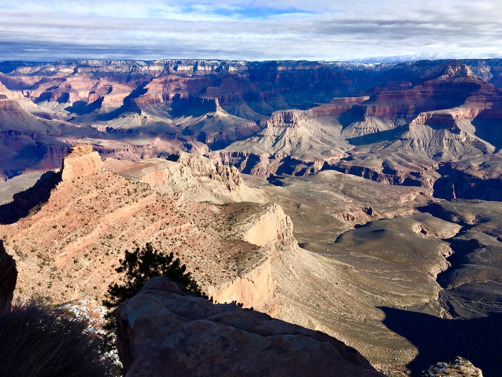
Orienting Yourself with Grand Canyon Hiking
Trail Designations/Difficulty Levels

To plan a hike in the Grand Canyon, you’ll need to understand the different trail designations. The Park Service divides Grand Canyon hiking trails into three categories: “Corridor Trails”, “Threshold Trails”, and “Wilderness Trails”. Corridor trails are well-maintained by the Park Service nearly year-around. They may have potable water sources, pit toilets, designated campsites, and/or rangers patrolling. They get a good amount of foot traffic and are very popular. Corridor trails include South Kaibab, Bright Angel, and North Kaibab. The reason I said these trails are maintained “nearly” year-around is because the North Rim is closed in the winter and therefore North Kaibab doesn’t get maintenance during that time. The South Rim is open year-around.
Threshold trails only get maintenance maybe once every three years or so, so they are more rugged and secluded than the Corridor trails. Still, you might see a few other hikers out there. There are not any potable water sources or amenities, but there are some designated campsite spots. If there has been recent rockfall through the trail due to weather, that will likely still be there during your hike since cleaning up these trails is not an urgent priority. Threshold trails include Hermit and Grandview.
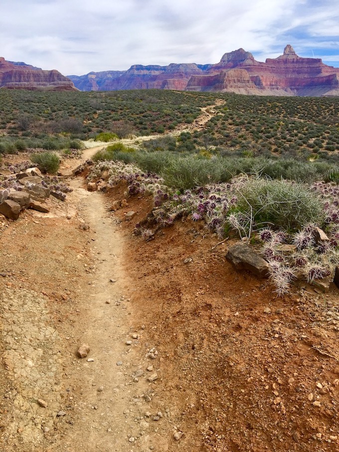
Wilderness trails (or “primitive trails”) are never maintained at all, so they are extremely rugged and secluded. It is unlikely that you’d run into any other hikers. There may be loose scree and exposed narrow sections with steep drop-offs. These include Boucher Trail, New Hance, some sections of Tonto, etc.
South Rim vs. North Rim
The North Rim (8000-8500ft) is 1000 feet higher than the South Rim (7000-7500ft) and is therefore cooler in temperature and snowier in the winter. It has an almost alpine environment that reminds me of Colorado. It’s open from May 15-Nov 30 each year, although in 2023 it was closed until June 2nd because of excessive snow. It takes four hours to drive from the South Rim to the North Rim, so most people choose one side or the other. The North Rim is generally less crowded than the South Rim, but it also has fewer hotel, restaurant, and activity options. If the rest of your trip involves northern Arizona sightseeing in and around Flagstaff, Sedona, and Petrified Forest National Park, the South Rim is the easiest part of the Grand Canyon to access. If most of your trip involves Southern Utah sightseeing in and around Kanab, Page, or St. George, the North Rim is the easiest to access.
For my purposes here I am going to focus mainly on the Corridor trails and Threshold trails. I’ll also focus mainly on the South Rim, although I’ll touch briefly on the North Rim. This guide is an introduction hiking in the Grand Canyon, but plenty of guidebooks out there will detail more involved wilderness routes.
Prefer to hike with a professional guide? Check out Wildland Trekking‘s guided day hikes and overnight backpacking tours in the Grand Canyon.
Grand Canyon Day Hikes
I am often asked for recommendations for “easy to moderate” Grand Canyon day hikes, and it’s important to note that I’m not sure any trail can be considered “easy” except the Rim Trail. Every hike that goes down into the canyon below rim is going to have some major elevation change, and regardless of your fitness level you’ll be breathing hard on the ascent back out. That said, you can go as far as you want and then turn around, and in the grand scheme of things I would say Bright Angel is the “easiest” below-rim hiking trail on the Grand Canyon South Rim. South Kaibab is the second easiest, Hermit is the third, Grandview is the fourth, and then you get into primitive trails which would be the toughest.
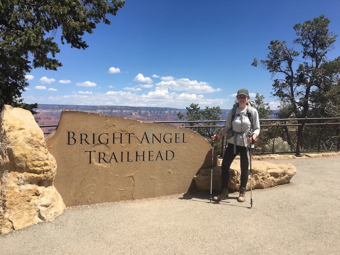
Bright Angel Day Hikes
Havasupai Gardens


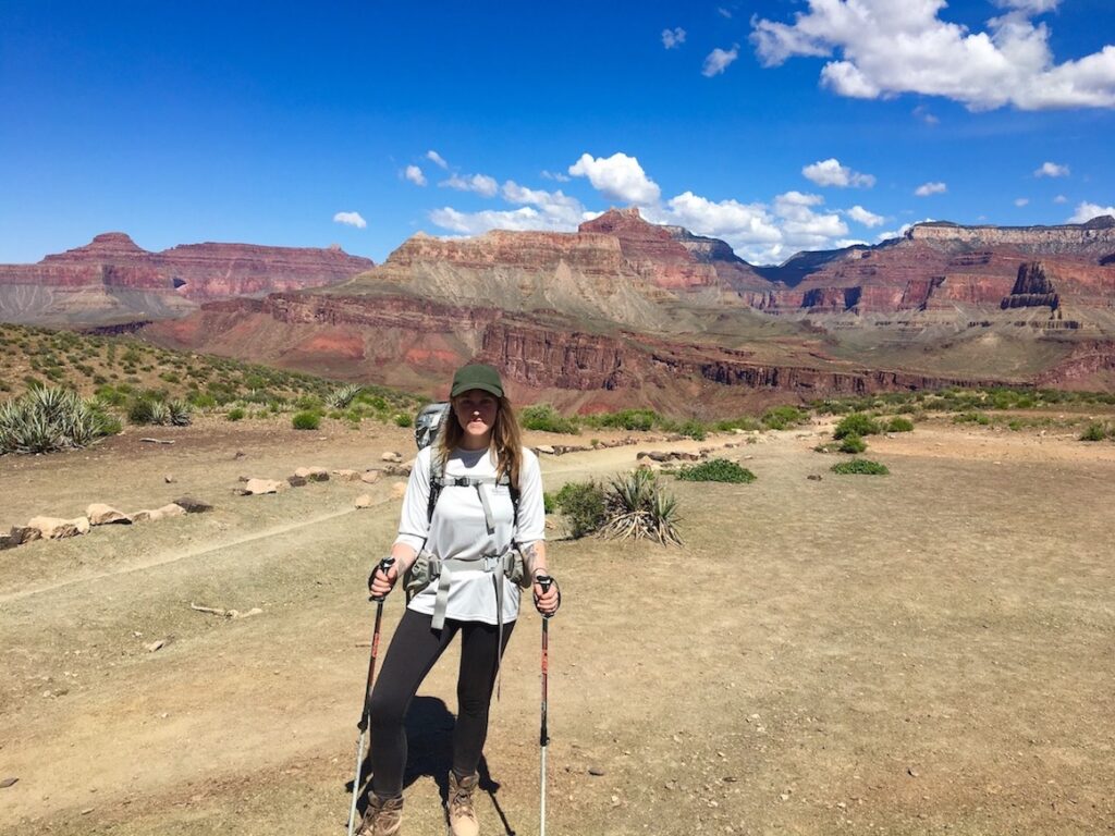
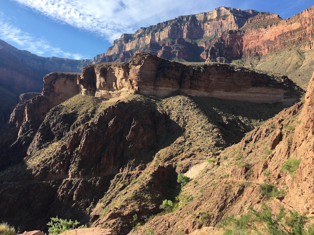
The most popular day hike on the South Rim is down to Havasupai Gardens and back on Bright Angel Trail, which would be 9 miles roundtrip. Havasupai Gardens was an agricultural site for indigenous people and is still a lush green oasis with a creek running through. It’s crazy to witness, considering the canyon sometimes appears dry and dead when you’re looking down at it from the rim. There’s a ranger station, campsite (you would need a permit from the Backcountry Office to camp), potable water refill station, and restrooms. This is also where the overnight mule riders stop for lunch and a rest when they’re headed down to Phantom Ranch.
When you hike the 4.5 miles one-way to reach Havasupai Gardens, you’re descending approximately halfway down the canyon. The top of the South Rim is at about 7000-7500ft, the bottom of the canyon at the Colorado River is about 2000-2500ft elevation, whereas Havasupai Gardens is maybe 4000ft.
You may see Havasupai Gardens referred to as “Indian Garden” in some places on the internet. The Havasupai Tribe requested the National Park Service change the offensive name in 2022.
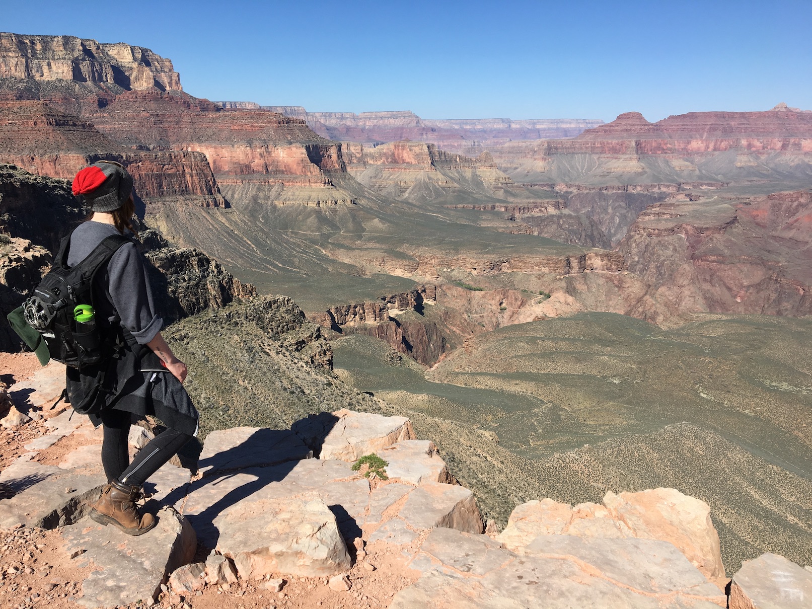
Plateau Point
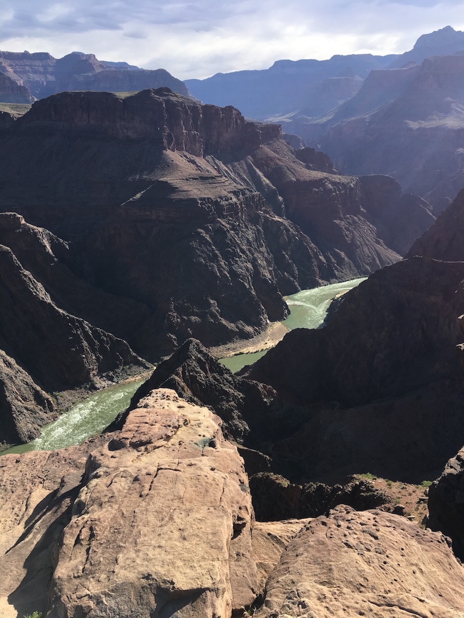
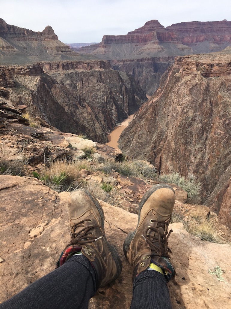
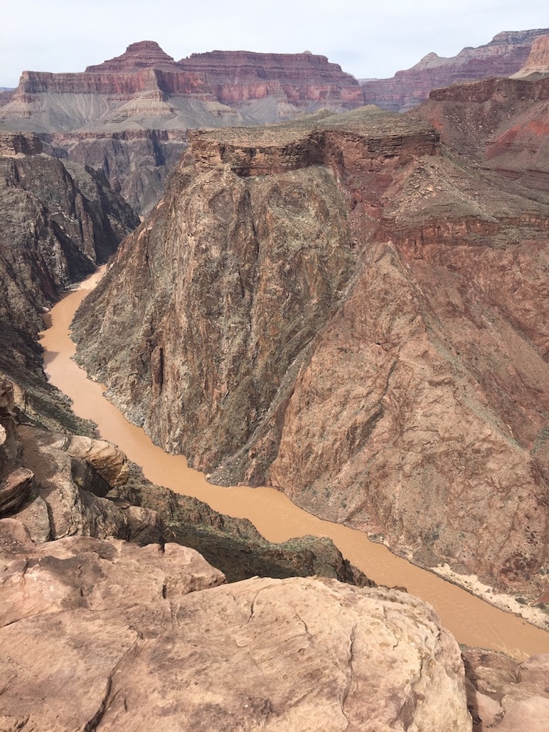


In my opinion, the best day hike on the Grand Canyon South Rim is to Plateau Point, another 1.5 miles past Havasupai Gardens (12 miles roundtrip from the South Rim). You can see the Colorado River really well from Plateau Point, and when you look up you’ve got 360° canyon walls encompassing you all around. My coworkers have seen California condors there. To get there you split from the Bright Angel Trail at Havasupai Gardens and take the Plateau Point Trail the rest of the way. That extra mile and a half is very flat and easy, so if you still have legs once you’ve reached Havasupai Gardens, it’s not too strenuous to add another 3 miles out-and-back to Plateau Point (but keep in mind you still have the big ascent back to the rim waiting for you). I wrote about how to hike to Plateau Point here.
Update: Plateau Point Trail has some upcoming closures.
1.5 Mile and 3 Mile Resthouse
The shortest and easiest day hikes on Bright Angel Trail would be to 1.5 Mile Resthouse (3 miles roundtrip) and 3 Mile Resthouse (6 miles roundtrip). There are pit toilets and emergency phones at each of those, potable water pumps in the summertime, and you get a cool view of the gorge. Although, if you only go that far you don’t reach the prettiest vegetation.
Even if you do a short hike on Bright Angel, you will pass Native American pictographs on the canyon wall if you know where to look, and walk beneath two rock arches. All of these are located within the first mile of the trail.
Things to Know About Bright Angel Trail
Keep in mind it’s the top 3 miles close to the rim that are the steepest, then it levels out the closer you get to Havasupai Gardens. So that means on the last 3 miles coming back up, you’re really huffing and puffing! The Park Service advises against going too much further than Havasupai Gardens or Plateau Point on a day hike because of the strenuous nature of the return ascent.
Bright Angel is the best option for below-rim day hikes if you’ve got children or people with fear of heights in your group. Other trails are a bit steeper and narrower on average. However, Bright Angel is the most crowded trail on the South Rim because the trailhead is located directly behind some of the hotels and gift shops. It’s very accessible. This is why there are enough rescues and safety incidents on Bright Angel Trail to consider it one of the most dangerous hiking trails in the United States. Tourists wander onto this trail in flip flops and without any water, snacks, or prior research.
If you park somewhere in the village (I mentioned various parking options in my Grand Canyon Trip-Planning post), you are walking distance from the traihead. If you park at the Visitor Center, it’d be best to take the free park shuttle.
The mule riders use Bright Angel trail. If you intersect with a mule train, you need to stop walking and get over to the wall side (not the canyon side) of the trail to allow them to pass. Don’t make sudden movements or noises so as not to spook the mules.
In advance of your hike on Bright Angel, you can check which potable water pumps are in service here. You can also double check at the Backcountry Office.
South Kaibab Day Hikes
Ooh Aah Point
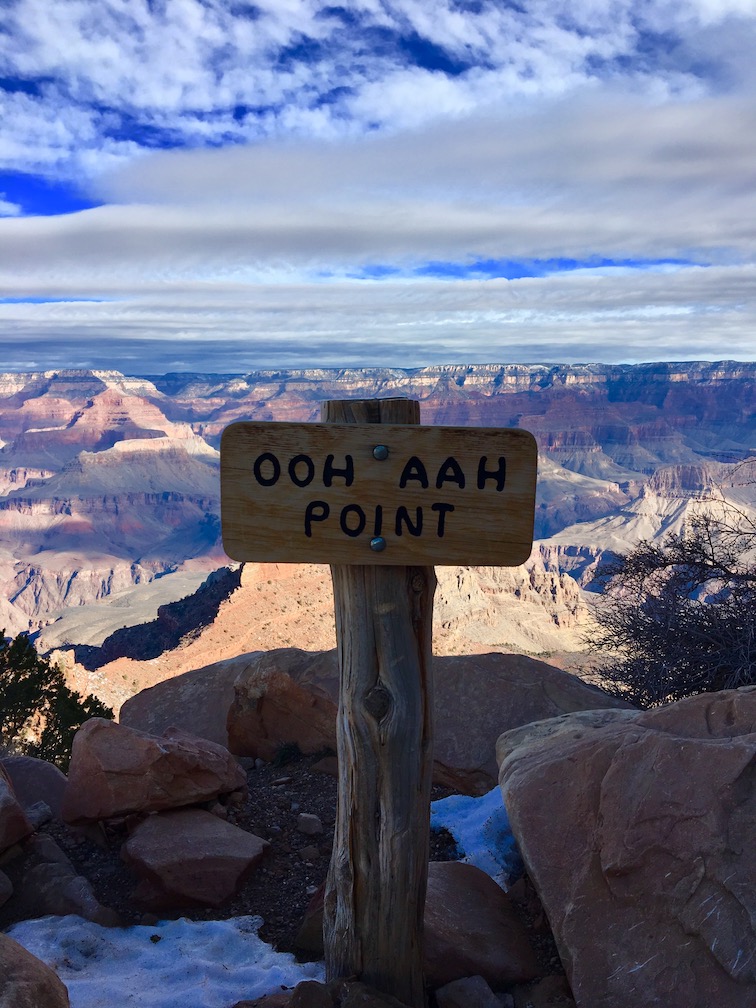
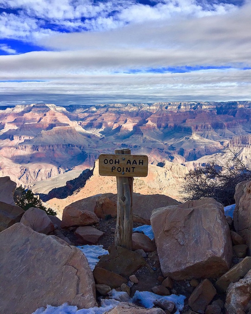

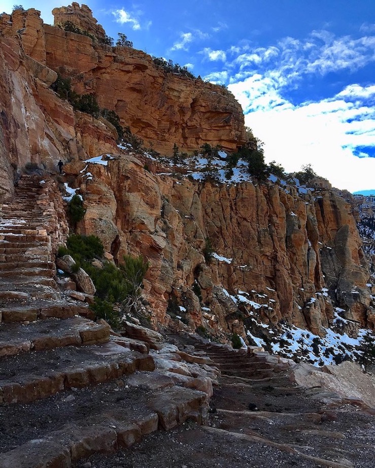

On South Kaibab Trail, the shortest day hike is to Ooh Aah Point and back. Ooh Aah Point is 0.9 miles down, or about 2 miles roundtrip. The reason it’s called Ooh Aah Point becomes apparent when you arrive at the viewpoint; you’ll have an expansive perspective over dramatic rock temples and buttes.
The first bit of South Kaibab Trail involves steep switchbacks, so there’s still some effort involved in doing the shortest hike. These switchbacks are in the shade, so snow and ice may linger here even when the trail is dry further down. You might want to wear microspikes depending on the season.
Cedar Ridge
Cedar Ridge is 1.5 miles down South Kaibab Trail, or 3 miles roundtrip. It’s a vast, flat plateau with a pit toilet restroom and a great place to rest for a snack. The view is not leaps and bounds better than that of Ooh Aah Point, in my opinion, so I feel that it makes the most sense to either hike only to Ooh Aah Point or to bite the bullet and hike all the way to Skeleton Point.
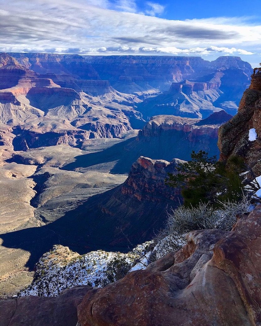
Skeleton Point
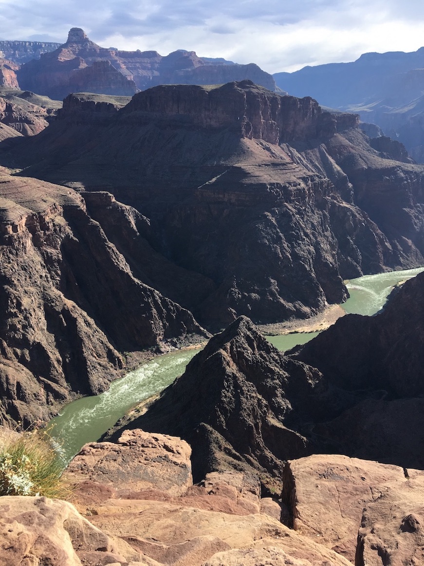
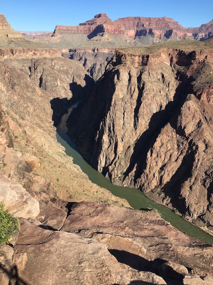
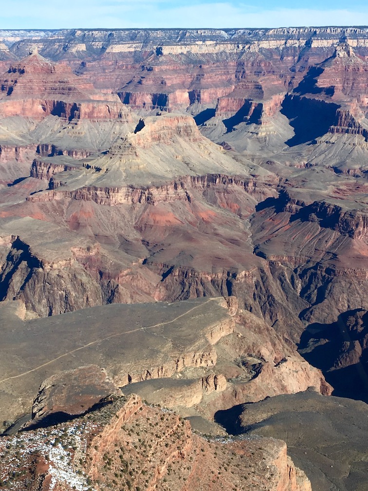
Skeleton Point is 3 miles down South Kaibab Trail, or 6 miles roundtrip. From Skeleton Point you will have a spectacular view that includes the Colorado River, so if setting eyes on the river was a priority but you’re not interested in the 12 mile roundtrip hike to Plateau Point on Bright Angel, this is definitely the choice for you. You’ll also get to pass directly next to O’Neill Butte if you go farther than Cedar Ridge towards Skeleton Point, which is one of my favorite rock formations in the park.
A lot of people stop trailside as soon as they reach the Skeleton Point sign, but they are missing out. There is a little spur trail on the left leading to a much better viewpoint. Walk just a few dozen feet in that direction and enjoy your lunch overlooking the river.
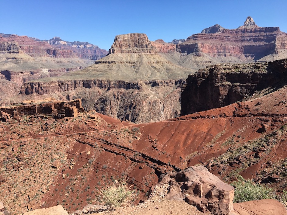
South Kaibab to Tonto to Bright Angel
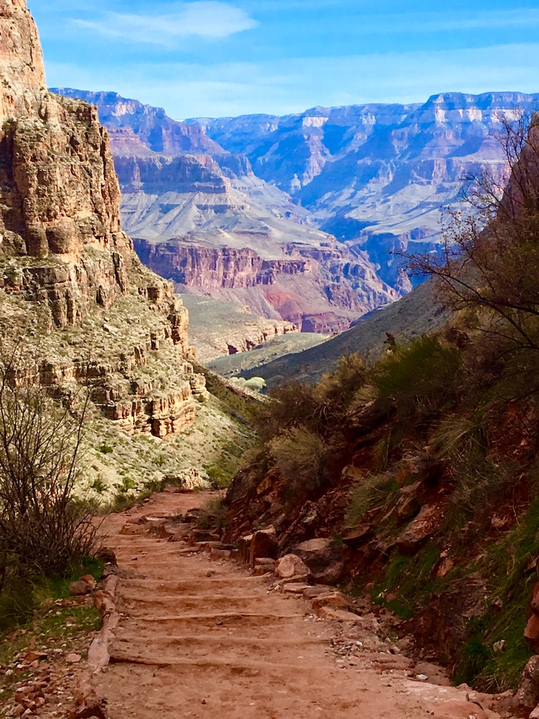
Some people who want to get a vibe for both South Kaibab and Bright Angel trails (but know they shouldn’t attempt a “Rim to River and Back” in a day – more on that in the backpacking section) will take South Kaibab 4.5 miles down to Tipoff Point, split off onto Tonto Trail across to where it meets up with Bright Angel Trail at Havasupai Gardens, then take Bright Angel up to the rim. That’s about 14 miles vs. the 17 miles of a Rim to River, but you’re saving yourself some elevation change and skipping the Devil’s Corkscrew on Bright Angel. Tonto is a flat connecting trail that runs horizontally across the canyon about halfway down.
Things to Know About South Kaibab Trail
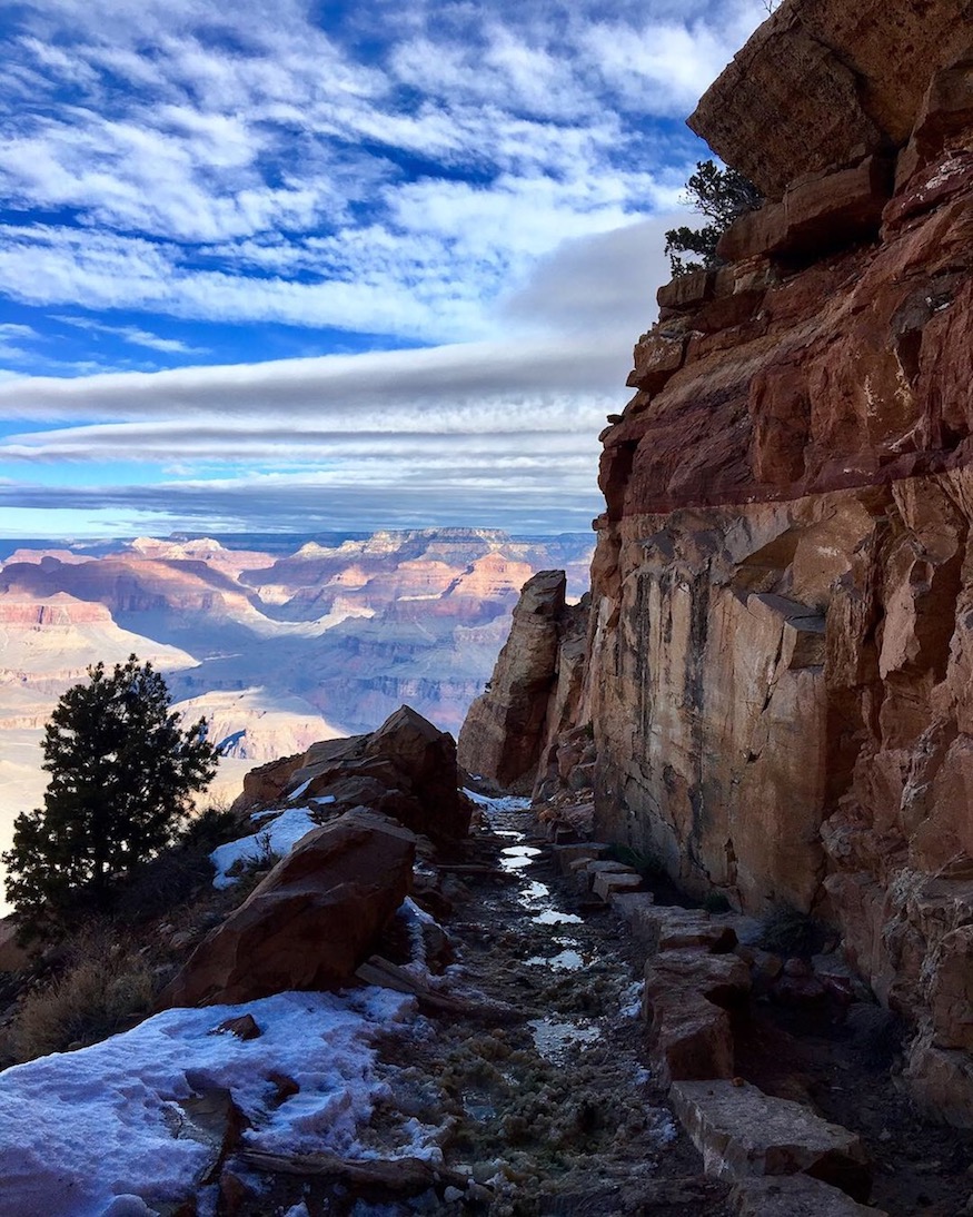
South Kaibab has stunning canyon vista views, but because it’s so steep you don’t want to go too far down on a day hike lest the return hike wear you out. That’s why backpackers rarely ascend South Kaibab trail; the ideal is to descend South Kaibab and ascend Bright Angel. I wouldn’t want to go any farther than Skeleton Point on a day hike.
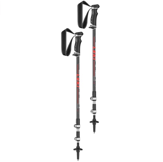
On any below-rim Grand Canyon trails, but especially South Kaibab, it’s a good idea to bring trekking poles to take some pressure off your knees on the downhill.
There is no water on South Kaibab, not even natural creeks or springs. After the initial switchback area prior to Ooh Aah Point, there’s also not any shade.
The mule riders use South Kaibab trail. If you intersect with a mule train, you need to stop walking and get over to the wall side (not the canyon side) of the trail to allow them to pass. Don’t make sudden movements or noises so as not to spook the mules.
You are not allowed to park at South Kaibab trailhead. You could technically walk there on the Rim Trail, but that’s a lot of extra effort. The best thing to do is take the free park shuttle.
Pro-tip: there is actually a little pull-off picnic area across the street from the spur road to South Kaibab trailhead where you can park for free, and then you can walk to the trailhead from there. When driving east from the Village, instead of turning left off Yaki Point Road to go to South Kaibab, which is not allowed, look to the right for the pull-off.
Threshold Trail Day Hikes
Hermit Trail Day Hikes


On Hermit Trail, the day hikes are Santa Maria Spring (5 miles roundtrip) or Dripping Springs (6 miles roundtrip). To get to Dripping Springs you actually split off from Hermit Trail, and the route becomes very skinny and narrow with exposed drop-offs. I hate the trail to Dripping Springs, but I love Hermit Trail. It’s much less crowded than the Corridor Trails but has equally impressive views the further down you go. The first couple miles are quite steep on uneven rock slabs, but the “drop” to the side of the trail during this section is not particularly scary. Then you reach a flat plateau and after that the canyon views really open up.
The Hermit Trailhead is located at Hermit’s Rest. The free Hermit Shuttle/Red Line Shuttle will take you there. If you’re a day hiker, Hermit Road is closed to private vehicles between March 1 and November 30, but in the winter you can drive and park at the trailhead if conditions are good enough.
There is not any potable water on Hermit Trail, but you can source and filter natural water from Santa Maria Spring or Dripping Springs. That said, the water at Santa Maria Spring looks pretty gross. Personally I would pack all my water in.
Grandview Trail Day Hikes
Grandview Trail is the old route to Peter Berry’s Last Chance Mine, so if you’re a history buff, this might interest you. My friend found an old clock and other artifacts down there. It goes to Horseshoe Mesa and also Cave of Domes. I haven’t hiked it yet because it doesn’t get much sun and therefore it can still have ice and snow on the narrow sections later in the season. I have crampons but it still looks sketchy.
To Coconino Saddle is 2.2 miles roundtrip, to Horseshoe Mesa is 6 miles roundtrip, to Page Spring is 7.4 miles roundtrip, and to Cottonwood Creek is 9 miles roundtrip. You could source and filter natural water from Cottonwood Creek when it’s not dry. Page Spring has arsenic.
The trailhead is at Grandview Point along Desert View Drive on the east rim. No shuttle goes there, so you’d need to drive or taxi.
North Kaibab Day Hikes
There are plenty of day hiking trails on the North Rim, including some that stay up on the rim and go through the forest instead of descending down into the canyon, but the most popular below-rim Corridor trail on the North Rim is North Kaibab Trail.
Day hike destinations on the North Kaibab Trail would be Coconino Overlook (1.4 miles roundtrip), Supai Tunnel (4 miles roundtrip), Redwall Bridge (5.2 miles roundtrip), Roaring Springs (a waterfall; 8.8 miles roundtrip), Manzanita Rest Stop (10.2 miles roundtrip), or Cottonwood Campground (13 miles roundtrip).
There are pit toilets and there should be potable water available at Supai Tunnel, Manzanita, and Cottonwood when the North Rim is open; you can check here. Bright Angel Creek runs through Cottonwood Campground if you need to source natural water, and a stream trickles near the Roaring Springs junction too.
Coconino Overlook is a great viewpoint. Supai Tunnel is not a viewpoint but more of a shady rest stop. It’s as far as the North Rim mule rides go (North Rim mules do not do trips to the bottom; only South Rim mules do). Redwall Bridge is a pretty bridge that helps hikers cross over a crevice from one wall of the canyon to the other. Roaring Springs can be quite an impressive waterfall when the water is really flowing with winter meltoff. Manzanita has a ranger station and you’ve pretty much made it to the bottom of the canyon by this point. Cottonwood Campground is truly at the bottom and has beautiful shady Cottonwood trees lining Bright Angel Creek. This is where Rim to Rim backpackers often camp on the first night or last night, depending on which direction they’re going.
Past Cottonwood you can continue on down to Ribbon Falls. Ribbon Falls is a day hike from either Phantom Ranch/Bright Angel Campground, or from Cottonwood Campground, though it’s a little too far for a day hike from the top of the North Rim.
Hiking Above Rim in the Grand Canyon


If you want to hike but not down into the canyon, you can take the Rim Trail. The Rim Trail follows the length of the South Rim and has great canyon views the whole way, but most of it is paved and flat. This is good for families or ADA. Dogs are allowed on the Rim Trail, but not any of the below-rim canyon trails.
Trail of Time
Going east from Bright Angel Lodge to the Geology Museum is 2 miles. That section is called “The Trail Of Time” because they’ve set it up so that every step you take represents a million years, and there will be information about what happened to form the canyon during that time. They’ve also brought rocks up from the bottom of the canyon so you can touch and feel what the Vishnu Schist or Coconino Sandstone feels like.
From the Geology Museum you could choose to go on another mile to Mather Point, a beautiful viewpoint behind the Visitor Center, and then another mile to the end of the Rim Trail which is at South Kaibab trailhead. You could walk back again the way you came, or you could hop on the free shuttle at the Geology Museum, Visitor Center, or South Kaibab trailhead to find your way back to the village.
Hermit Road
West from Bright Angel Lodge is 7 miles of Rim Trail along Hermit Road. These are gorgeous views, but this part of the trail has some slight elevation gain and a few unpaved sections. You can go as far as you want and then walk back, or take the Red/Hermit Route shuttle back to the village.
Hermit Road has some of the most famous sunrise and sunset viewpoints in the park, including Hopi Point and Mohave Point.
Grand Canyon Backpacking Routes
Everyone has heard of the Rim to Rim backpacking route in the Grand Canyon, but there are actually a ton of backpacking itinerary options that are equally scenic. “Rim to Rim” has the name recognition and people get too hung up on that, in my opinion. The following recommendations are all moderate difficulty level backpacking routes in the Grand Canyon that you might try before leveling up to something more unmaintained.
Rim to River Backpacking Route


“Rim to River and Back” is a popular South Rim Grand Canyon overnight route for first-time visitors who are avid backpackers looking for more than a day trip. The draw of this 17 mile route is that overnighters will get to step in the Colorado River at the very bottom of the canyon, cross both suspension bridges over the river, and will also get to experience the entire length of two of the most iconic trails in the park, South Kaibab and Bright Angel. It is not recommended to do this as a day hike (although I did it; it took 9 hours). With safety in mind, the Park Service will suggest you do an overnight. This requires a permit from the Backcountry Office – see below for “Camping Below Rim”.
To get to the Colorado River, most hikers go down South Kaibab Trail (7 steep miles) in an average of 4-6 hours. At the bottom, they’ll pitch a tent at Bright Angel Campground or get a reservation for a dorm or cabin at Phantom Ranch. The second day (or over the course of two days, if you camp at Havasupai Gardens) they’ll hike up Bright Angel Trail, which is 10 miles long but has a more gradual grade and a potable water refill station halfway up at Havasupai Gardens.
In the summer months there will also be water at 3 Mile Resthouse and 1.5 Mile Resthouse unless the pipes are broken, which is not uncommon (check which pumps are currently active here). Be sure to pack in plenty of water just in case, and bring a water filter so you can source natural water from creeks if needed. There’s no water on South Kaibab and there’s no shade from the sun, so it’s not a good route for the uphill trek. That’s why people prefer to take Bright Angel up, plus it’s just some good variation of scenery.
The Devil’s Corkscrew is a series of switchbacks on Bright Angel Trail towards the bottom of the canyon (lower than Havasupai Gardens but higher than the Colorado River) that people seem to fear, but this section is really not harder than the rest of the hike in my opinion. The hardest part is the series of switchbacks in the very last 3 miles close to the rim, which are relentless and come at the very end of your trek after you’re already tired.
There are side hikes you can do from Phantom Ranch/Bright Angel Campground if you’ve got some extra days down there, like Clear Creek, Cheyava Falls, or Ribbon Falls.
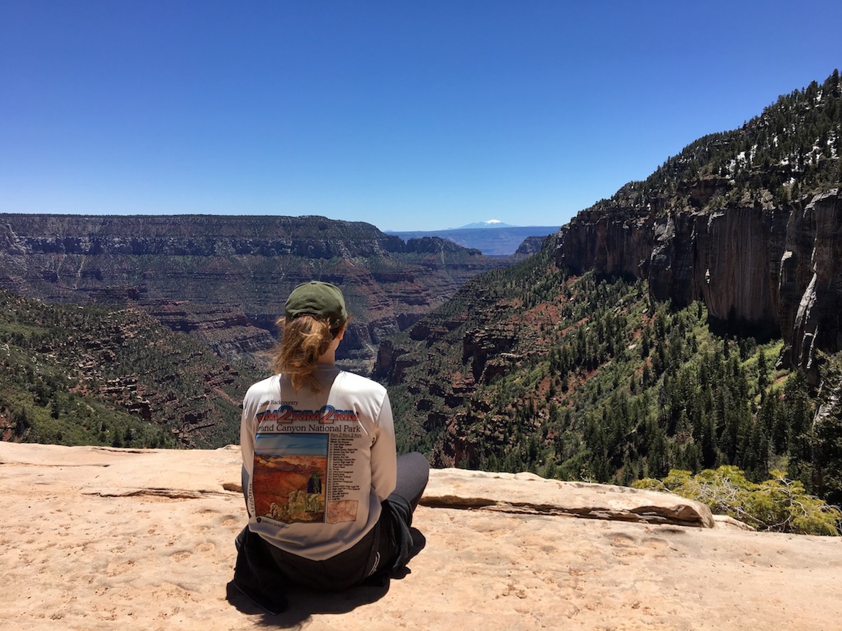
Rim to Rim (to Rim) Backpacking Routes


The most famous bucket list hiking trip in the Grand Canyon is the Rim to Rim, where you hike across the width of the canyon either North to South (24 miles) or South to North (21 miles). You’ll hike all the way to the bottom, cross the Colorado River, and then ascend back up the other side. I’ve completed the Rim to Rim a few times as a day hike, as a night hike, and as a Rim to Rim to Rim (R^3) out-and-back backpacking trip. I wrote an extensive Self-Guided Rim to Rim Backpacking Planner you can download for free.

Some major highlights of the Rim to Rim include two waterfalls, Ribbon Falls and Roaring Springs (although Ribbon Falls was closed during my trip because the bridge to the falls had collapsed over winter), the black and silver suspension bridges over the Colorado River, the fact that you’ll get to see both the South Rim and North Rim, and you’ll get to visit Phantom Ranch even if you aren’t staying there. There are side hikes you can do from Phantom Ranch/Bright Angel Campground if you’ve got some extra days down there, like Clear Creek and Cheyava Falls.
One mistake many hikers make on the Rim to Rim is getting caught in “The Box” during the worst heat of the day. This landmark area of North Kaibab Trail is an enclosed gorge along Bright Angel Creek that traps humidity and heat in. When going South to North, The Box comes just after Phantom Ranch/Bright Angel Campground. You want to organize your itinerary so that you’re passing through that area in the morning when temperatures are cool.
Getting back to your car on the opposite rim after you’re done hiking is a major part of trip planning; I’ve detailed how to go about this in my dedicated posts about the Rim to Rim.
Hermit Trail Backpacking Routes


Hermit Trail is in the category of “Threshold Trails”, which means it only gets maintained once every few years. If there has been some rockfall through this trail during the winter time, that will probably still be sitting there when you hike through in spring, summer, or fall. It won’t be as crowded as the Corridor Trails and you’ll feel like you have more peaceful solitude with the canyon. I really love this trail.
Hermit trailhead is just behind Hermit’s Rest on the Red/Hermit Shuttle Route, and the endpoint of the out-and-back route can be Hermit Creek or Hermit Rapids (making it a Rim to River hike). You can also connect Hermit Trail to Bright Angel Trail via the Tonto and create a loop.
You’ll pass by the remnants of the old Hermit Camp, which adds a dose of historical interest. This trail does have some steep and scrambly sections and would be quite a lot for out-and-back in a day. That said, I am someone who is afraid of cliffside drops and getting too technical, and I felt comfortable on the Hermit Trail.
Get a camping permit from the Backcountry Office if you plan to stay overnight. Parking a private vehicle at Hermit’s Rest is not allowed for day hikers from March 1st to November 30th, but backpackers with an overnight permit can receive the gate code to get through.
Phantom Ranch
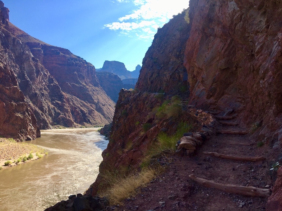
Phantom Ranch is the historic, rustic accommodation at the bottom of the canyon at the junction of South Kaibab, Bright Angel, and North Kaibab trails. It’s located right next to Bright Angel Campground and the Colorado River.
Note the word “rustic”. Phantom Ranch is a relaxing respite for weary hikers and mule riders. It is a total privilege. It is at THE BOTTOM OF THE CANYON. How cool is it that there’s lodging down there at all? It is not luxury lodging. They have power and a lot of amenities, but conditions in the canyon sometimes cause issues where the power or pipeline can go out. Be prepared to swing with the punches. To make repairs, workers have to hike down the canyon with tools in hand. It might take a second. They get their resupplies for meals and canteen stock from pack mules. It’s a well-oiled machine but delays and weather events happen.
How to Get Phantom Ranch Reservations

Reservations at Phantom Ranch are not expensive, but it fills up fast. You can enter the lottery 15 months in advance at PhantomRanchLottery.com or call Central Reservations (888-297-2757) between 12-2 months out to scoop up any leftover dates not booked via the lottery. Another option is to physically go to the Bright Angel Transportation Desk to get on the waitlist the day before you want to hike, in case of last minute cancellations. Then you need to return to the desk the morning you want to hike to see if your name gets called. Last minute hiker cancellations are much more common than mule riders cancelling last minute, so you do have a shot, but it’s usually just the first party or two on the waitlist who might get lucky.
I’ve also seen some people check at the Transportation Desk for last minute Phantom spots, have no luck, start hiking down anyway, call us from the phones at the trail rest stops to check again, and be able to grab a spot at that time. This is not good practice if you want a guaranteed spot, and god forbid you get down there and still nothing has become available and now you’re at the bottom of the canyon without a place to stay, but super duper last minute bunks or cabins do become available from time to time. Some hikers with reservations get started on their hike, twist an ankle, can’t make it down, and have to cancel just 3 hours before they were meant to check in (when I was on my Rim to Rim to Rim, the last night I had a Clear Creek camping permit but I swung by Phantom before setting up my tent to check for a last minute bunk and got one! I stayed there instead and had a nice stew dinner). This is also why, if you’re already at Phantom, you may be able to add on an extra night to your stay if someone who was supposed to be checking in after you ended up being a no-show.
Another way people have gotten creative has to do with the setup of the Phantom Ranch cabins. There are two-person cabins, four-person cabins, and ten-person cabins (in addition to the two ten-bunk female dorms and the two ten-bunk male dorms). The dorms are shared, but not the cabins. They will not book multiple parties to share a cabin, so your group will have one privately to themselves. Sometimes a party of two books a 10-person cabin because it’s all that’s available. I heard about one couple that did this, but then sold the remaining 8 beds in their cabin to campers at Bright Angel Campground who had wanted a bed but couldn’t get one. If you book it, it’s yours to do with what you please, so as long as those 8 new friends know the name on the reservation and can say they’re with that party, it’s fine.
Amenities at Phantom Ranch

Nearly everything is already provided at Phantom Ranch, so you shouldn’t need to pack much if you’ve got a Phantom reservation. They have bedding, linens, towels, soap, shampoo, and a canteen where you can buy meals, snacks, first aid equipment, postage stamps and postcards (you can mail a postcard from there and it will arrive at its destination marked “mailed by mule” since the mules take it up in a duffel). Meals should be reserved in advance. There’s a steak dinner, stew dinner, vegetarian chili, early breakfast, late breakfast, and sack lunch. You can still reserve meals at Phantom Ranch even if you’re not staying there, for instance, if you’re camping at Bright Angel Campground. Snacks can be purchased easily on-site like any convenience store. They have trail mix, bagels, protein bars, lemonade, etc. They have restrooms and showers (showers are for Phantom guests only, not campers). They even have a bookshelf with interesting canyon- and hiking-related literature. All you really need to pack is a change of clothes, toothbrush and toothpaste, and any personal items you prefer, plus whatever you need for hiking when you’re actually on the trail.
If you bring any of your own food to Phantom Ranch, you should still make sure to pack it Leave No Trace style. Critters will get into the cabins and dorms looking for easily accessible goodies, and may dig through your pack if you’re not careful. There are lock boxes for your food in the dorms and cabins.
My favorite thing to do at Phantom is dip my feet in Bright Angel Creek or the Colorado River! But don’t go for a full swim in the Colorado, as it can take you away in the current.
If you are a hiker who has a lot of stuff and you don’t feel like backpacking it all down, you can pay $83 for the duffel inbound service to take your belongings to Phantom Ranch for you via mule. To pack it back out on the duffel outbound service is another $83. There are duffel weight and size requirements and windows of time you must abide by for claiming your bags afterwards, so make sure to read up on the regulations.
Permits for Camping Below Rim
*SUMMER 2023 UPDATE: Backcountry permits have a whole new application system for trips starting in January 2024 or later! I wrote in more detail about how it works here.

Grand Canyon Has a New Permit System: How to Apply (2024)
You do not need permits for day hikes in the Grand Canyon, and you also do not need permits if you’re camping above rim (like at Mather Campground), but backcountry permits are required if you plan on tent camping overnight below rim. For trips in January 2024 or later, you apply for these on Recreation.gov. Permits are handled by the Backcountry Information Center/National Park Service (not Xanterra, who handles Phantom Ranch reservations).
Applications are due 4 months in advance of the date you want to camp, by the first of the month. For instance, if interested in an October trip, you must apply in the lottery on Recreation.gov by June 1st (and no earlier than May 16th). If you miss the deadline or are unsuccessful with your application, you can keep checking Recreation.gov for cancellations or try to get a last minute walk-up permit in person. The most competitive months to try to win a permit are May, September, and October.
If you can’t snag a permit for the main campgrounds (Bright Angel, Havasupai Garden, Cottonwood), you can try to get the less maintained dispersed camp spots instead like at Clear Creek, Utah Flats, Horn Creek, Cremation, etc. These will add a few extra miles to your hike, but it’s better than nothing! These are also great destinations in and of themselves if you’re looking to branch out from the Corridor.
Amenities at Grand Canyon Campsites
Each tent site at Bright Angel Campground, Cottonwood Campground, and Havasupai Gardens has a picnic table a metal food storage can. These campgrounds all have pit toilets (like outhouses), but none have showers.
You can splash off in creeks, but do not put soaps in natural water sources, even if they’re marketed as biodegradable. Bring wet wipes if staying fresh is important to you. Read about how to deal with proper waste disposal in the canyon here.
Grand Canyon Hiking Tips and Preparation
Grand Canyon Temperatures and Weather

Keep in mind it is always 20 degrees Fahrenheit hotter at the bottom of the canyon than at the top of the South Rim. The South Rim is at 7000-7500ft elevation while the bottom is at 2000-2500ft. In the summer this means scorching temperatures at the bottom, well over 100 degrees. I would have never attempted Rim to River in one day if it had been summer. In fact, I don’t really want to hike at the Grand Canyon in the summer at all. If you do, get started very early in the morning before the sun comes up to beat the afternoon heat, post up somewhere shady once the heat does set in to wait things out, then if you still have more hiking to do you can finish those miles around dusk. In spring and fall you could get away with only packing about three liters of water per day, but in the summer pack at least a gallon.
Summertime is also monsoon. July and August (possibly even late June or early September) could have heavy rains and even dangerous flash flooding in the canyon. You do not want to be at the bottom of the canyon during a flash flood.
If you were to Google the average temperatures on the South Rim for any particular month, then to find the average temperatures at the bottom of the canyon you would just do the math by adding 20 degrees. Contrastingly, the North Rim is 1000ft higher than the South Rim and will be 5-10 degrees colder as a result.
In spring, fall, and winter, when you get started hiking in the morning you may be chilly for the first couple miles. As you descend in elevation, your blood gets pumping from activity, and the sun rises higher, you’ll warm up quickly and likely end up shoving extra jacket layers into your backpack. The best times to hike in the Grand Canyon are generally mid-March through mid-May or mid-September to mid-November, as far as temperatures and weather. Fall is probably less crowded and has a smaller chance of being impacted by a weird, lingering winter like we can have in “springtime.”
Winter can be pretty hardcore in the Grand Canyon some years. When I was working on the South Rim we had tons of blizzards and continued to have snow days up until April, and then randomly had a freak one in June which is unusual. In 2023, the North Rim is not opening at all until June 2nd, which is practically unheard of. More commonly, the worst of the blizzard conditions is around New Years; almost every single year we get a big winter storm around that time. We might typically see our first snow days around Thanksgiving, but nothing too big until later in December. Then we’ll continue to have heavy winter conditions at least through February. Strangely enough, at the very bottom of the canyon it may feel like springtime! The ice and snow sticks to the upper miles but dissipates as you descend in elevation.
Safety Tips for Hiking in the Grand Canyon
- Prior to hiking in the Corridor, check which potable water pumps are in service here. You can also double check with the rangers at the Backcountry Office. Bring a water filter in case you need to source from creeks.
- Before a hike, always check the Alerts and Conditions page on the Grand Canyon website to learn about the latest trail closures and conditions.
- Again, it is 20 degrees hotter at the bottom of the canyon than at the top, so prepare accordingly. In the summer it’s brutal. Sunscreen, wide-brimmed hats, long sleeves and pants for protection from UV rays, and plenty of water are essential. Start hiking early morning, wait out the afternoon heat, and continue in the evening if you must.
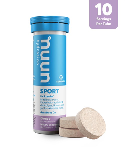
- If you’re coming from sea level, you may experience nausea and altitude sickness. The South Rim is at 7000-7500 feet elevation, and the North Rim is at 8000-8500 feet. Take extra care if you have plans to hike to the bottom of the canyon, which is at 2000-2500 feet. Drink lots of water and bring electrolyte tablets. Hyponatremia is as common as dehydration. Electrolyte tablets replenish the salts and minerals you’re sweating out. They really help me keep from losing steam.
- Summer is monsoon. Please check the forecast for rain and heed warnings about potential flash floods, especially in July and August. Other times of year don’t really get much rain at all; it’s feast or famine in the high desert!
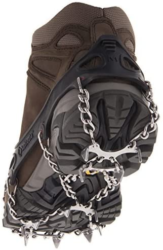
- If you’re here in winter, there will be ice and snow on the trails. Crampons or microspikes are essential, and hiking boots with good tread. I’ve seen people try to go down icy trails in sneakers and they function basically like snowboards. Traction devices are sold at the Bright Angel gift shop, Maswik gift shop, and General Store at Market Plaza for $25. When I was there the best option they sold were the Icetrekkers Diamond Grips. I don’t like other models as much; coils break easily and spikes fall out. If you’re able to get your hands on Kahtoola Microspikes, even better.
- Trekking poles help with joint pressure on the downhill. You can buy them at the Bright Angel or Maswik gift shops, but you’ll find more variety at the General Store at Market Plaza (that’s where I got my Leki poles). You can rent them from the General Store for $3 a day too.
- Mountain lions are incredibly rare. You’re more likely to see mule deer, elk, or bighorn sheep. They will mainly leave you alone, especially the deer, but elk and sheep have been known to kick if they’re caught off guard or have babies around. Do not try to interact or get too close to the animals. Smaller critters like the pink rattlesnake (also very rare), gila monster, or various lizard and scorpion species could find their way underfoot. Be careful where you step, and don’t leave your shoes outside your tent lest something crawl inside. Lastly, do not feed the squirrels! There are signs everywhere but people still do it. It is illegal. Not only does it harm the squirrels in that they get too comfortable around people and stop foraging for food, but the number one canyon injury to humans is actually squirrel bites, and they can carry diseases including plague. The actual bubonic plague.
- Remember that however far you go down, you still have to come back up, and the uphill will be harder. It’s the reverse of a mountain where the hard part comes first and the easy part later. Evaluate yourself as you go and make sure you’ll be up for backtracking as far as you’ve come. You can turn around at any point.
- Don’t swim in the Colorado, it can take you away in the current and there are some crazy rapids.
- If you are coming from out of state and planning on doing a strenuous hike, consider purchasing travel insurance. I believe helicopter rescues are generally not paid for by hikers unless the reason you need rescuing is due to blatantly stupid or illegal behavior, but getting an emergency mule “drag out” is incredibly expensive. When I take a hiking trip or other active adventure holiday, I usually get the World Nomads Explorer Plan. To compare multiple providers and plans, input your criteria via Travel Insurance Master.
- Investing in a GPS Spot Tracker satellite emergency communication device is always a good idea for hiking adventures. I have the Garmin InReach Mini and it gives me peace of mind when I’m out of cell service range.
- No campfires allowed below rim in the canyon.
- Leave No Trace!
My comprehensive list of the best day hikes and backpacking itineraries at the Grand Canyon South Rim should keep you going for not only your first visit to the national park, but hopefully a few repeat visits too. I hope it’s also enabled you to think creatively about how you might string different trails together to create your own adventure. After completing these, report back! What do you think is the best hiking trail at the Grand Canyon?
🏨 Are all the in-park hotels already booked out? Find budget hostels near the Grand Canyon here, and standard hotels in Tusayan here.
🏕️ Find free or paid campsites near the Grand Canyon via The Dyrt.
✈️ Coming to Arizona from further afield? Use an Airalo eSIM for affordable international cell data and don’t forget to protect your investment with travel insurance.
Related:


Pin It:

My dream is to write travel and hiking content full-time. All of my guides and itineraries are free and my travels are self-funded. If you enjoy my site and would like to support, you can donate any amount to my Ko-fi page. Thank you!!