

Hike Among Hoodoos in Chiricahua National Monument
Purchases made through some links on this page may provide The Detour Effect with commissions (at no extra cost to you). Thank you!
If you’re a desert hiker, you can’t get enough of strange, alien-looking rock formations. It’s kind of our thing. Typical alpine scenery is nice, sure, but our southwestern desert canyons in the United States are a gateway to psychedelia. Few hiking trails showcase this more uniquely than the Heart of Rocks Loop in Chiricahua National Monument in southern Arizona.
What’s unique about Chiricahua National Monument?
A Sky Island

If quizzed about which national park units have rock “hoodoos,” most people would remember Bryce Canyon in Utah first, but that’s only if they’ve never been to Chiricahua. Once you’ve seen the impressive hoodoo jungle of southern Arizona, it never escapes your heart.
The Chiricahua Mountains form a “sky island” jutting abruptly up out of the surrounding desert lowlands, similar to the nearby Dragoon Mountains (where I hiked Cochise Trail). They were appropriately referred to by the Apache as “the Land of Standing-Up Rocks”.
To arrive in the Chiricahuas (cheer-i-cow-ah) you’ll drive many miles through barren, lonely, tumbleweed-laden flatlands that seem to stretch endlessly in all directions, wondering how you could possibly be doing a mountain hike later that same day. Then, suddenly as if launching yourself through a time/space-bending portal, you are surrounded by the towering rock spires and hoodoos of this wild range originally utilized by the Chiricahua band of Apache. It’s like whiplash.
A sky island is an isolated mountain range that rises up out of the surrounding desert “sea.” The Chiricahua National Monument Visitor Center is 5,400 feet (1,646 meters) above sea level. The high point in the Chiricahua Mountains – Chiricahua Peak – is 9,795 feet (2,986 meters) above sea level. The Chiricahua sky island rises about 6,000 feet (1,829 meters) above the Sulphur Springs Valley. – National Park Service

Thanks to this varied elevation, it was actually quite cold when I visited in January despite being so close to the southern border of the country.
Wildlife of Chiricahua
The diverse climate means the Chiricahua Mountains are teeming with animal and plant life. You might have expected bobcats, mountain lions, bears, javelinas, coatis, and snakes, but jaguar and ocelots have been captured on trail cameras here too! While I hardly saw another soul during my hikes, imagining camouflaged eyes fixed on me meant I never felt alone.
If stepping into another dimension sounds like your kind of party, read on for a breakdown of things to consider when planning a visit to the trippy Chiricahua Mountains, plus the best hikes in Chiricahua National Monument.
Orienting Yourself

Most people visiting the Chiricahua Mountains are going to want to zone in on the part of the range known as the Chiricahua National Monument. This is a small swatch of federally protected land in the northwestern corner of the larger Chiricahua Mountain range. There is an 8 mile scenic drive from which you can access 17 miles of day use hiking trails.
Campground, Amenities, Entrance Fee
When you first drive into the Monument from the west via Arizona State Route 181, the Visitor Center will greet you on the right almost immediately. A short distance further down the road, you’ll find Bonita Canyon Campground on the left. This is the only campground and it requires reservations made through recreation.gov (or you could try to get walk-up spots). There is no entrance fee for the Monument, but it’s $20 to camp. Before you get this far, keep in mind that the nearest gas stations are in Sunizona and Willcox, 27-37 miles away. There is also nowhere to buy food within the National Monument.
Chiricahua Hiker Shuttle
There is a hiker shuttle, but I don’t understand it. Considering there is no public transportation to help you reach Chiricahua and you already have to drive yourself all the way out to this remote part of southern Arizona, I’m not sure why you wouldn’t just drive the last tiny bit from the park entrance to the trailheads too. Maybe there is concern about parking availability at the trailheads, or maybe some folks prefer to leave their car behind to mark their spot at the campground.
A free hiker shuttle operates from September to May and takes hikers to the Echo Canyon or Massai Point trailheads. It departs from Faraway Ranch parking lot at 9:00am and the campground restrooms at 9:10am. Shuttle is on a first-come, first-served basis. Shuttle is subject to weather and staff availability. Currently, the hiker shuttle runs on Thursdays, Fridays, Saturdays, and Sundays.
NPS
Trailheads in Chiricahua National Monument Explained

One hiking trail begins at the Visitor Center, the Lower Rhyolite Canyon Trail. Silver Spur Meadow Trail and Bonita Creek Trail are accessible from the campground.
All of the other trailheads are located further up the scenic drive after you pass the campground. These include Natural Bridge trailhead, Sugarloaf trailhead, Echo Canyon trailhead, and Massai Point. Massai Point is also the end of the scenic drive.
The Natural Bridge trailhead just leads to Natural Bridge Trail, and the Sugarloaf trailhead just leads to Sugarloaf Mountain. However, the Lower Rhyolite, Echo Canyon, and Massai Point trailheads all lead to a tapestry of the same interconnecting trails. From any of these points, you can ultimately link up with Upper Rhyolite Trail, Sarah Deming Trail, Heart of Rocks Loop, Big Balanced Rock Trail, Inspiration Point Trail, Hailstone Trail, Mushroom Rock Trail, Ed Riggs Trail, and Echo Canyon Trail. It’s just a matter of choosing your own adventure!
I always like to start hiking early in the morning, even though this is stupid in winter. By doing so I only saw two other parties during my hikes in Chiricahua, and there was only one other car parked at each trailhead. However, when I returned to my car later in the afternoon, it was suddenly packed. So I guess starting early isn’t such a bad idea if solitude is more of a priority for you than trying to avoid extra jacket layers.
Choosing a Day Hike in Chiricahua National Monument
Heart of Rocks Loop


When you download the PDF hiking guide from the National Park Service here, a lot of the moderate and strenuous route choices are just variations on how you might connect the different trails starting from Echo Canyon trailhead or Lower Rhyolite trailhead. “The Big Loop” option would connect almost everything in one hike.
Since the Lower Rhyolite trail starting from the Visitor Center looks like it stays pretty flat and straight for 1.5 miles before you get to the good stuff, I decided to start at Echo Canyon trailhead instead in order to reach Chiricahua National Monument’s crown jewel, the Heart of Rocks Loop. From Echo Canyon I took Ed Riggs to Mushroom Rock to Big Balanced Rock to Heart of Rocks Loop. I thought about taking Sarah Deming to Upper Rhyolite to Hailstone or Echo Canyon Trail to get back to my car, but ultimately did an out-and-back.
A trip to Chiricahua without doing the Heart of Rocks Loop would be an opportunity missed. From the loop you’ll have expansive views out over thousands of hoodoos dotting the horizon, plus up close and personal scrambles as you shimmy between a few rocks yourself. There are interpretive signs pointing out the names of special rock formations, like the Kissing Rocks or Punch and Judy. You’ll also notice snow capped peaks in the distance, which almost made me feel like I was back in Flagstaff.
Natural Bridge Trail


If you have multiple days or if you start early enough in the day to fit multiple hikes in, then separately you could drive to Natural Bridge trailhead or Sugarloaf trailhead. These two cannot be connected to any of the “Big Loop” trails on foot.
When I did Natural Bridge Trail, it was apparently the only day of rain they’d had in a month. It added an extra mysterious, moody vibe to the landscape!
Backcountry: The Chiricahua Wilderness
What about the rest of the Chiricahua mountain range outside of the National Monument? This rugged and untapped land is the Chiricahua Wilderness. If you’re looking for a true backcountry experience, there are miles of additional unmaintained trails to be found here. Backpacking and dispersed camping is allowed in the Wilderness, but not in the Monument. “You may camp outside of developed areas across most of the Coronado National Forest at no charge” and permits are not required to make use of dispersed camping sites.
Be forewarned that the Chiricahua Wilderness is the Wild West in more ways than one. Mexican cartels smuggle drugs through these mountains, as is thoroughly reported, and the Park Service advises caution.
Cave Creek, Arizona
On the eastern side of the Chiricahua Mountains, another cool place to visit that’s a bit more established is Cave Creek and the cute town of Portal. Qualitatively the hiking options in Cave Creek are completely different from those in Chiricahua National Monument.

Best Ways to Reach Cave Creek by Car
You cannot drive straight across to Cave Creek from the National Monument via the scenic road. You’d need to drive west back out of the Monument the way you came, then take Pinery Canyon Road across to the east side. This road is not always accessible in winter time and is twisty turny.
An alternative is to return to civilization briefly by driving northwest to Willcox, then taking I-10 East so that you can go around the mountain range instead of through it, and then come back down on the east side. Note that as you approach Portal from this direction, you’ll be on a washboard dirt road for quite a few miles which could potentially be difficult in times of flood.
Or, if your whole trip is starting from the eastern states, you could easily reach Cave Creek from New Mexico.
Portal, Arizona
You’ll want to put the town of Portal, AZ into your map if the Cave Creek area is your destination. Portal is a tiny town that feels basically off-grid. They must have to ship supplies in from towns that are hours away. There is one general store and cafe which is so lively and fun, which is confusing since I can’t figure out where all the patrons live. It’s about the only building I saw the entire time.
Trailheads in Cave Creek
From Portal you can find access to trails like South Fork, Ash Spring, Silver Peak, and McCord. I believe you need permission from Cave Creek Ranch to hike McCord trail, but the others are easily accessible.
The eastern side of the Chiricahuas near Portal has a very different flavor. Because of the creek, the vegetation is more lush. Red rocks loom over greenery, forested shade, and sparkling water, and there’s a relaxed neighborhood vibe. The Cave Creek area is to the Chiricahua National Monument as Sedona is to the Grand Canyon.
South Fork Trail


If looking for a gentle, pleasant walk, I really enjoyed the South Fork Trail to “the Bathtub”. It was easy yet magical because of the water crossings and sunlight glistening through the leaves. At the end, you reach a little hidden mini waterfall which you realize has been feeding the creek you’ve been weaving over throughout the hike. Nobody was there when I arrived so I got to have this oasis all to myself.
On my way back, some sort of large animal moved amongst the trees in my periphery, and to this day I have no idea what it was. My immediate thought is always “bear”, although you’d think they’d be in hibernation in January. Bigfoot? Probably just a deer…
Native American and Pioneer History at Chiricahua
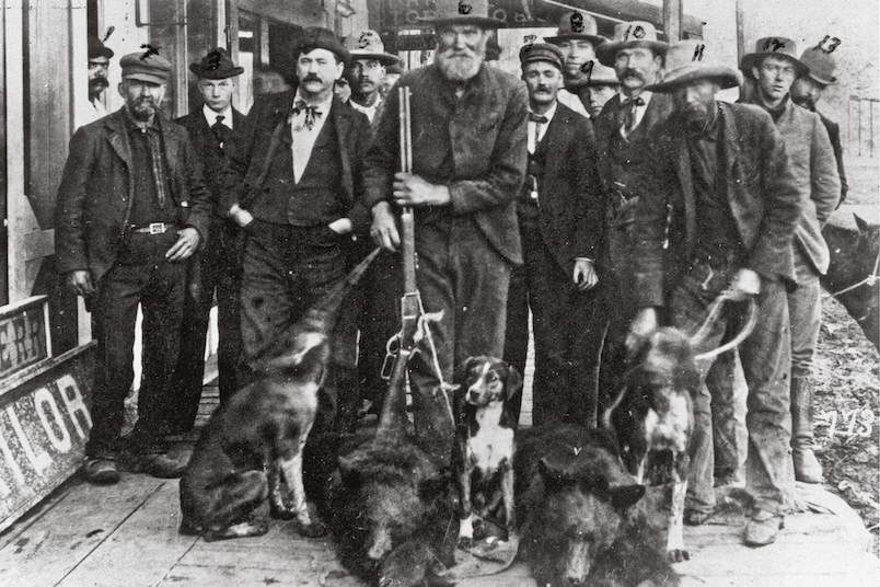
The Apache Wars
🔊 Recommended Listening: Stuff You Should Know podcast episode “The Apache Wars” for an accessible overview, or Distorted History episode “Apache Wars Part 1: Mangas Coloradas, Geronimo, and the War with Mexico” for an extremely detailed play-by-play.

As I was driving to and from Chiricahua, I listened to podcasts about the Apache Wars. Famous figures like Geronimo and Chief Cochise fought for their lands and people among the sky islands of southern Arizona. You can see why these difficult mountain ranges would serve as a tactical advantage against lowlanders, almost like a natural barricade. They also would have provided much of the resources needed to survive in an otherwise inhospitable part of the state. The Apache spent winters in the lowlands and summers in the mountains.
If interested in visiting Cochise Stronghold in the nearby Dragoon Mountains, I recommend hiking the Cochise Trail. Chief Cochise was secretly buried somewhere in the Dragoons, and the knowledge of the exact location went to the grave with his people.

Hiking Cochise Trail in the Dragoon Mountains, Arizona
Chiricahua Desert Museum

There are several historical roadside stops you can make if you are leaving Portal by going south on State Route 80. As you briefly pop into New Mexico, you’ll find the Chiricahua Desert Museum. This place is an odd hybrid of a herpetarium, where live snakes and other dangerous desert reptiles are on display, and the Apache Museum, where you can learn more about the Chiricahua Apache and their conflicts with settlers. $10 gives you access to both. They don’t have the largest collection of artifacts I’ve ever seen, but it’s hard for me to skip a museum.
Geronimo’s Final Surrender
Then as you continue south and curve back into Arizona, keep an eye out for road signs mentioning a historical marker. They’re referring to a tall stone memorial built to mark the general location of Geronimo’s final surrender on September 6, 1886. It says, “The surrender of Geronimo in Skeleton Canyon on that historic day forever ended Indian Warfare in the United States”. It might as well say ‘the end of the Native American way of life’. The monument stands alone in a vast, silent stretch of roadside desert. Taking in the memorial was quite a somber moment.


Johnny Ringo’s Gravesite
If leaving the Chiricahua Mountains from the west side near Willcox instead of the east side near Portal, you might take a detour to visit Johnny Ringo’s gravesite. He was a Wild West outlaw who got into a confrontation with Doc Holliday in Tombstone, AZ, which is depicted in the movie Tombstone. He turned up dead with a bullet wound to the head, and it’s widely suspected that Holliday and Wyatt Earp had something to do with it. His grave is located at 31° 51.952′ N, 109° 25.131′ W. More information on finding the site is here.
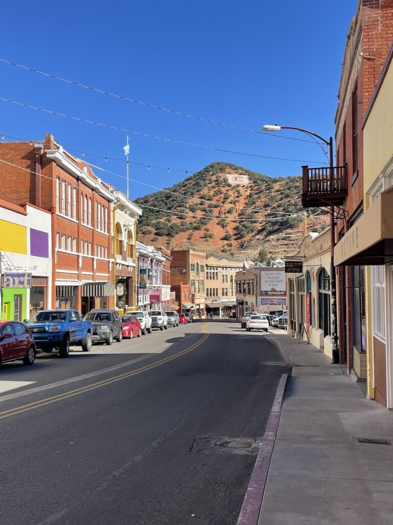
I’ve had a blast during my month in southern Arizona so far. Having lived in northern Arizona I was already quite familiar with that terrain, but this is a whole new playground. The hikes in Chiricahua National Monument are unlike anything I’ve ever seen. Coupled with my great experience staying in the charming, quirky mining town of Bisbee, Arizona, I could see myself living here permanently one day and exploring endlessly in the Chiricahua Wilderness and other nearby sky islands.
What’s your favorite hike in the Chiricahua Mountains, or your favorite lesser-known hiking destination in southern Arizona? I’ve only got a couple more weeks to do it all!
🏨 Find free or paid campsites near Chiricahua or hotel options in Bisbee.
✈️ Coming to Arizona from further afield? Use an Airalo eSIM for affordable international cell data and don’t forget to protect your investment with travel insurance.
Related:


Pin It:

My dream is to write travel and hiking content full-time. All of my guides and itineraries are free and my travels are self-funded. If you enjoy my site and would like to support, you can donate any amount to my Ko-fi page. Thank you!!