

Best Moderate Difficulty Sedona Day Hikes
Purchases made through some links on this page may provide The Detour Effect with commissions (at no extra cost to you). Thank you!
In the two years that I’ve lived in northern Arizona, I’ve managed to cover a good bit of day hiking ground in Sedona. I haven’t marked everything off my list yet (and could you ever?), but this is partially because I love the trails I’ve done so much that I continue to go back to repeat them! I’ve sorted my favorite moderate difficulty Sedona day hikes into categories depending on your priorities, and listed a couple “easy” options as a contingency in case you wear yourself out. Happy hiking!
Pre-Hike Planning Tips:
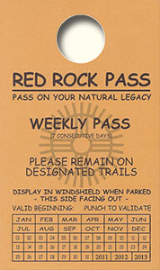
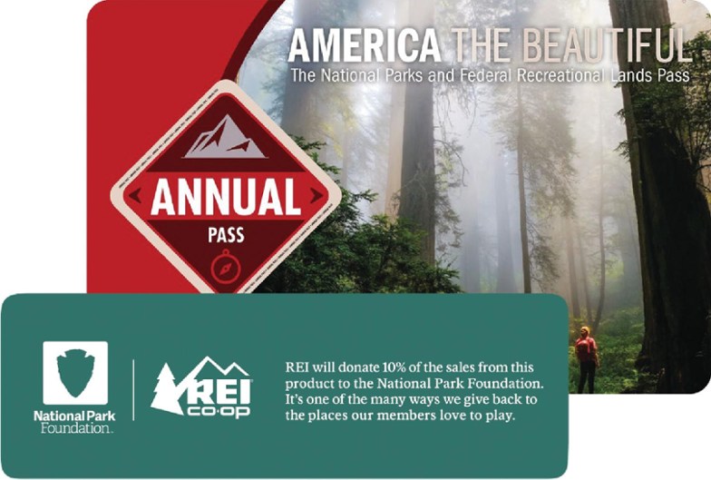
• Parking at most Sedona trailheads requires that you pay a $5 fee for a day pass. There are electronic machines at the trailheads that will take cards, or sometimes there is a staffed station where an actual person will take your payment. You can also buy a weekly or annual Red Rock Pass to put in the windshield of your vehicle, which will give you access to park at multiple trailheads. Alternatively, the America the Beautiful Annual Parks Pass is valid in lieu of the Red Rock Pass except in a few special locations, like West Fork.
• As far as I can remember, there have been bathrooms at every Sedona trailhead I’ve ever parked at.
• As far as I can remember, there is not a place to fill up your water bottle at any of the trailheads, so be sure to pack full water bottles/hydration reservoirs.
Best Sedona Day Hikes for Views
Bear Mountain


Mileage: 5 miles out-and-back
Fee to Park: Yes, $5 day pass. Annual Red Rock Pass or America the Beautiful Pass accepted.
Payment Machine or Forest Service Employee: Machine
Other parking notes: The area where you park is close to other trailheads, like Doe Mountain. You’ll need to walk across the road to reach the Bear Mountain trailhead.
AllTrails | USFS
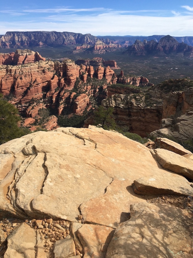
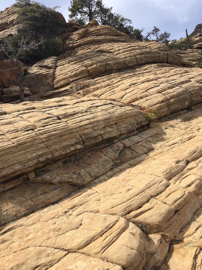
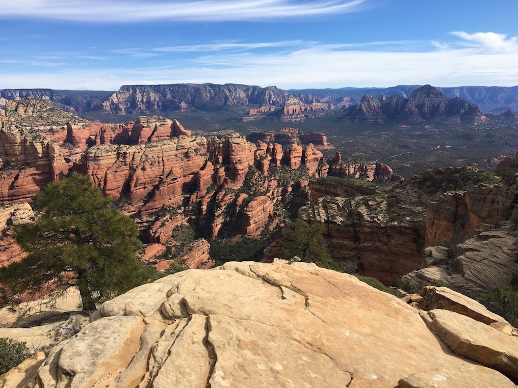
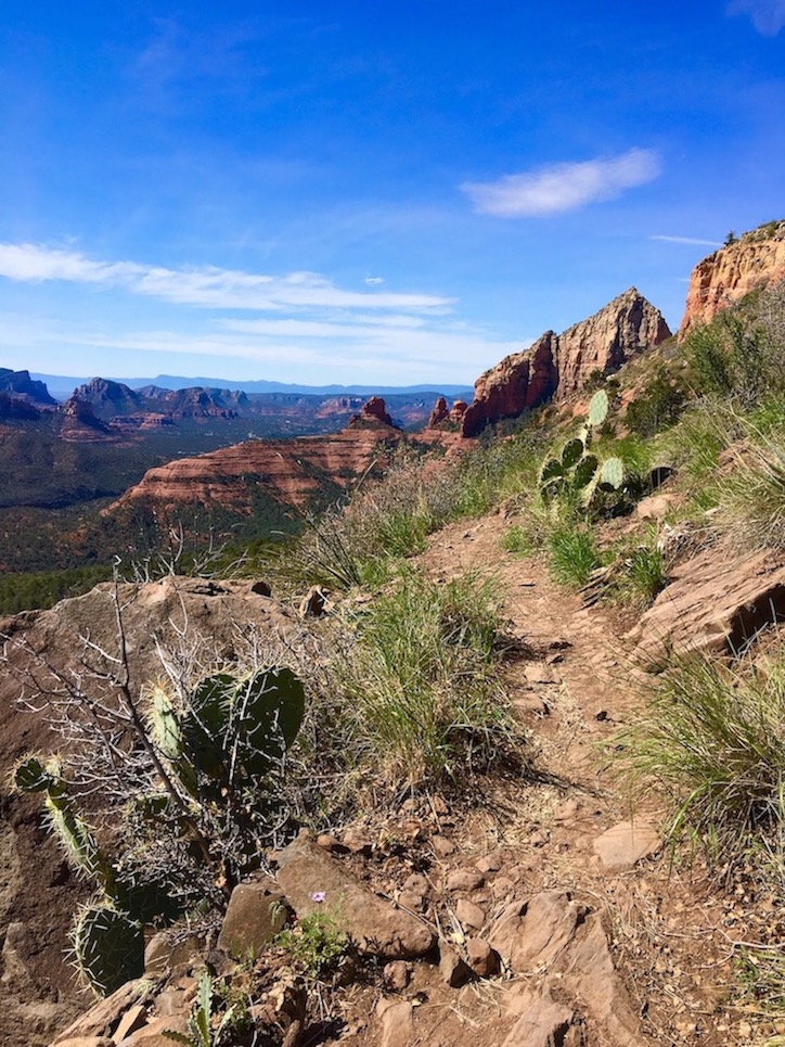
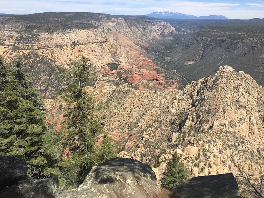
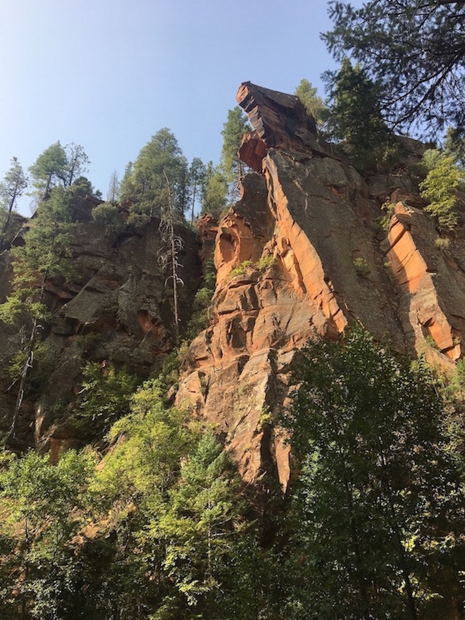
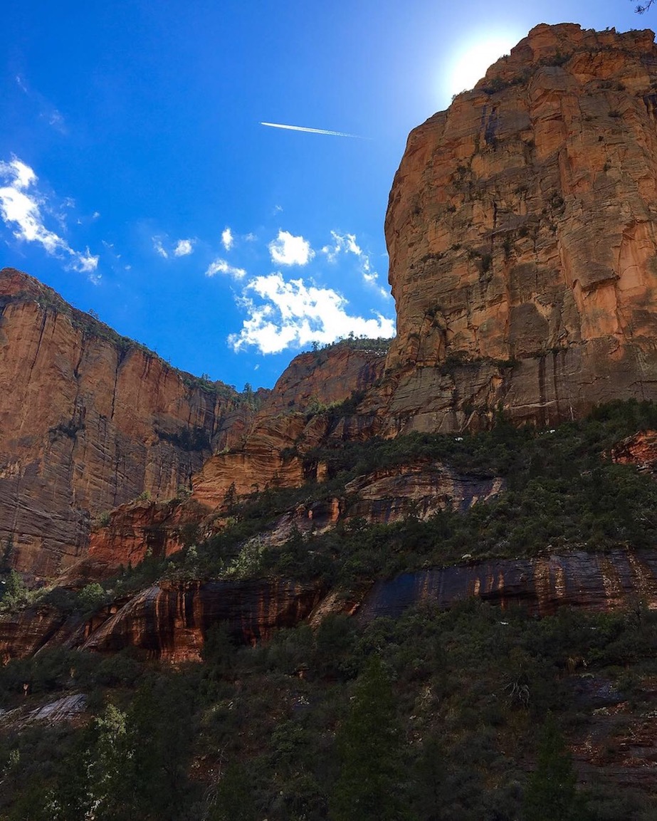
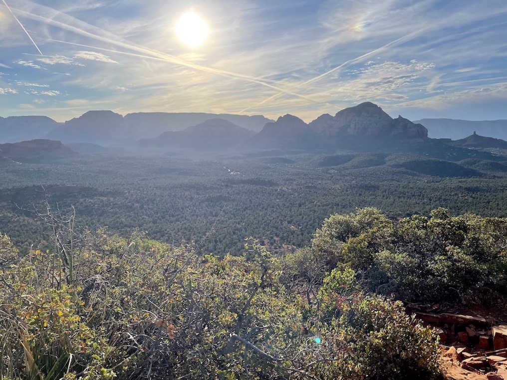
The Bear Mountain out-and-back hike has hands-down the best views of any trail I’ve done in Sedona! Of course, it comes at a price. There are multiple false summits before you reach the very top, and most of the hike is uphill. One section requires a very brief scramble where you need to use your hands to hoist yourself, but there are good footholds. The terrain on some of the flatter sections is comprised of odd, gently sloping slabs of slickrock that require careful steps. There is also no shade on this trail, so it’s not a great one for summertime. When I hiked Bear Mountain I was still having problems with my knees, so the downhill on the return descent was a bit painful. If I did it again now this wouldn’t be a problem, and probably isn’t for most people.
If you’re looking for a good challenge and incredible sweeping views over the whole landscape of Sedona, Bear Mountain is a winner!
Wilson Mountain


Mileage: 11.5 miles out-and-back
Fee to Park: Yes, $5 day pass. Annual Red Rock Pass or America the Beautiful Pass accepted.
Payment Machine or Forest Service Employee: Machine
Other parking notes: The parking lot for the regular Wilson Mountain route is right next to Midgley Bridge. It’s a bit small and can fill up fast. The parking lot for North Wilson Mountain is prior to Midgley Bridge if you’re coming from the North (from Flagstaff). It’s not usually as busy.
AllTrails | USFS
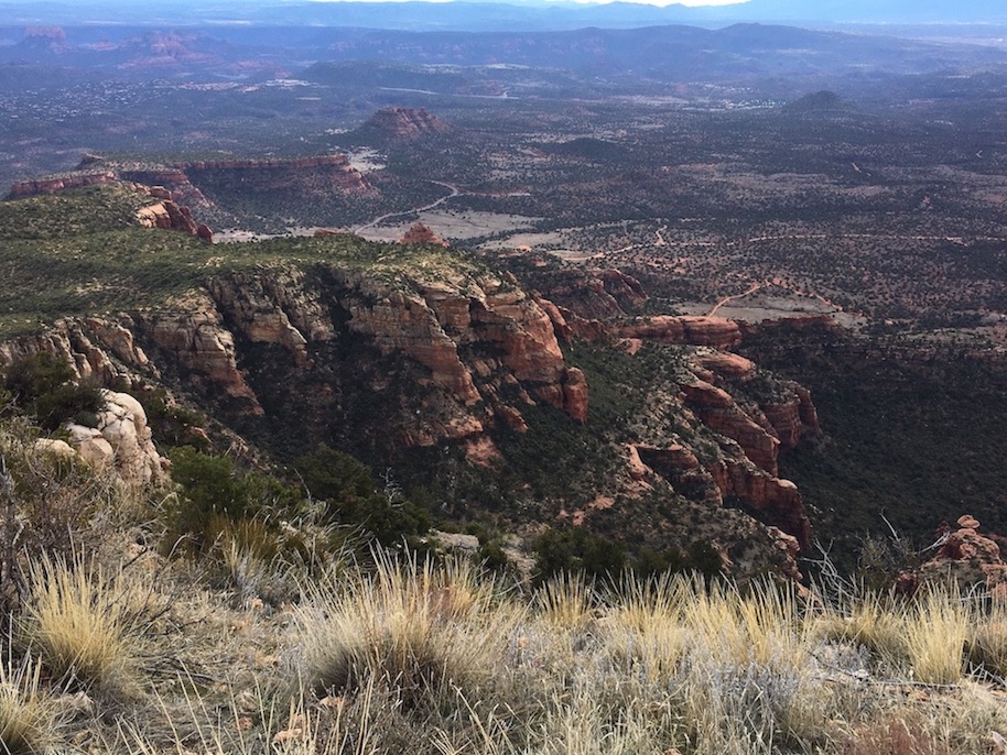
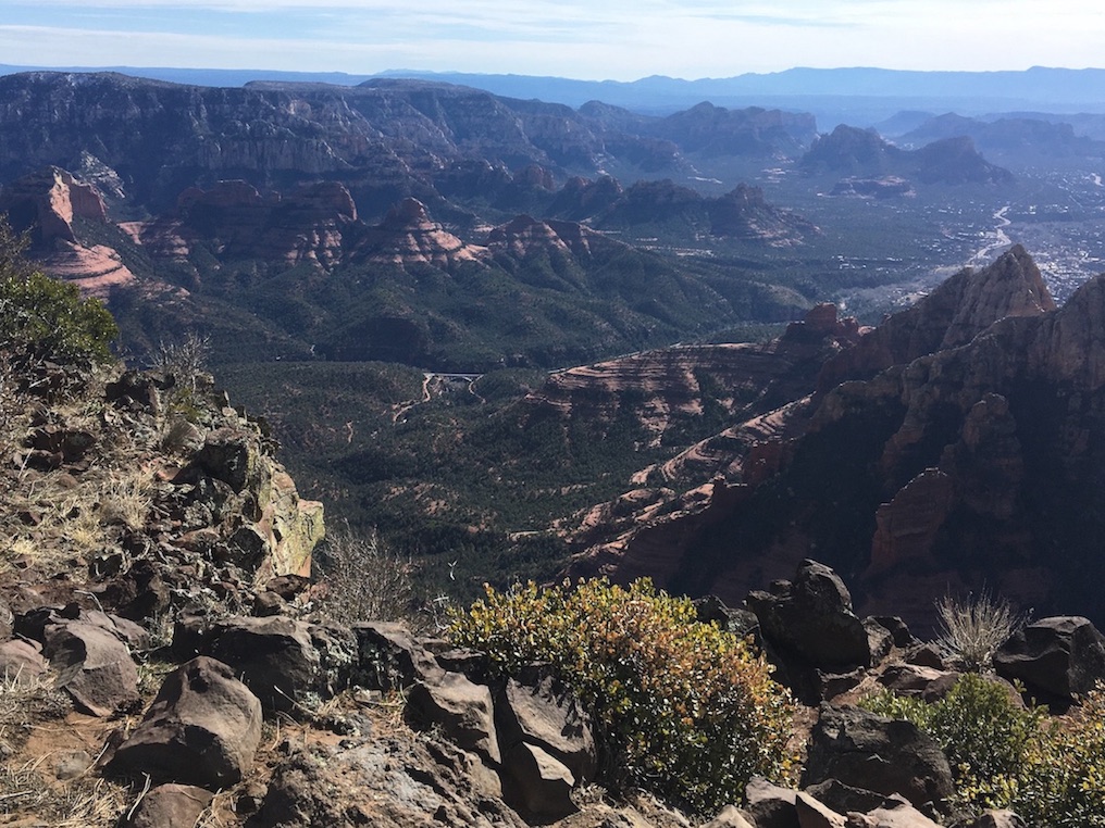
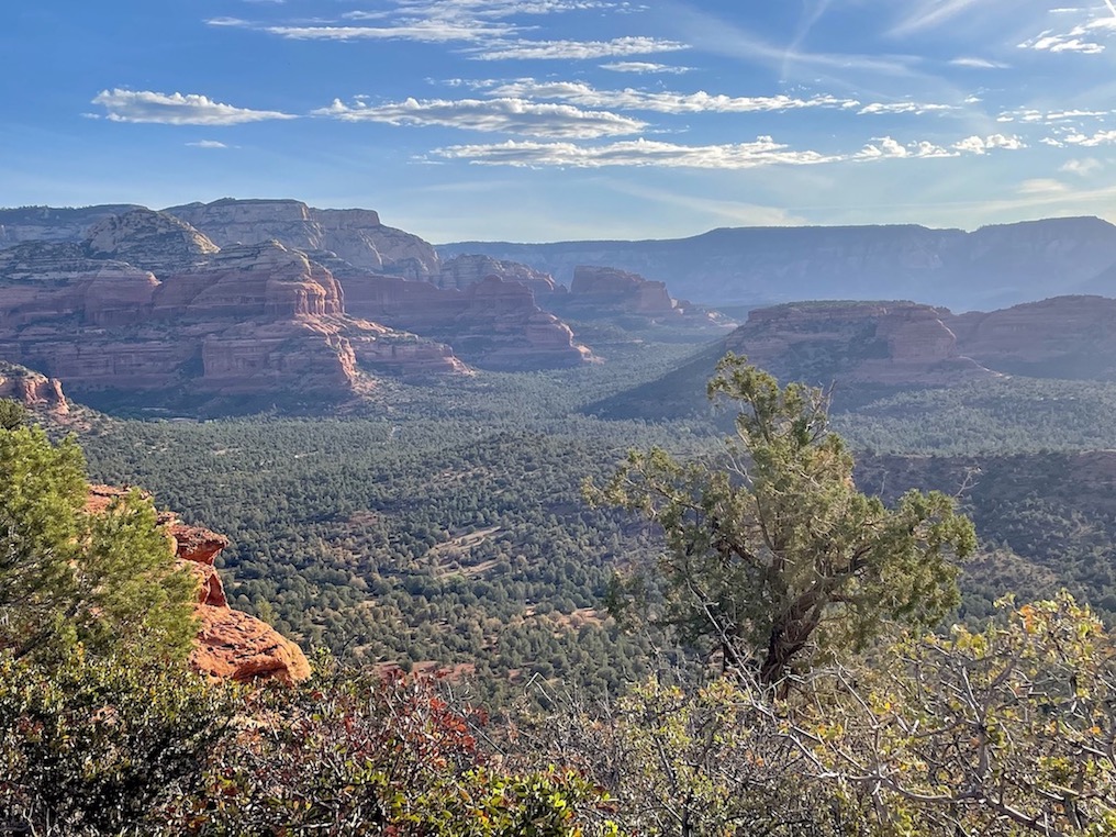
Before I did Bear Mountain, I thought Wilson Mountain had the best views. It is still spectacular and one of my favorite Sedona day hikes overall, though it clocks in at #2 for views now. This is also an out-and-back, though there are two different routes to summit Wilson Mountain – the regular way, and then the North Wilson Mountain trail. I prefer the regular way because it includes a few miles of desert landscape before you get into the forest, whereas the North Wilson route spends most of the time in the forest.
Even though Wilson Mountain is double the mileage of Bear Mountain and is also one of the more challenging hikes on this list, it includes more flat sections and the uphills are more gradual, so I would actually rate it as easier than Bear Mountain. There is a false summit – you arrive at a saddle (right after one of my favorite sections where you cross a wildflower-covered ridgeline) and believe you’re finished, but there’s actually another couple miles of uphill to go. Some people turn around at the saddle, but you’re really missing out if you don’t continue!
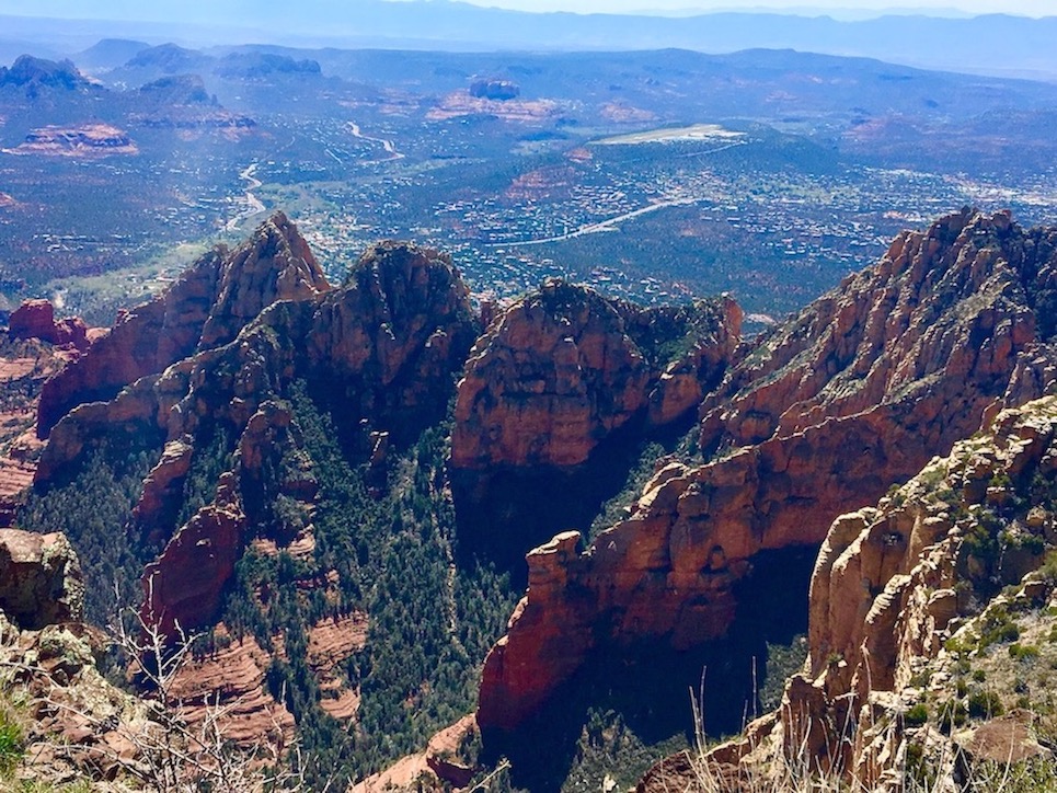
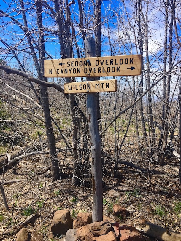
At the very end, you will see a sign pointing you towards two different overlooks. There’s the Sedona Overlook to your left, and the North Canyon Overlook to your right. If you only have time for one, the Sedona Overlook is much more spectacular, as you can see over the town of Sedona. All the rock formations that usually look so huge from below look tiny from up above. The North Canyon Overlook is ok, but is mostly a birds-eye view of the forest canyon and Humphreys Peak in Flagstaff in the distance. It also takes what feels like ages to get there (though in actuality it’s only another couple miles) for not as much payoff. But I am glad I have seen both!
Note: Last time I did this hike, I heard a pack of coyotes howling nearby. On the North Wilson route, I once heard a rattlesnake rattling it’s tail. You are more likely to encounter snakes on the forested North Wilson route; there is even a warning sign about it at the trailhead.
Best Sedona Day Hikes for Shade
West Fork Trail


Mileage: 7 miles out-and-back
Fee to Park: Yes, $12 day use. America the Beautiful or regular Red Rock Pass are not valid here. The Grand Annual Red Rock Pass is valid and can be purchased onsite from the manned payment station.
Payment Machine or Forest Service Employee: Employee
Other parking notes: There is a lot of space in a good-sized parking lot. It is such a popular trail that it can still be packed though; arrive early. Be careful exiting back onto the road afterwards as it’s hard to see cars coming around the bend from the right.
AllTrails | USFS
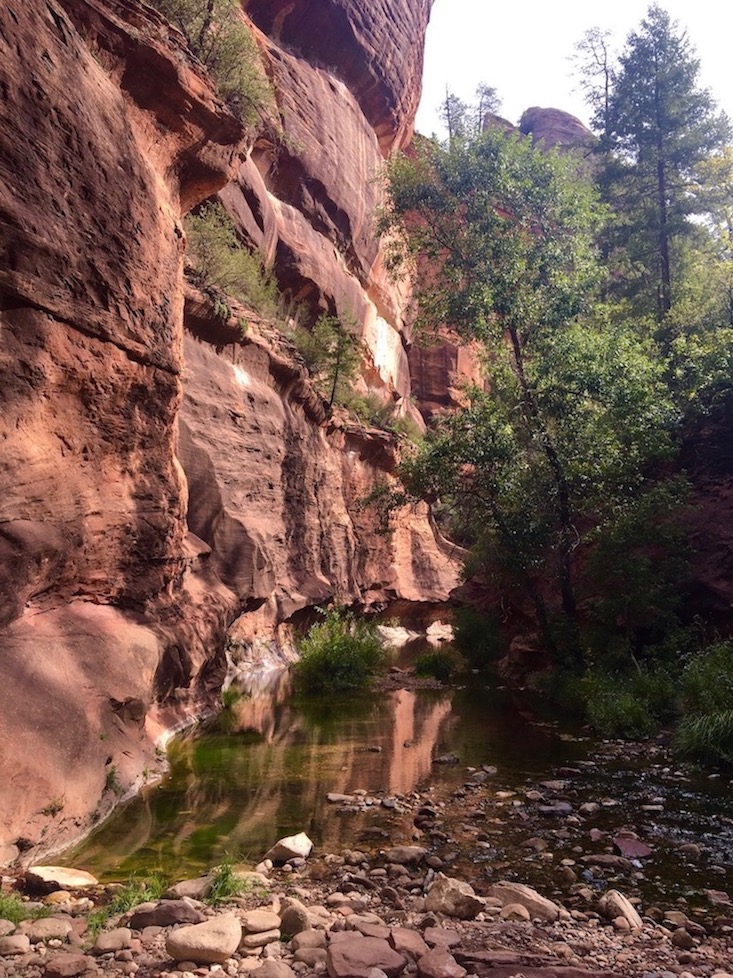
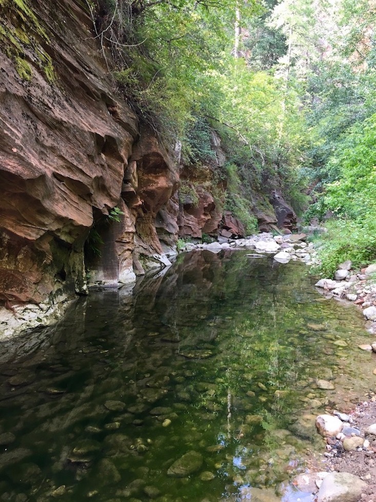
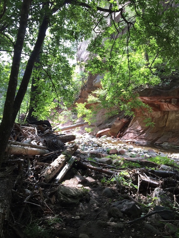
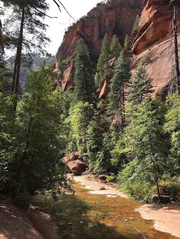
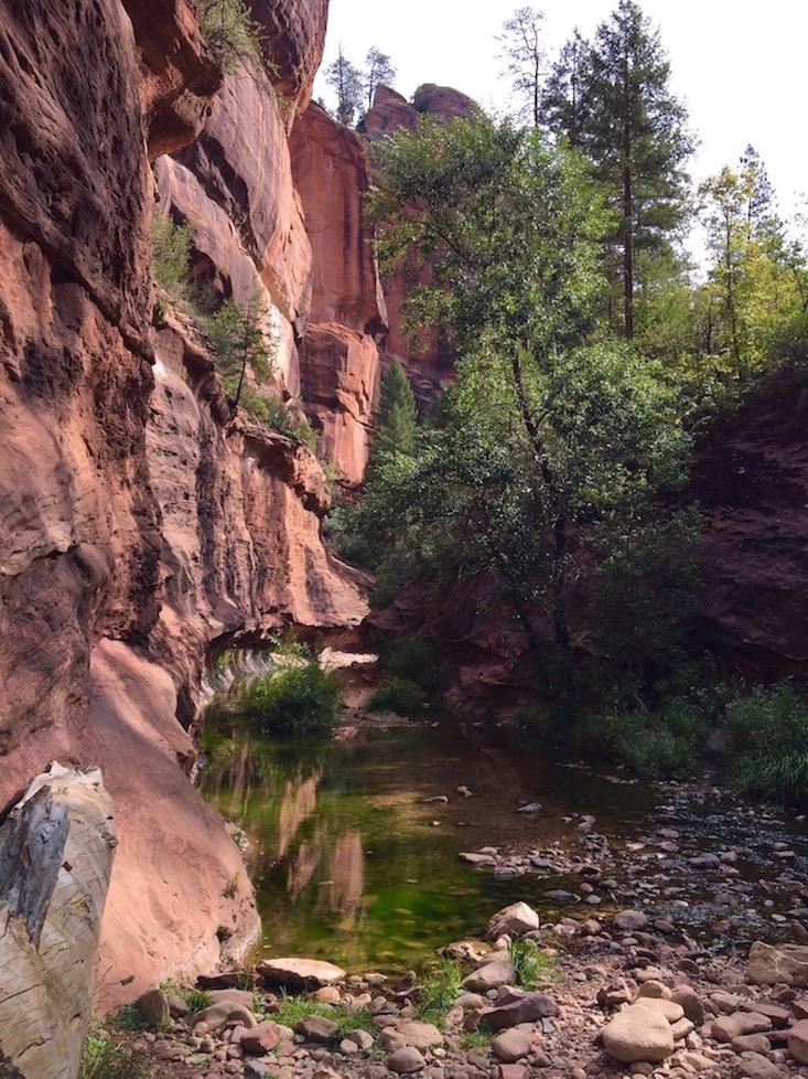
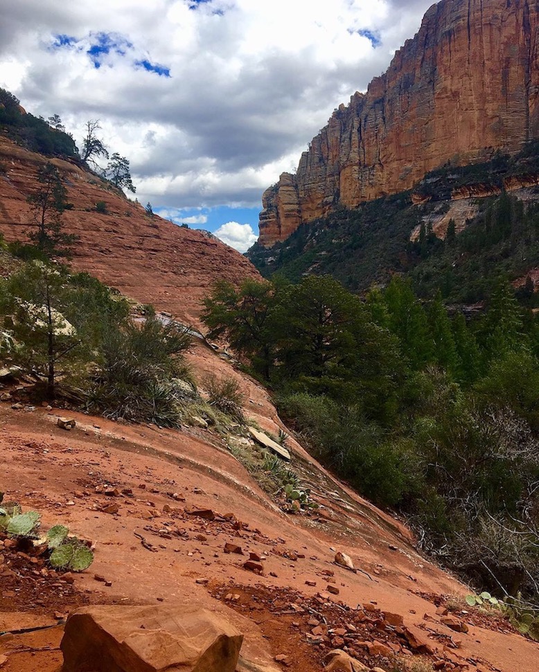
West Fork Trail is a very popular out-and-back day hike in Oak Creek Canyon, and for good reason. It’s a peaceful, enchanting jaunt through shaded trees and includes 13 creek crossings, ultimately leading to an area some refer to as the “narrows” where you’d need water shoes of some kind to continue on. If you have a permit to camp beyond the narrows, that is the main reason to continue from here, but most people turn around at this point.
West Fork Trail is entirely flat, so it’s a good choice if you’re interested in earning a hefty dose of beauty without strenuous effort. Hikes in Oak Creek Canyon are also just about the only viable choice in the hot summer months because of cool water access and tree cover. This isn’t a great hike when winter snow is melting off, because the creek levels can rise rapidly and render some of the crossings impossible, or precarious at the very least. One time in January I wasn’t able to finish this hike because I met some people a few miles in who were already returning from the endpoint, and they told me that in the time it took them to get there and back to where I currently was, the water had already risen a foot. They predicted that if I pushed on, it could have been difficult for me to cross back again on my return.
The abandoned homestead you’ll see towards the very beginning of this hike belonged to Jesse Jefferson “Bear” Howard, a local legend.
Boynton Canyon Trail


Mileage: 6 miles out-and-back
Fee to Park: Yes, $5 day pass. Annual Red Rock Pass or America the Beautiful Pass accepted.
Payment Machine or Forest Service Employee: Machine
Other parking notes: The parking lot was full both times I did this hike. I ended up parking on the street, which is allowed along a couple stretches of the road.
AllTrails | USFS
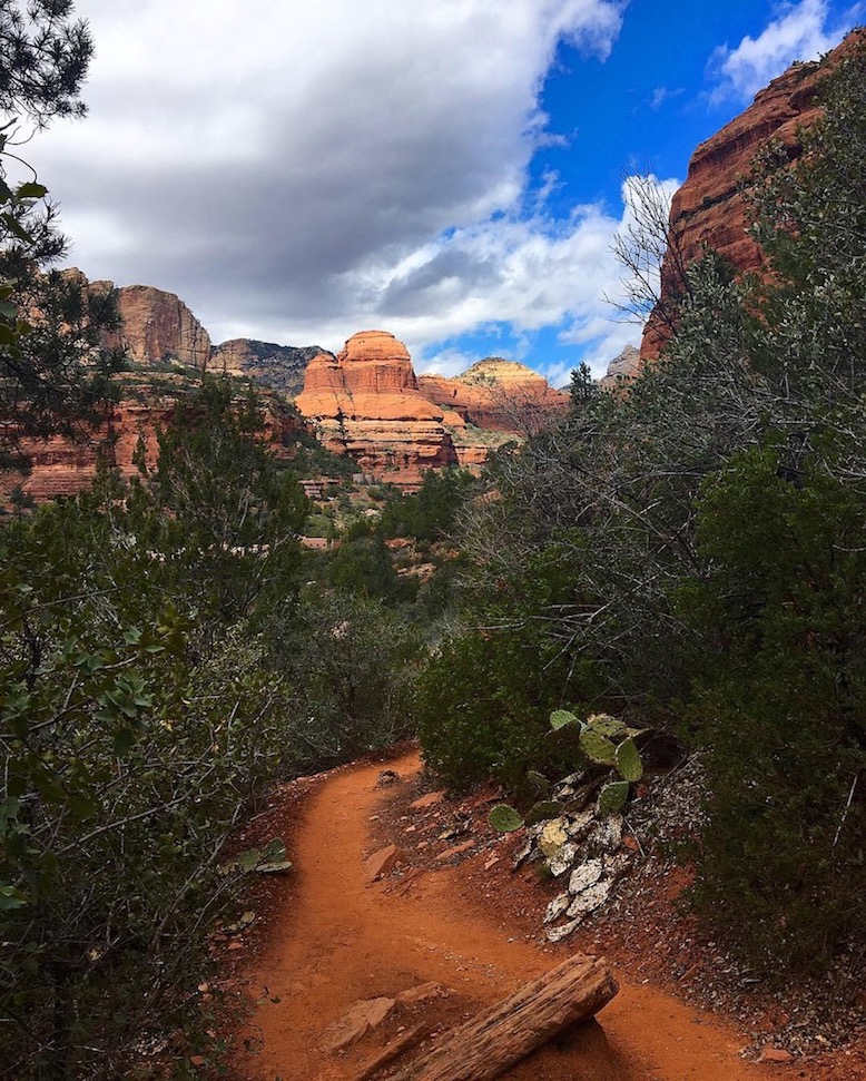
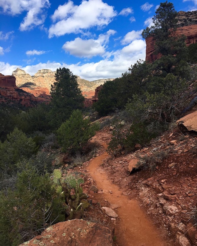
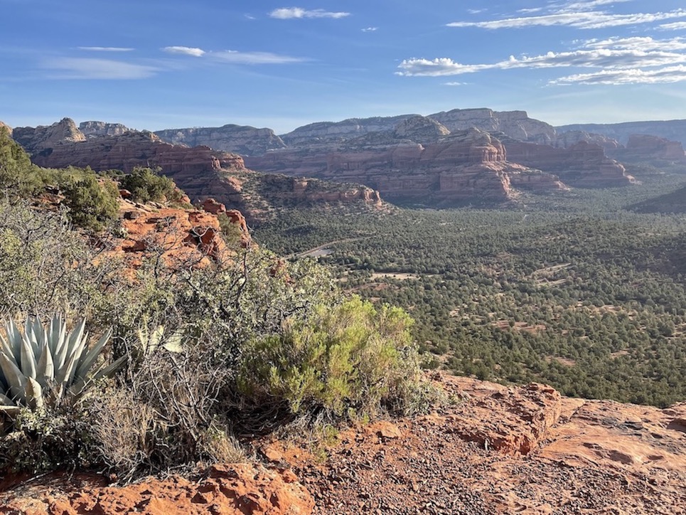
The Boynton Canyon out-and-back is another good hike if you’re looking for a mostly flat trail with portions of shade! The first mile or so is all in the open desert sun and follows alongside a resort for a bit. Then you enter the trees, remain in the shade, and feel more secluded for the majority of the route. At the very last second, there is suddenly a steep uphill to climb to an impressive viewpoint. From this view you are looking down the canyon rather than over the entire city like on Bear Mountain or Wilson Mountain. When you’re at the viewpoint, you’re standing on a vast rock surface where most hikers take a seat and break out the snacks.
Every time I’ve hiked Boynton Canyon, I’ve seen javelina running along the road just before I parked. There’s also always a ton of butterflies along the trail. You’re likely to meet some of the infamous Sedona hippies, because this trail includes a vortex site. When I first did this hike, one guy was balancing atop a tall rock formation playing a flute (I have no idea how he got up there), and another guy gave me a rock shaped like a heart and told me he was passing on the good vibes.
Easy but Iconic Sedona Day Hikes
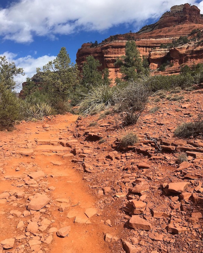
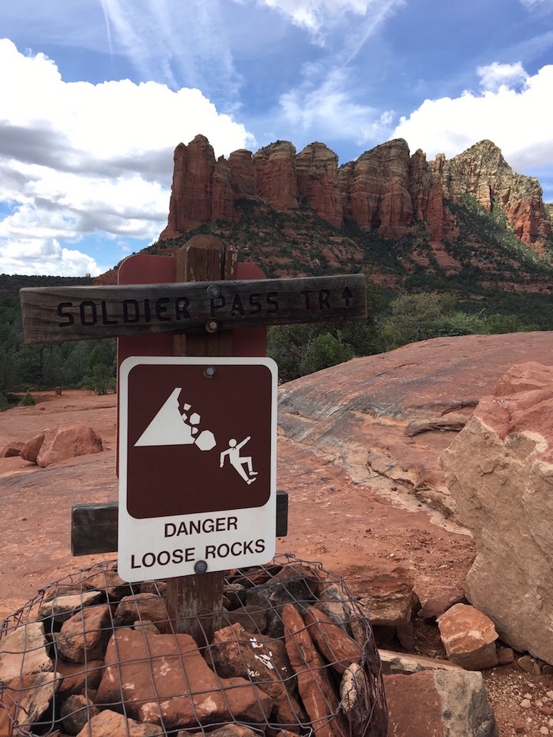
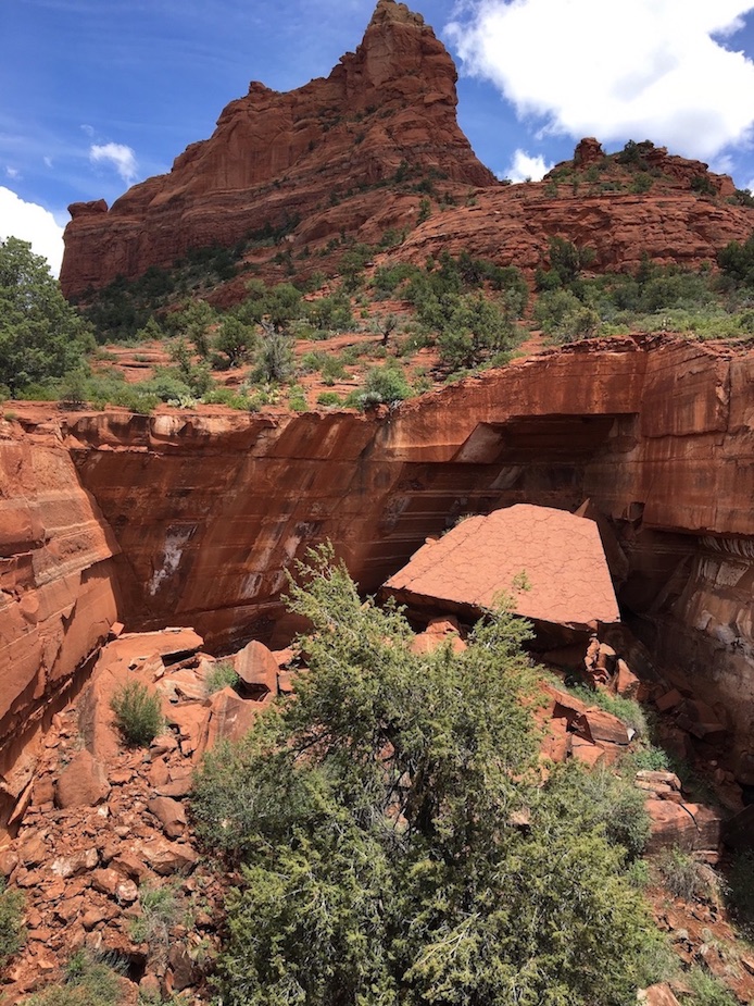
Cibola Pass to Jordan Trail to Soldier Pass Trail to Brins Mesa


Mileage: 8 mile lollipop
Fee to Park: Jordan/Brins Mesa trailhead requires the $5 day pass. Annual Red Rock Pass or America the Beautiful Pass accepted. There is now a free park-and-ride shuttle for Soldier Pass trailhead available on Thursdays-Sundays.
Payment Machine or Forest Service Employee: Machine
Other parking notes: If you park at the Jordan/Brins Mesa trailhead, make sure your car can handle the rough road as some reviews of the trail online mention trouble driving (I had no problem in my Toyota Tacoma). The Soldier’s Pass trailhead is smaller and fills up on parking. If one lot is full when you arrive and you have to park at the other, that ultimately might be your deciding factor on how you organize the sequence of your loop.
AllTrails | USFS
Cibola/Jordan/Soldier/Brins is a famous Sedona day hike because people have seen the Seven Sacred Pools on Instagram. I didn’t think the potholes were particularly noteworthy; there are other things to admire about this route, like interesting views over the greater Sedona landscape.
There are a few connecting trails in this area, so you can organize your loop a variety of ways to make it shorter or longer, or go clockwise vs counterclockwise. Putting Brins Mesa last will give you a cool endpoint destination; I like to have a rewarding goal to push towards. This isn’t much of a “wilderness” trail, but what I enjoyed about it was the variety. There are some open desert sections, forested sections, grassy meadows, the Devil’s sinkhole, and a large rock plateau you can climb up to for an expansive perspective.
Towards the beginning of the hike, I got confused about whether I was on the right path or not since I was trying to connect Cibola, Jordan, Soldier’s, and Brins correctly. You’ll see comments on AllTrails that other people have had some confusion finding the trail as well. It might be a good idea to download offline maps beforehand if it’s important to you to connect the route in a certain order.
This is the same part of town as the Chimney Rock and Sugarloaf Summit hikes that @GolsonCharles recommended I try, which I also enjoyed! Both are shorter trails but include a good little workout to get up to a summit viewpoint (I posted videos here and pictures here). Thunder Mountain Trail connects the Chimney Rock loop to the Sugarloaf Summit loop, or you could just do them separately. Their trailheads are a 4 minute drive apart. Technically I think you could connect these two loops to Brins Mesa, Soldier Pass, and Jordan Trail too.
Doe Mountain Trail


Mileage: 1.5 miles out-and-back
Fee to Park: Yes, $5 day pass. Annual Red Rock Pass or America the Beautiful Pass accepted.
Payment Machine or Forest Service Employee: Machine
Other parking notes: It’s the same parking lot as the Bear Mountain lot.
AllTrails | USFS
If you hike Doe Mountain Trail at sunrise you’ll get to watch hot air balloons rise up over the horizon! I didn’t get to the trailhead early enough to catch the balloons during my hike, but I did see them while I was driving over from my campsite. I pulled over to take pictures and then continued on to the trailhead.
The out-and-back Doe Mountain trail isn’t very long or strenuous, but it is uphill with switchbacks. When you get to the top you reach an expansive, flat mesa you can explore further for panoramic views. Each side of the mesa will give you different perspectives.
Honorable Mentions
I haven’t done the following trails yet, but they’re on my list:
Mitten Ridge – includes an old wagon trail, more secluded than the trails mentioned above. Trail reports mention some dicey sections and exposed dropoffs. Read also: Hangover Trail
AB Young Trail – someone in my Flagstaff Hiking Club facebook group recommended this one and the views look amazing! It’s a lot of elevation gain over a short period and requires a confusing creek crossing to get to the trailhead.
Vultee Arch Trail – a quiet, secluded choice with a short scramble at the end. The road to get here requires 4-wheel drive. The trailhead is very close to the Devil’s Bridge trailhead so you could actually do both the same day.
Devil’s Bridge – Iconic rock formation, very popular, too much hype on instagram so I’ve been avoiding it – but I’m sure it’s worth it.
Bell Trail – @jwenerd did this trail and posted a cool video jumping off a rock into a swimming hole, so obviously that’s all we need to know to be excited about this one.
Bell Rock – Iconic rock formation, short and popular, not well-marked.
General Sedona Recommendations
Where to eat in Sedona: I love stopping by Local Juicery for a healthy smoothie or Berry Divine for an acai bowl after a long hot hike when I need something refreshing! There is a place called ChocolaTree that I haven’t eaten at yet which always piques my interest based solely on the chocolate reference, though it is an actual restaurant with organic options.
Where to stay in Sedona: All of the little inns down in Oak Creek Canyon look adorable. I’ve yet to stay in one since I live so close, but anything there would be a cozy, secluded choice. Josie (from Adventures with Josie!) recently told me about TinyCamp, a beautiful tiny home retreat that’s nearby most of the hikes listed above. I’m chomping at the bit to try it out! Sedona Camp Tiny House looks like a similar alternative. If you’re into camping, I love using The Dyrt to find free or paid campsites.
Guided Tours in Sedona: If you prefer not to go it alone, there are tour companies that operate in the Sedona area. Pink Jeep Tours does sightseeing tours and Wildland Trekking does private day hikes and group backpacking and lodge-based trips. Hot air balloon rides (here and here) and helicopter tours are also quite popular in Sedona. GetYourGuide features a ton of Sedona-area day tours, including open air van tours, a Vortex yoga hike, a nighttime UFO and stargazing tour, and day trips to the Grand Canyon, Montezuma, and other nearby attractions. I think the “Hopi Lands: Full-Day Archaeology and Culture Tour” sounds particularly interesting.
Winter in Sedona: Sedona can actually be quite snowy in the winter. It’s considered “high desert,” more like Flagstaff than Phoenix. I mentioned that West Fork Trail is not a great option this time of year, but there are plenty of other things to do in Sedona in winter.
✈️ Coming to Arizona from further afield? Use an Airalo eSIM for affordable international cell data and don’t forget to protect your investment with travel insurance.
What are your favorite day hikes in Sedona? Do you think the Insta-famous routes are worth it, or do you prefer to get away from the crowds? Everything in Sedona is gorgeous, so it’s hard to go wrong. Don’t forget that cell service is not great at some of the trailheads, especially the ones down in Oak Creek Canyon, so you’ll want to have your transportation sorted in advance. It would be difficult to call a taxi to pick you up and Uber is not a big thing in Sedona.
Related:


Pin It:
My dream is to write travel and hiking content full-time. All of my guides and itineraries are free and my travels are self-funded. If you enjoy my site and would like to support, you can donate any amount to my Ko-fi page. Thank you!!
As a nearly life long resident of AZ who has been hiking it since Boy Scouts days I have to say I am disgusted by the overcrowding by way to many hikers. It’s not fun anymore. As a lifelong journalist I must ask you to tell it like it is and tell readers it is overcrowded.
Yeah, anytime I post anything about Sedona on Twitter a local always comes out of the woodwork to gatekeep. I used the words "popular" and "packed" in this post to describe some trails but personally I can’t say I don’t find it fun anymore.
Love your recommendations for Sedona. We managed to do Devils Bridge without the crowd and the views were amazing. Going to have to venture back and check out your recommended hikes. Thanks for posting
Thanks Steve, that’s awesome that you had a more secluded experience out there and got to take it all in! Every nook and cranny of Sedona is beautiful, worth many visits!
this is so amazing! really wishin’ we had hikes like this where i’m from!
After my one hiking experience in Arizona (I was young, stupid, from another country, and not prepared for the heat), it put a little smile on my face to see that you’d included West Fork Trail as a shady option. I’d definitely opt for this one!
I feel you, when I was living in Los Angeles I made a few bad decisions to hike in terrible heat as well – always considering the shade factor/time of day nowadays!
These all look like fantastic hikes to go on! I would love to go hiking on them during the autumn time.
The colors at West Fork are beautiful in autumn!
Wow! These hikes really are beautiful. We haven’t visited Sedona, but your post makes me want to. I especially love the views from Bear Mountain!
Boynton Canyon is on my radar! You had me at javelina! 😀
This makes me wanna be back in Sedona so badly! There’s several trails on here I haven’t tried yet so def saving this for my next trip. I usually am in that area in the winter for a long weekend but, yeah, prob ain’t happening this year!
I’ve done a couple of hikes and overnights in the Sedona area. It is a gorgeous wilderness. I didn’t do any of these so this will be a great resource in the future.
Would be curious which overnights you did! Red Rock Secret Mountain area?
So many cool trails to explore in Sedona! These are calling my name – as a Vermonter, I am always drawn to red rocks and canyons. It’s so different from what I’m used to. Looks like I’d need to spend a whole week to explore them all. How’s the winter hiking?
Same here, I grew up in TX and then spent many years on the east coast (Boston and NYC) and in California before finally exploring the Southwest, and it blew my mind. Red Red Country is my favorite now, it’s hard to turn back!
I’ve only seen the Grand Canyon and Flagstaff in winter, this will be my first winter where I may go visit Sedona too. It’s supposed to be gorgeous, and since the elevation is lower, I would wager it’s easier hiking than Flag or GC. In those areas spikes are extra necessary and some trails become too dicey for my taste. I think driving to Sedona via Oak Creek Canyon will be scary in wintertime though. I’ll have to work up the courage to do it.
This post is so helpful. I especially love how you break down the parking and fee piece. It might sound silly, but I really like researching that ahead of time so I know if there’s a fee, if I need cash, is it cheaper if I pay in advance, etc. Thanks for doing the work for me!
Awesome, thanks Kristen! That part always gives me anxiety as well, and when I suggest trails to people it’s always the first thing they ask so I think it must be universal!
Flipping ‘eck Claire! I missed your writing. I love that when you write about an area, you fill it with aaaaaall the juicy details so that we can go hiking in the best spots and find the best detours. 🙂
I am a bit scared of what is happening South of the border right now (it seems like the current administration has given up on containing covid-19) but hopefully at some point it’ll get to the point where I can come South to walk with you.
I was thinking of you when I wrote this one! Decided to take your advice and talk about some of my local adventures and not worry that perhaps people just want to hear about the big long epic ones. You were right, it felt good to share these day hike stories! And hopefully it’s helpful to more people’s daily lives.
Girrrrl you know if you do come visit here we have got to HANG
We really do! I just hope we both have some hiking legs left after the madness (and sitting on our arses) of 2020!