

Five Hikes for Fall Foliage Viewing Near Twin Lakes, Colorado
Purchases made through some links on this page may provide The Detour Effect with commissions (at no extra cost to you). Thank you!
There are just a couple weeks left for hikers to enjoy the colorful golden aspen leaves near Twin Lakes, Colorado. The viewing window in this high elevation region of the state is rather short; the leaves begin to change in mid-September, peak in early October, and typically fall before November. This year, snow has already dusted Mount Elbert and the surrounding peaks, and although it’s not quite sticking yet, locals are bracing for the coming winter. Hiking shoes will soon be traded for snow boots and not see the light of day again until May.
My suggested day hiking trails provide opportunities to see fall foliage near Twin Lakes, Colorado and throughout Lake County and nearby Leadville. Many of them intersect with the Continental Divide Trail or Colorado Trail, so you may meet thru-hikers along the way. Southbound CDT hikers aim to get through Twin Lakes by the first week of October so they can make it through the San Juan Mountains before the weather gets too dicey.
While this list isn’t a comprehensive compiling of all the possible hiking trails where you can see fall colors in the region, if you’re driving up from Denver or Colorado Springs for a weekend leaf peeping trip, you won’t have a chance to hike every single aspen-lined trail anyway. These five hikes near Twin Lakes are worth prioritizing.
There is another town called Twin Lakes, Colorado north of Denver. This article focuses on the Twin Lakes near Leadville and Buena Vista. “Twin Lakes” can refer to either the town (aka Twin Lakes Village) or the geographical feature it was built next to: two side-by-side lakes.
Hope Pass


Mileage: 5.5 miles total from Sheep Gulch, or 8.5 miles total from Willis Gulch
Style: Out-and-back (otherwise you’d need to have someone park at the opposite trailhead to pick you up if you plan to hike point-to-point)
Elevation high point: 12,600ft
Elevation change: 2,644ft of change from Sheep Gulch, or 3,254ft of change from Willis Gulch.
Trailhead: Sheep Gulch or Willis Gulch
AllTrails 1 / AllTrails 2 / USFS

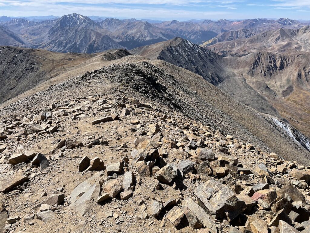
Hope Pass is a landmark on the Continental Divide Trail, but you don’t have to be a thru-hiker to experience its phenomenal views. Hope Pass can be reached on a day hike by starting at Sheep Gulch trailhead, or on the opposite side of the pass at Willis Gulch. I chose Sheep Gulch, and this route instantaneously became one of my favorite day hikes near Twin Lakes, Colorado. While it starts out very steep from the get-go, it tops out at 12,600ft and is not as demanding as a fourteener. Still, no views are sacrificed. Your vantage point looking out over the Collegiate Peaks is breathtaking, and when you reach the pass, a new perspective towards Twin Lakes comes into view. In late September the fall colors were dazzling at Hope Pass, and I can’t see how it could have been made any more beautiful by continuing the extra distance to summit Mount Hope or Quail Mountain (but go for it if you still have legs!).
On your way to the trailhead, you’ll pass Vicksburg ghost town just off the road, which is easy to pull over and explore without extra hiking. Further down the road after the trailhead is another ghost town called Winfield. You can either drive to Winfield, or you could hike to Winfield from Sheep Gulch trailhead instead of hiking to Hope Pass if you’re looking for an easier alternative without a steep ascent.
Mount Elbert


Mileage: 12 miles total (6 miles each way) from South, or 10 miles total from North
Style: Out-and-back
Elevation high point: 14,433ft
Elevation change: 4800ft from South or 4400ft from North
Trailhead: Upper South Mount Elbert or North Mount Elbert
AllTrails 1 / AllTrails 2 / USFS 1 / USFS 2
Mount Elbert is the tallest mountain in the state of Colorado, and a “must hike” for any peakbagger going after all the 14ers. Since most hikers think of summiting Elbert as a physical challenge first and foremost, it’s easy to forget that the trails to get there, South Mount Elbert and North Mount Elbert, also have plenty to offer in terms of intrinsic beauty. Hikers will spend the first ~2.5 miles weaving through aspen trees. Once they emerge above treeline, they’ll have views of Twin Lakes, Forebay Reservoir, Turquoise Lake, and distant mountain ranges on all sides. The fall foliage is especially stunning in the area surrounding Twin Lakes, so I recommend choosing South Mount Elbert Trail over the North Trail since it provides more views of that region.
Other fourteeners in the Twin Lakes area include Mount Massive, La Plata, Mount Belford, Mount Sherman, Mount Oxford, Mount Yale, Mount Harvard, and Huron Peak, to name a few.
South Elbert vs. North Elbert: Which Should You Hike?
Are you traveling with an adventure dog?
I’ve started creating souvenir Dog Collar Patches for many of the destinations I’ve visited – they are hand-drawn and snap onto the collar, so they are removable, collectible, and mix-and-matchable! Check out the Mount Elbert design:


Lily Ponds


Mileage: 5.7 miles total (2.85 each way)
Style: Out-and-back
Elevation high point: 10,533ft
Elevation change: 1,079ft
Trailhead: Lower South Mount Elbert Trailhead
AllTrails / USFS
If you’re not interested in summiting a 14er this fall, which might be wise as the temperatures drop later in the season, you can instead hike from the South Mount Elbert Trailhead to the Lily Ponds, sometimes referred to as the Beaver Ponds. This stretch of the trail will really prioritize the aspens and still provide a nice view over Twin Lakes without requiring you to gain such drastic elevation. You can even take a spur trail down to Twin Lakes Village if you’re up for some extra mileage, or if you park another car in the village so you don’t have to hike back. Reward yourself with a nice lunch at one of the food trucks!
Interlaken


Mileage: 4.6 miles total (2.3 miles each way)
Style: Out-and-back
Elevation high point: 9,272ft
Elevation change: 219ft
Trailhead: Interlaken Trailhead
AllTrails / USFS
*June 2024 Update: Some idiots didn’t put out their campfire properly and lit the whole forest on fire near Interlaken. The wildfire has raged for a week now. It’s a miracle the buildings themselves didn’t light up yet. If a lot of the trees immediately trailside are affected, this might not be the prettiest hike this fall.
When the leaves start changing in Lake County, it’d be a shame to eschew the hiking trail to the old Interlakken ghost town – or, more accurately, ghost resort. The resort originally opened in 1879 and vacationers would take a boat across Twin Lakes to reach it. Today the abandoned cabins at Interlaken form a historic landmark, and in the summer and autumn you can hike or kayak to them. The hike traces along the lakeshore beneath the shade of trees, and especially in the last mile before you reach the cabins, you’ll find yourself in a maze of white aspen tree trunks topped with golden leaves. Keep an eye out for an osprey nest!
The trail to Interlaken is mostly flat with negligible elevation change, though it does roll briefly over a few tame hills. You may see folks on the beach near the parking area fishing, kayaking, stand-up paddle boarding, or throwing sticks in the lake for dogs to fetch.
Lost Man Lake


Mileage: 5.5 miles total
Style: Out-and-back (it can be done as a point-to-point thru-hike if you park cars on both ends)
Elevation high point: 12,815ft
Elevation change: 1,601ft
Trailhead: Independence Lake Trailhead
AllTrails / USFS

While the coolest parts of the Lost Man Lake trail are above treeline, the first 1.5 miles or so showcase beautiful yellow and red leaves in the ground cover and low lying bushes. I felt like I was hiking through a Monet painting because of the way the colors melted and swirled throughout the highland meadows. Eventually you will reach Independence Lake on your right, and finally up on the pass you’ll be rewarded with a view of Lost Man Lake on the other side. When standing on the narrow pass, you can see both vantage points and both lakes simultaneously. It’s quite special.
Reaching the trailhead for Lost Man Lake requires driving Independence Pass towards Aspen from Twin Lakes, which some drivers may find anxiety-inducing if they’re not used to twisty-turny mountain roads, but this drive is spectacular in autumn for fall foliage viewing!
Another trail you can try in this area is North Fork Lake Creek; I can’t speak to the fall foliage here since I’ve yet to complete this trail in the fall, but it spends more time under tree cover than the Lost Man Lake trail does, so it seems like a promising option.
If you’re up for more adventuring after your hike, continue driving along Independence Pass towards Aspen so you can pull over to visit the ghost town of Independence or check out the Grottos Trail Ice Caves.
Honorable Mentions


The section of the Colorado Trail just above Clear Creek Reservoir near the town of Granite showcases nice fall colors. There’s no specific ending point so it’s difficult to list it here with a helpful description. Choose your own adventure and turn around when you’re ready.

There are a lot of scenic day hikes around Turquoise Lake, but there are not too many aspen trees in this area. Hiking to Native Lake, Windsor Lake, or to Hagerman Tunnel/Douglass City would be well worth the effort in general, but not if fall foliage is your priority. You may glimpse some pretty colors along Turquoise Lake while driving to the trailheads, though. You could always just hike around the lake, but that’s not as fun as the trails that go up into the mountains.
Hiking up to the Hagerman Pass railroad tunnel and the ghost town of Douglass City is a cool lesson in how nature reclaims what was once considered human progress. The old tunnel has become an ice cave! You can connect this trail with the trail to Windsor Lake to create a loop, or do them separately. Native Lake is a fantastic hike for wildflowers in early summer. Timberline Lake is an easy trail for families or leashed dogs (if a bit boring, in my opinion), although the rocky bit at the very start may be tough on paws. A more strenuous option from the Timberline Lake trailhead is Saint Kevin Lake (some folks park at Bear Lake trailhead to reach Saint Kevin, which is shorter, but this requires driving an extremely rough road).
Miss the Prime Fall Foliage Viewing Season in Twin Lakes?
If you’re too late in the season and have missed out on your chance for prime fall foliage viewing near Twin Lakes and Leadville, Colorado, consider dropping down a couple thousand feet to nearby Buena Vista, Colorado instead. At almost 8000ft, Buena Vista’s peak viewing period for fall colors is a bit later. On trails like Browns Creek Falls, which includes a beautiful waterfall, you might still get a pop of color in mid/late October.
When people think of fall foliage viewing destinations, Colorado is often at the top of the list, in addition to Maine, Vermont, New Hampshire, and the Smoky Mountains. That said, for some reason specific autumnal destinations within Colorado are not as well known as the Adirondacks, Catskills, or White Mountains. People have heard of Aspen, but are otherwise unsure of where to see fall colors in Colorado. If you’re on the hunt for vibrant red, orange, yellow, and golden hues this fall, Twin Lakes and the hiking trails surrounding it won’t let you down.
🏨 Right in Twin Lakes Village, check out the Twin Lakes Inn or Roadhouse Lodge and Cabins. Find budget hostels in Leadville here and standard hotel options here.
✈️ Coming to Colorado from further afield? Use an Airalo eSIM for affordable international cell data and don’t forget to protect your investment with travel insurance.
Related:






Pin It:

My dream is to write travel and hiking content full-time. All of my guides and itineraries are free and my travels are self-funded. If you enjoy my site and would like to support, you can donate any amount to my Ko-fi page. Thank you!!