
Top Three Easy Day Hikes in Los Angeles
Purchases made through some links on this page may provide The Detour Effect with commissions (at no extra cost to you). Thank you!
During the years I lived in Los Angeles, I was surprised to find that outdoor adventures are never very far away. Indeed there is urban sprawl and endless traffic, but contrary to popular belief, you don’t have to drive out of the greater Los Angeles area to discover beautiful hiking trails. There are options within city bounds for every ability level.
Throughout my time in California I did simple Google searches for “the best hikes in Los Angeles”, “the best hikes in SoCal”, and importantly for my translucent skin, “shaded hikes in Los Angeles”. Since I was working full time I mainly completed day hikes instead of backpacking excursions, but that was rewarding enough. Even a short dose of nature is a necessary antidote to city life. These memorable hiking trails were my top three favorite easy day hikes in Los Angeles.
Read up about your trail on the Forest Service website, AllTrails, and/or your favorite trail report app prior to any hike in case there is recent news about trail conditions/closures or wildfire mitigation.
1. Chantry Flat / Mt. Wilson
Mileage: 14 miles out-and-back or 7 miles one-way
Trailhead: Chantry Flat Trailhead
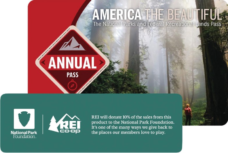
Fee: You will need a Southern California Daily or Annual Forest Adventure Pass, or the America the Beautiful National Parks Pass can be displayed instead.
Maps/Resources: AllTrails 1, 2, 3, 4 | USFS


Chantry Flat trailhead is in Arcadia, about a 30 minute drive from where I was living in Burbank. The website where I initially found this hike dubbed it the “Enchanted Forest”, and there’s no confusion as to why. In October the fall colors in the San Gabriel Mountains are spectacular. The vegetation and mist create an autumnal fairytale atmosphere, which is rare in the Los Angeles area. Inner city parks often look dead and dusty (Griffith, Runyon, Wildwood), so this change of pace is rejuvenating.
There are a few different day hiking routes starting from the Chantry Flat parking area. The first time I visited, I showed up later in the afternoon on a gloomy day, so there was hardly anyone there and I had the short trail to Hermit Falls almost all to myself. At this time of year the falls were dried up, and unfortunately there is a ton of graffiti on the rocks near the creek when you get there, but it’s still a beautiful hike.

I came back again the very next day. Upon arrival in the morning it was totally packed, which is more typical. There were no available parking spaces in the regular lot, so it was necessary to drive further and further back down the way I came until I finally spotted a space on the shoulder of the road where the car could fit (I’m not sure if this is *technically* allowed, but dozens of other cars were doing the same thing). This time I took the short trail to Sturtevant Falls, which should be the bigger of the two waterfalls during the summer. There was only a slight trickle in October, but no graffiti!
The third time I came back in November, a friend and I hiked the entire 7 mile trail from Chantry Flat to the Mount Wilson Observatory. It’s a loop trail that’s actually 14 miles if you plan to hike back down afterwards, but we only had a half a day at our disposal so we parked one of our cars at the Observatory and the other at Chantry Flat. Once we reached the top, we drove back down and saved some time. Since there’s a cafe at the Observatory where we could have replenished our energy and the return trip would have been mostly downhill, it shouldn’t have been too strenuous to do the whole thing if we’d had the time.


The full hike up Mt. Wilson was amazing. We got a different perspective when the trail took us up and over the Sturtevant waterfall, and there were huts and campgrounds along the way that were fun to explore. Sturtevant Camp had well-maintained cabins and gaming equipment that can be reserved. A group was partying there when we trekked through and said they definitely recommend the stay.
The first half of the hike was a breeze, then the last bit gained steeper and steeper elevation with every step. In total Mt. Wilson tops out at only around 5,710 feet, but our legs felt it. You may want to download offline maps using a navigation app like GAIA or AllTrails, because we did get confused at one fork in the trail and having the directions to reference kept us on course.
2. Echo Mountain
Mileage: 5.5 miles out-and-back
Trailhead: Cobb Estate Trailhead
Fee: Free
Maps/Resources: AllTrails | USFS


This moderate day hike is in Altadena. I found Echo Mountain via Sam Merrill Trail on Hikespeak and HikingGuy, which both give thorough play-by-play trail reports. A couple other trails do connect to this trail, but the main route is incredibly obvious, so it’s almost impossible to get lost. The only exception may be in the first few hundred yards when you’re trying to find the correct starting place at the ravine/dry riverbed mentioned by HikingGuy. From there it’s just good fun, with tons of switchbacks and a fair amount of uphill trekking to give your thighs a solid workout.
The day I went a lot of people were clogging up the trail, but free street parking was easy to find in the neighborhood surrounding the trailhead. The views are spectacular as you gaze out across Los Angeles and all the way to the ocean. Once you arrive at the top there are artifacts and ruins to investigate from the railroad and abandoned resort. People pause to eat at the picnic tables while soaking in the view, or yell out to test the echo. It’s worth reading up on the history of the trail to fully appreciate the payoff at the top.
“The story of Echo Mountain House is entwined with that of the Mount Lowe Railway. In the late 19th century, Thaddeus Lowe established the railroad just north of Los Angeles as a way for tourists to easily ascend the San Gabriel Mountains. The railway welcomed its first passengers on the Fourth of July in 1893. Then, in the fall of 1894, the Echo Mountain House, located at the summit, opened its doors. It was a luxury hotel said to rival San Diego’s Hotel del Coronado, with 80 rooms as well as amenities such as a dance hall, a casino, and a zoo. There was also a telescope and observatory as Lowe was very interested in astronomy and even brought on esteemed astronomer Dr. Lewis Swift, who would discover nearly 100 nebulae from the site’s observatory.”
– Fodor’s Travel
A friend did this hike at nighttime. He said it was cool to see all the city lights, and since he did it on the fourth of July he could watch fireworks across Los Angeles. You want to be careful since the trail has some narrow places and it’s easy to trip over rocks even in the daytime, but apparently it’s a common night excursion. He also told me a story of his friend getting lost up there at night somehow and having to be airlifted out, so I guess like anything it depends on your skill and preparation. Bring a headlamp!
Not into solo hiking? Find group day hiking tours to join in Los Angeles here or here, or join a guided multi-day Southern California hiking or trekking trip.
3. Malibu Creek State Park
Mileage: 2 miles out-and-back (there is also a 4.5 mile variation)
Trailhead: Rock Pools Trailhead
Fee: Parking fee is $12 per car for all day, $9 per car for 3 hours, $6 per car for 2 hours, or $3 per car for 1 hour. Alternatively, you can buy an annual California State Parks Pass or check one out from your local library for free.
Maps/Resources: AllTrails 1, 2 | State Park


I learned about the rock pools at Malibu Creek State Park while searching for local Los Angeles hikes with swimming holes. Swimming in the natural water here is so fun that I went three times! That being said, the walk to the rock pools alone is just a flat mile (2 miles total out-and-back) with no elevation change. For more of a hiking experience, you will want to connect other nearby trails. Still, be aware that while the walk in and out is short, it is very exposed to the sun and the direct heat can be gnarly in the summer. Start as early as possible, wear sunscreen and a hat, and keep hydrated.

Skin Cancer Protection for Hikers
The rock pools are usually busy with a lot of families and people blasting boom boxes (I will never understand subjecting other people to your music), but I found that the earlier I arrived the more privacy I had. Regardless, I didn’t mind watching more adventurous swimmers jump from the highest precipices into the pools below, or rock climbers scaling ledges nearby. I mainly swam and explored the partially submerged rocks, which feel gloriously cool on a summer’s day. If you decide to hike other trails in the area, the most popular is the path leading to the M*A*S*H site, where they filmed the TV show.
*Note: I always wished I brought cash with me to Malibu Creek State Park because local farmers sold strawberries and other fresh fruit near the park entrance.
I most regret never getting to the Bridge To Nowhere trail, where people bungee jump. I also wanted to see the weird Nazi spot at Murphy Ranch, hike Escondido Falls, and try the Six Pack of Peaks challenge! Like many other points of interest in California, they will have to remain on my bucket list for the future to keep me hungry and in a constant state of FOMO.
I think I could live in California all my life, and maybe one day if I get tired of moving around it will be my long-term spot, but I keep asking myself: how can you ever know that for sure if you haven’t seen and experienced all the alternatives? There’s too much out there left undone, waiting for me. I’ve never seen the Smoky Mountains or the Grand Canyon. I’ve never lived abroad! All things I’ve got up my sleeve for the coming year…fingers crossed. (2021 Update: I made it to both parks!)


If you get the chance to do any of these beginner day hikes in Los Angeles, let me know what you think! And even though I’m not in California currently, I’m looking for more moderate/difficult suggestions for next time. Drop me your SoCal hiking recommendations and make me jealous.
🏨 Search budget hostels in Los Angeles or standard hotel options in Los Angeles.
🏕️ Find free or paid campsites near Los Angeles via The Dyrt.
✈️ Coming to California from further afield? Use an Airalo eSIM for affordable international cell data and don’t forget to protect your investment with travel insurance.
Related:


Pin It:

My dream is to write travel and hiking content full-time. All of my guides and itineraries are free and my travels are self-funded. If you enjoy my site and would like to support, you can donate any amount to my Ko-fi page. Thank you!!