
Best Hikes Near Las Cruces, New Mexico
Purchases made through some links on this page may provide The Detour Effect with commissions (at no extra cost to you). Thank you!
This February and March I’ve been working remotely from Las Cruces, New Mexico and have made it a mission to find the best day hikes near Las Cruces. I was inspired to find cool hikes in this region because “Pin Pal” Rodney Rhodes often posts interesting pictures of his hiking adventures in southern New Mexico. I’ve been able to check out mountain ranges and wilderness areas that wouldn’t have been on my radar otherwise. As I repeatedly discover throughout my nomadic travels, it’s such fun to fall in love with parts of the country that I couldn’t have even pointed to on a map just a couple months ago. Do you know where the Organ Mountains are?
If you’re interested in American history and New Mexican cuisine, don’t forget to scroll to the bottom for bonus suggestions of things to do in Las Cruces, New Mexico!
Baylor Canyon Pass
Organ Mountains-Desert Peaks National Monument
Mileage: 7.2 out-and back (shorter variation is 4.3 miles)
Trailhead: Baylor Pass West Trailhead (or Aguirre Spring Campground eastern trailhead)
Fee: If starting at the western trailhead from Baylor Canyon Road, there is no fee to park. At the eastern trailhead there’s a $5 day use fee.
AllTrails 1, 2


When I told my outdoorsy friends that I would be hiking near Las Cruces, everyone asked “are you going to check out the Organ Mountains?” Then, during the first stop I made when I arrived in town (the ruins and museum at Fort Selden), I overheard the cashier recommending the Organ Mountains to a visitor. It became immediately clear that the Organ Mountains-Desert Peaks National Monument is the crown jewel of hiking in the area. While there are many trails to explore here, one of the top rated routes on both GAIA and AllTrails was Baylor Canyon Pass.
There are two different ways to reach Baylor Canyon Pass, either west from Baylor Canyon Road or east from Aguirre Springs Campground. The Aguirre Springs route is shorter at 4.32 miles and is rated easier, so I opted for the western route. From Baylor Canyon Road the hike is 7.2 miles.
From the trailhead parking area, you’ll make your way through a long stretch of open grasslands towards the mountain range looming ahead. This portion looks deceptively flat, but you’re actually ascending gradually. Finally as you meet with the foot of the peaks, you’ll begin to ascend more sharply. You’ll traverse back and forth through enough switchbacks to break things up, finally arriving at the saddle between the western and eastern sides of the pass. Here you’ll be rewarded with expansive views in both directions.
The day I was there was extremely windy – be sure to wear a hat that you can anchor to your head somehow! I was quickly reminded of my previous trip to New Mexico/Bisti Badlands when I deemed New Mexico “The Windiest State”.
Slot Canyon
Radium Springs
Mileage: 2.5 mile loop (or shorter out-and-back)
Trailhead: North Valley Drive
Fee: None
AllTrails


It’s impossible to pass up a good slot canyon. The greater Las Cruces area has two of them. I visited the slot canyon near Radium Springs, which is easily accessible and great for all skill levels.
You’ll park on the side of the road in practically the middle of nowhere, asking yourself how there could be anything of interest in such a desolate location. There is no fee, but you’ll need to hop over a locked gate to begin the trail, which feels a little like making a payment in the form of dignity.
The route you’ll find on navigation apps is a loop. If you want to reach the slot canyon quickly, head left to go clockwise. If you plan to do the entire loop instead of just turning around after the slot canyon, I would advise downloading the offline map on GAIA or AllTrails as there’s not much of a visible “trail” at some points, though cairns do aim to help.
I had previously been to the slot canyons at White Domes in Valley of Fire State Park and also Antelope Canyon in Page, Arizona. My memory of these slot canyons is that the rock walls are smooth and windswept. The one near Radium Springs is nothing like this. The walls here are textured like rubble with tiny rocks lodged inside. It seems truly carved out of the earth, as if one of the Old Gods dug their hand down into the ground and scooped it out for source material to build the nearby Organ Mountains.
The other slot canyon near Las Cruces is the Leasburg Slot Canyon in the Robledo Mountain Wilderness. This hike requires crossing the Rio Grande river on foot, which is not advisable during spring or summer. Trail reports mention that the trail is not well-marked and the hike is overall more challenging than the Radium Springs slot canyon.
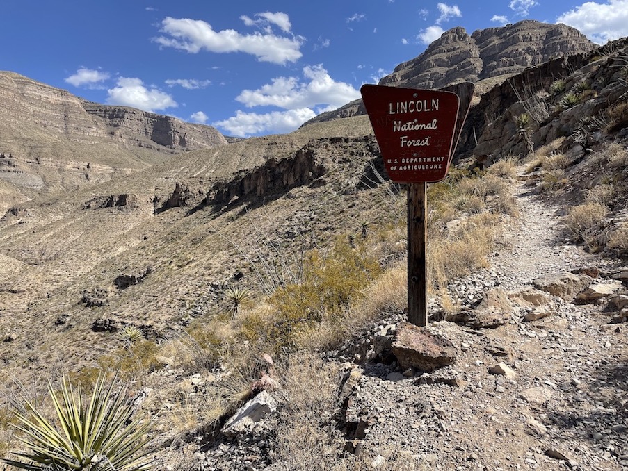
Dog Canyon Trail
Oliver Lee Memorial State Park
Mileage: 10 miles out-and-back
Trailhead: Oliver Lee Memorial State Park Visitor Center
Fee: There is a $5 day use fee at Oliver Lee Memorial State Park, or you could purchase an annual New Mexico State Parks Pass.
AllTrails


Dog Canyon Trail in Oliver Lee Memorial State Park might be my favorite hiking trail on this list. The Wild West history behind the trail is intriguing in and of itself, complete with a murder mystery and connections to notorious outlaws, but I enjoyed the views and challenging ascent prior to reading up on the stories.
It turns out Oliver Lee was a pretty divisive figure. At one point he was chased down by and got into a gun fight with Sheriff Pat Garrett – the same Pat Garrett who killed Billy the Kid (allegedly; I fell into the conspiracy theory rabbit hole). Lee was also a rancher and was accused of cattle rustling.
On this hike you’ll steeply ascend up to the remains of an old cabin next to a spring. A hermit named Francois-Jean Rochas lived in it, or “Frenchy“. He worked with Lee to help create an irrigation system down to Lee’s ranch, and was mysteriously murdered in the cabin. Other people around Lee also came up murdered, like AJ Fountain (the case that caused Pat Garrett to go after Lee). Lee went on to live a prosperous life and had the State Park named after him, but it’s Frenchy’s spirit that you feel in this area of Lincoln National Forest.
You can continue hiking on past the cabin if you wish. The ascent up to “The Eyebrow” is pretty relentless, so if you’re not up for a long day, turning around at the cabin is a great option.
The day I hiked this trail was even windier than at Baylor Canyon. I could see White Sands National Park kicking up gypsum on the horizon – can you spot it in the fifth photo in my gallery above? By the end of the hike the air had grown thick with ominous dust. As I drove away the mountains were barely visible behind me.
Alkali Flat Trail
White Sands National Park
Mileage: 4.5 mile loop
Trailhead: Alkali Flat Trailhead
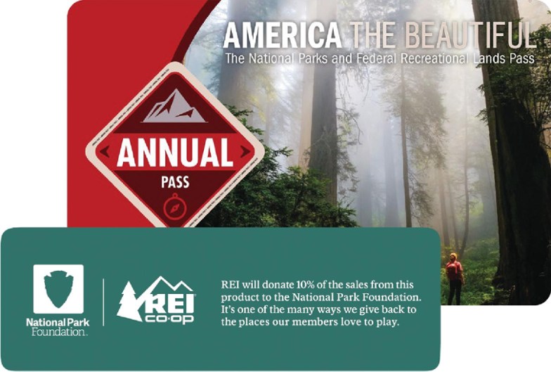
Fee: You can display your America the Beautiful Parks Pass to enter White Sands National Park, or pay $25 for 7 days of entry for one vehicle.
AllTrails


I have a vague memory of dune sledding in White Sands National Park in my teenage years on a road trip with friends, but it became conflated in my mind with Great Sand Dunes National Park since I drive back and forth across Colorado so frequently. Eventually it got to the point that if someone asked me whether I’d visited White Sands, I wasn’t sure which one it was, or whether I had.
I was excited to properly remedy this during my stay in Las Cruces. White Sands doesn’t offer too many hiking trails; there are four of them plus one boardwalk stroll. I chose the longest one, the Alkali Flat Trail. When I arrived early in the morning, only one other car was parked at the trailhead and the man who owned it was just returning from finishing the loop as I began. I was able to follow his footprints and his dog’s pawprints as I traversed the rolling white gypsum knolls. Because water lurks beneath the surface, the sand is actually cool in temperature. I took my shoes off and did the walk barefoot, which felt great – highly recommended!
As I made it back towards the trailhead tons of other people were arriving and sledding along the trail, so I was glad I got there when I did. Feeling like the only person around for miles in a glimmering sea of dunes was transportive. I imagined I might be in a previously undiscovered achromatic expanse of the Sahara, or the only pioneering inhabitant of a planet from a science fiction novel. I was glad I wore the sunglasses in the gallery above that protected my periphery from flying sand, as the wind did draw swirling dust up into the air.
The nearby missile range does random testing and even the National Park does not have much advance notice as to when this will happen. They try to post park closure dates/times here, but these are not always accurate. You should call White Sands Missile Range at 575-678-1178 prior to your visit for updates. The day I went, the National Park website said the park was going to be closed, but when I called the number that morning, they said it was not. So I drove out there despite what it said on the website and lo and behold, the park was open for regular hours.
Three Rivers Petroglyph Site
Tularosa
Mileage: 1.2 miles out-and-back
Trailhead: Three Rivers Petroglyph Site
Fee: You can display your America the Beautiful Parks Pass or pay a $5 day use fee onsite.
AllTrails


Three Rivers Petroglyph Site was a recommendation from Scott Jones, who is a public lands expert and wizard. When he said there were more than 21,000 petroglyphs at this location, that’s all I needed to hear. I couldn’t imagine what that might even look like. I’d only ever seen a handful of petroglyphs or pictographs together in a small cluster. The most I’d seen in one location prior to this was at V Bar V Heritage Site in Arizona.
Three Rivers is truly sacred and magical. I was the only person walking along the trail this particular morning. It was quiet as snow gently floated down around the petroglyphs, which were created by the Jornada Mogollon sometime between 900-1400AD.
With every step I took, my eye caught another piece of art curving around the next rock face. While crouching to photograph one petroglyph, I’d notice another one hiding near my foot. It was overwhelming not only in the sheer number of petroglyphs, but also in their clarity and preservation. It’s possible to make out facial features and jewelry on figures of people, and arrows drawn into the backs of animals.
At one point while I was admiring a drawing of a bird, ravens flew overhead at the same moment. It made me feel connected to the Native people who created this art. Today I can still witness the wildlife that they documented here in southern New Mexico. I can see what they saw.
The trail is very gentle; in fact it may not really qualify as a “hiking trail” at all. It’s more of a nature walk, but I can’t leave it off this list. On my hikes I hope to see extraordinary things, and this petroglyph site is extraordinary.
If you visit, please be careful to be a good steward of our public lands. What a tragedy it would be for someone to deface or damage such precious time capsules from the continent’s history.
Pine Tree Trail
Organ Mountains-Desert Peaks National Monument
Mileage: 4.5 mile loop
Trailhead: Aguirre Springs Campground
Fee: There is a $5 day use fee to park at the trailhead.
AllTrails


The 4.5 mile Pine Tree Trail starts near the Aguirre Springs Campground, like the eastern route to Baylor Canyon Pass mentioned above. I hiked the loop counterclockwise per suggestion from the trail reports, which I did not find to be very difficult at all. It was a pleasant hike to get my limbs moving and a good opportunity to take in the scenery without much anxiety or overexertion. As a result I don’t remember too much about it besides a general feeling of contentment, and sometimes that’s what you need.
North Franklin Peak
Franklin Mountains State Park
Mileage: 7.2 miles out-and-back
Trailhead: West Cottonwood/Agave Loop Trailhead
Fee: There is a $5 day use fee which can be paid at the Visitor Center, or you could use a Texas State Parks Pass.
AllTrails


Franklin Mountains State Park is actually in El Paso, Texas, but this is only about a 45 minute drive from Las Cruces (on this trip I also hopped over to Guadalupe Mountains State Park in Texas, but that’s a farther drive). I found a handful of cool hikes in the area, but if I was only going to do one, I wanted it to be North Franklin Peak. You may sometimes see it called “North Mount Franklin” or “North Franklin Mountain” trail. The highest point in El Paso looked like a good challenge, and boy was it worth it! I loved the sweeping views in all directions and even enjoyed the smaller incremental moments leading to the summit.
For the first stretch after the trailhead, the route is extremely rocky. It made me mad. Hang in there. Eventually you’ll get past the ankle-rollers and start to climb higher into the mountain range. There comes a point where you cross from one side of the pass to the other (I believe this is Mundy’s Gap), and suddenly you have completely different views looking east instead of west. From here the trail becomes infinitely more interesting with every step. Switchbacks provide different perspectives along the way. You’ll pass an abandoned car for some reason, and notice a hut perched atop a distant peak. I saw two deer grazing just before reaching a deceptive cairn that does not mark the summit. From the cairn you still have a little ways to go, but before you know it you’re taking in impressive 360 degree views.
Dripping Springs and La Cueva
Organ Mountains-Desert Peaks National Monument
Mileage: 5 miles if you combine Dripping Springs Trail with La Cueva loop
Trailhead: A.B. Cox Visitor Center
Fee: You can display your America the Beautiful Pass or pay a $5 day use fee at the Visitor Center.
AllTrails 1, 2


Dripping Springs Trail is the first hike you’ll find on a Google search for great hiking trails near Las Cruces, but the Dripping Springs Natural Area actually provides multiple points of interest.
Dripping Springs Trail leads to the ruins of Van Patten Mountain Camp, an abandoned resort built in the late 1800s by Colonel Eugene Van Patten. There’s also the Boyd Sanatorium, which you can read about in more depth via Bryan Lindenberger. If you time your visit right, the waterfall might be trickling over the rocks at the spring. This trail is an easy walk over gravel terrain most of the way, so it’s more about seeing the historic ruins than getting a workout.
The Fillmore Canyon Trail will lead you to La Cueva, which is a natural cave beneath a giant rock formation. According to the Bureau of Land Management, “The use of this cave started in archaic times around 5000 B.C. by the Jornada Mogollon, who were probably drawn to the area by water. They left behind rock art and grinding holes.” Thousands of years later, an ascetic hermit named Giovanni Maria Agostini lived in the cave. His life is quite storied, and his murder in the cave was not solved. You can read more about him via the information plaque photo in the gallery above, or at my “Historical Adventurers Whose Lives Deserve Movie Adaptations” post.
I also enjoyed Soledad Canyon Trail near the Dripping Springs area, which is not particularly strenuous but provides a lot of bang for your buck in terms of beautiful scenery.
Pro-tip: Close to Dripping Springs Natural Area is the Bureau of Land Management dispersed camping site at the Sierra Vista trailhead. You’re allowed to park and camp here for up to 14 days with no fee, and it even has pretty good wifi signal. I squatted here for about a week and a half while working remotely with my wifi hotspot.
Things to Do in Las Cruces, New Mexico
If you’re spending any real amount of time in Las Cruces, you’ll want to do more than just hike. Have a few bonus recommendations!
Visit Old Mesilla


Old Mesilla is the historic district of Las Cruces. There is one main street that is fun to walk around if you have a free afternoon to shop, eat, and check out some art. The Billy the Kid Gift Shop now inhabits the old courthouse where Billy was sentenced to hang, though it is not the courthouse jail where he was held in the lead up to gallows day – that would be the Lincoln County Courthouse below.
The Zuhl Museum, which houses fossils of dinosaurs, woolly mammoths, and prehistoric marine and plant life, is also quite close to Old Mesilla.


Lincoln County Courthouse


Everywhere I go throughout the Southwest, I am looking for Wild West outlaw history. Obviously chasing Billy the Kid around the Las Cruces area and Lincoln County was a priority for me. It became a goose chase akin to what I imagine the police experienced back in Henry McCarty/William H. Bonney’s time.
After I went to the petroglyph site, I drove up to Ruidoso because they have a Billy the Kid National Scenic Byway Visitor Center. They say Billy spent some time in Ruidoso, but when you ask about this, it turns out there’s not much to see related to Billy in town. By that point I was 40 minutes from Lincoln, New Mexico and decided I might as well push on to see the Lincoln County Courthouse where Billy made his last great escape.
The lady at the Visitor Center in Ruidoso told me the Courthouse should be open on Thursdays, and indeed their website and the sign out front of the courthouse concur. However, when I arrived it was not open. I’ve noticed that a lot of the smaller towns in southeastern Arizona and southwestern New Mexico have these weird unpredictable opening hours, which have only been made more tentative due to COVID, I assume. If you want to actually enter the building and see the museum it’s a good idea to call or reserve in advance. This is one situation where my unplanned “detour” backfired.
Another Billy the Kid related stop would be Fort Sumner, where he was killed in 1881, but that was a bit far for me coming from Las Cruces. In a similar vein to Ruidoso, another cute town to visit near Las Cruces would be Cloudcroft, although there’s no Kid history there that I’m aware of.
Walk of Flame
The self-guided “Walk of Flame” tourist route in Las Cruces will bring you to restaurants and bars throughout the city that feature interesting green chile dishes! Being so close to the town of Hatch, green chiles are obviously a major staple.
Some of the Walk of Flame restaurants are located in Old Mesilla, so you could kill two birds with one stone. I was trying to be frugal with my expenses during this trip and didn’t eat out much, but I did visit Caliche’s Frozen Custard to try the green chile sundae. It was so weird that it was actually kind of good?
Fort Selden


Fort Selden was an Army post active from 1865-1891 in what is now Radium Springs (you could visit the Fort in tandem with the Slot Canyon). It’s original purpose seems to have been to protect settlers from Native Americans.
Today the Fort is in ruins, but you can still make out its skeleton and imagine its heyday. Be sure to grab a map inside the museum prior to walking the grounds so you can read about what was housed in each building. The man at the counter advised that I do the walk first so that I’d have context when reading the information and viewing the artifacts inside the museum, which I agree was a good idea.
Something particularly special about this site is that the Buffalo Soldiers that served in the 9th Cavalry, who were African-American-only, are honored at Fort Selden with a statue called The Sentinel.
If you’re already driving to Fort Selden you might also check out the Lake Valley Historic Townsite, an abandoned ghost town an hour from Las Cruces. They are closed on Tuesdays and Wednesdays which are my days off so I got the short end of the stick on that one. You’d think a ghost town couldn’t be “closed”.
🏨 Search budget hostels in New Mexico, standard hotel options in Las Cruces, or free camping near Las Cruces.
✈️ Coming to New Mexico from further afield? Use an Airalo eSIM for affordable international cell data and don’t forget to protect your investment with travel insurance.
Do you have a favorite hiking trail near Las Cruces, New Mexico? I didn’t spend much time exploring the Robledo Mountains, Chihuahuan Desert Nature Park, Picacho Peak Recreation Area, or Prehistoric Trackways National Monument. As always, the more you discover, the more there is left to do!
Related:


Pin It:


My dream is to write travel and hiking content full-time. All of my guides and itineraries are free and my travels are self-funded. If you enjoy my site and would like to support, you can donate any amount to my Ko-fi page. Thank you!!