

Northern New Mexico Road Trip: Bisti Badlands, Ancestral Ruins
Purchases made through some links on this page may provide The Detour Effect with commissions (at no extra cost to you). Thank you!
Hiking in Bisti Badlands should be a top priority on any good northern New Mexico road trip itinerary. The Four Corners area has quickly become my favorite part of the United States, and that love began with Bisti Badlands/De-Na-Zin Wilderness, just south of Farmington.
Since my first road trip to Bisti Badlands, I’ve returned to New Mexico many times (sometimes revisiting Bisti) and have been able to add more road trip destination ideas in northern New Mexico to this itinerary, including Chaco Canyon and other significant Ancestral Puebloan sites. This itinerary has a unique historical, archaeological, and geological focus and does not include big cities like Albuquerque or Santa Fe.
Bisti/De-Na-Zin Wilderness
Know Before You Go
Bisti (pronounced “biss-tee”, according to my Navajo tour guide) is a vast, desolate stretch of dry desert badlands in northern New Mexico that I learned about from following Vernan Kee’s hiking adventures. It’s Bureau of Land Management and Navajo land, and, unlike a national park, there is no entry fee and you will not find any rangers policing where you go and what you do.
I only came across one convenience store where you might stock up on amenities. It’s a very good idea to fill up on gas before entering Bisti Badlands/De-Na-Zin Wilderness; I learned this the hard way. On my first trip, I was oblivious enough not to realize the sheer distance from one side of the wilderness area to the other (I went north to south) and 45 minutes into the desert, decided to turn all the way back to Farmington to fill up on gas and then start over, because I was worried I’d go empty before I made it to the next gas station on the other end.
Fill up on gas before entering Bisti Badlands/De-Na-Zin Wilderness!
It’s also a good idea to have a navigation app on your phone like GAIA for reference, and bring a GPS emergency communication device if you have one. It’s very easy to get confused and turned around since there are no trails or trail markers at Bisti Badlands. Bring lots of water; the dry air can cause dehydration quicker than you think, and there is nowhere to fill up on water in the badlands. There is also no shade, so wear a hat and sunscreen. It’s preferable to have four wheel drive and good clearance since you’ll be driving on rugged dirt roads. That said, I do think most cars could handle it as long as there hasn’t been a recent storm to cause flooding.
While you will have a lot of freedom at Bisti, please be respectful and Leave No Trace. Do not take any artifacts, rocks, or petrified wood, and don’t climb on the rock formations. Irresponsible people have caused ancient hoodoos to topple and break in the past. Keep dogs leashed and do not bring any motorized vehicles or wheeled devices (bikes, strollers, etc) past the designated parking areas and onto the land.
Soon Navajo Tours will be opening a campground, which is great news for travelers who prefer more amenities. Right now you’re allowed to camp in the badlands, but you’ll need to be totally self sufficient. There is one pit toilet facility near this trailhead.
Navajo Translation: Bisti comes from the Diné (Navajo) word Bistahí. Online the meaning is described as something akin to “large area of shale hills” or “among the adobe formations”. The second one is closer to the truth. During my Navajo Tours hike, my guide clarified that the phrase refers to the perfectly lined up rows of sandstone hoodoo formations – the word “Bis” describes the crumbly sandstone sediment, and the rest of the word could be translated as “in a row”. De-Na-Zin translates as “Standing Formations.” I read online initially that it means “Standing Crane”, but my guide explained this is incorrect. The Diné word for “crane” sounds very similar to the word for “formations” but would not be spelled like the “De” in “De-Na-Zin.”
Best Way to See Bisti Badlands
There are no signs to lead you on your explorations. It’s best to reserve a guided hike with Navajo Tours so you can see the coolest rock formations. The first time I visited I didn’t reserve a guide, so I drove past the turnoff for the hikes I wanted to do a million times and ended up needing to ask the cashier at the trading post if she knew where my trails were. She was super helpful, but it was still hard for her to describe to me the exact location without street names. She said to look out for the giant rock that’s shaped like a bear.
I did finally find one turnoff, though I’m not sure if it’s actually any of the ones I had researched prior. I drove down a long dirt road and parked at a trailhead that no trails emanated from. The idea is to basically walk whichever way you please, which was badass, but I sort of wandered aimlessly.
The next time I visited I did hire a guide, and it was so worth it. I missed out on so much by trying to figure things out by myself the first time. My guide showed me rock formations like The Pyramid, the Queen, Stone Wings, Egg Hatchery, Chocolate and Vanilla Hoodoos, and Manta Ray. He explained the geological processes that created such strange landmarks over the millennia, and talked about life on the Navajo reservation. He also suggested some great indigenous-owned restaurants in Farmington.


Bisti is known for its alien mesas, buttes, and jenga-esque spires that appear precariously unbalanced, like drip-castles you make at the beach. The word “moonscape” is becoming cliché, but there’s no better way to describe hiking in Bisti Badlands; interplanetary vocabulary is necessary.
From the pictures I always assumed the entire place was dry and dead, so it was interesting to step on the cracked surface and feel my foot softly sink. The terrain isn’t mud, but it’s not solid either. It’s important to step carefully and do as little damage as possible to the cryptobiotic soil.
In the gallery below you may not be able to tell the zoomed-in photos of sediment from the zoomed-out photos of landscape; I thought it was interesting how the macro world imitates the micro world.


Bisti Badlands Weather
In the summer, be cognizant of monsoon and potential flash flooding. Supposedly in winter they do get snow, but I didn’t see snow during either of my two winter visits. On my first trip, I was most surprised by the intense wind, which blew so hard that I found it difficult to walk against. This land is constantly taking you for unexpected turns; at one point I also became the pack leader for a gang of chihuahuas. The whole place feels trippy and cinematic, and when I posted some photos of lonely looking houses in the endless dust, a friend on Twitter said it reminded him of No Country For Old Men. I said it reminded me of Courage The Cowardly Dog.


Things to Do Near Bisti Badlands
Most road trippers know that a northern New Mexico road trip is incomplete without visiting at least a few Ancestral Puebloan ruins and heritage sites, especially Chaco Canyon, but some of the following itinerary ideas may catch you by surprise.
Ice Cave & Bandera Volcano
Heading south from Bisti Badlands towards Las Cruces, you’ll see many billboards advertising the Ice Cave and Bandera Volcano. After hiking in Bisti, there may still be enough time to make a detour here before they close. Once you pull in to the parking lot, pay $12 at the gift shop for access to the two trails, one to the ice cave (which is rather short, about a ten minute walk) and one to the volcano (reserve more time, maybe twenty or thirty minutes one-way).


As I reached the crater of the volcano, the wind was howling and the snow underfoot was slippery, so I didn’t stay long. It honestly seemed like you could easily tumble right into the crater. I made my way back quickly as the sun went down, but still paid attention to the pretty views. You’re allowed to camp at Ice Cave and Bandera volcano, so it’s worth stopping here for the night.


Ancestral Puebloan Sites
Chaco Culture National Historical Park


Chaco Canyon in New Mexico was once the center of the world for thousands of Ancestral Puebloan people. They began to build here in the mid-800s AD and expanded and remodeled up until about 1150AD. According to the Park Service, it was a “ceremonial, administrative, and economic center”. Chacoan people also built roads leading out from Chaco towards other smaller Great Houses throughout New Mexico; much like Rome, all roads led to it.
Today, Chaco Canyon is a UNESCO World Heritage Site and the most expansive example of Ancestral Puebloan architecture I’ve ever seen. Pueblo Bonita alone is a massive feat, as well as the Great Kiva near the Casa Rinconada community, but there are many other impressive Great Houses and ruins throughout the canyon. It’s almost too overwhelming to try to see them all. My favorites are the ruins you have to hike to, such as Tsin Kletsin (3 miles out-and-back or 4 miles as a loop), Pueblo Alto (5.4 miles as a loop) and Peñasco Blanco (7 miles out-and-back). They are hidden away atop the mesas that surround the canyon and sneak up on you as you approach. The people who lived here must have valued stealth; perhaps they didn’t want to be within sight of the many travelers who came to visit Pueblo Bonita. These lonely sites are less excavated than the lower elevation pueblos, so visiting them while the mesa top winds whip through your hair is a spiritual experience. I didn’t see anyone else on South Mesa Trail to Tsin Kletsin or Peñasco Blanco Trail during my visit in early March, so I got to explore the ruins by myself.
There are many opportunities to see petroglyphs and pictographs in Chaco Canyon, as well. There is a very easily accessible petroglyph site just behind the Visitor Center near the Una Vida ruins. If you hike towards Peñasco Blanco, there is an offshoot called the Petroglyph Trail with many fine examples. Even closer to Peñasco is the “Supernova” pictograph featuring a rock art painting of a hand amongst celestial symbols.
If you camp at Gallo Campground, try to get sites 23, 24, or 25 so you can be closest to the cliff dwellings under the rock overhang that forms the campground boundary.
Aztec Ruins National Monument


Exploring Aztec Ruins National Monument is special because you can actually go inside some of the pueblos! At Chaco you can wander what remains of the plazas and even descend through a doorway into a room at Pueblo Bonita, but most of the ruins at Chaco don’t have roofs. I always have trouble imagining what life might have been like in another time and place, but being able to physically put yourself there helps. In my Aztec Ruins photo gallery above you can see an original mat from 900 years ago that still hangs in a doorway, and original wood ceilings. What do you think the green stripe on the outside of some pueblos was for – simply decoration?
Ancestral Puebloans lived at Aztec Ruins National Monument from about 1100AD to the late 1200s AD. Archaeologists estimate the West Ruin once had about 450 or 500 rooms.
Obviously, the name “Aztec” is incorrect. It was assigned by the Spanish explorers who had no grasp of the differences between groups of native people throughout northern Mexico and the southern United States.
Salmon Ruins Museum


The Salmon Ruins are on private land and the site is not administered by the Park Service. Still, they’ve done a wonderful job with the museum ($4 entry for adults) and the self-guided tour map of the ruins. Some of the pueblos and kivas are still partially buried, so it gives you an idea of how time reclaims history prior to the full excavation you’d see at other sites. You can walk inside one of the kivas (at Aztec you can walk into pueblos, but not any kiva ruins; only the reconstructed Great Kiva) which feels like a real honor and privilege, as kivas were typically sacred buildings. There is evidence that after the original inhabitants who built in the Chacoan style left, other new people moved in and repurposed the dwellings, often turning square rooms into circular kivas.
There is also a homestead from the 1800s to explore on the grounds. It was built by the Salmon family who pioneered the Bloomfield area and protected the Ancestral Puebloan ruins for many years. All around the Salmon ruins and homestead there are modern homes, as well, which is quite strange. People still live almost right on top of these older settlements today.
Mesa Verde National Park
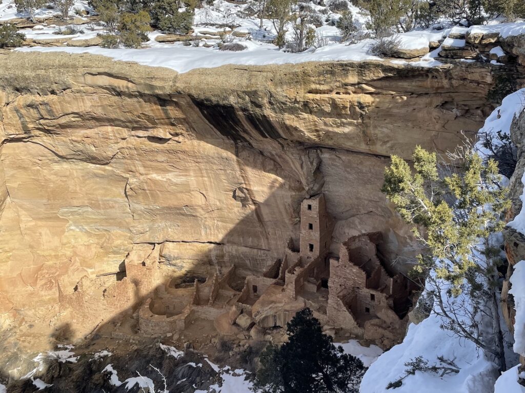
Mesa Verde in southern Colorado is most known for its fantastic, towering cliff dwellings that were built into natural sandstone alcoves. Most tourists visit Mesa Verde between spring and fall, but I loved snowshoeing there in the wintertime and had the park almost entirely to myself. Canyons of the Ancients, Yucca House, and Hovenweep National Monuments are all nearby as well. This area is worth its own post:
Things to Do in Mesa Verde National Park in Winter
Bandelier National Monument
Ancestral Puebloan people lived in the area of today’s Bandelier National Monument near Los Alamos and Sante Fe from 1150 CE to 1550 CE. Like the other monuments, it was eventually abandoned, but not because these migrating people mysteriously “disappeared”:
“Oral traditions tell us where the people went and who their descendants are. The people of Cochiti Pueblo, located just south and east along the Rio Grande, are the most direct descendants of the Ancestral Pueblo people who built homes in Frijoles Canyon. Likewise, San Ildefonso is most closely linked to Tsankawi.”
NPS
The dwellings here are unique in that they were built from volcanic tuff, which is soft and malleable. Some structures were freestanding and others were carved into the cliffs.
There are over 70 miles of trails in Bandelier National Monument, including shorter more accessible frontcountry trails like the Pueblo Loop Trail and Alcove House, and some longer backcountry routes that are suitable for overnight backpacking excursions as long as you acquire a permit.
Next Stop: Las Cruces
For those continuing south and looking for more road trip ideas, consider heading towards Marfa, Texas and Big Bend National Park by way of Las Cruces, New Mexico (while blasting the song “Las Cruces Jail” by Two Gallants) and Guadalupe Mountains National Park.
Billy the Kid broke out of the Lincoln County Courthouse in his last great escape, which is probably what is referenced in the song. That building is still located in Lincoln, New Mexico (not Las Cruces) and is now a museum dedicated to this era. However, Billy was sentenced to hang at the courthouse in Las Cruces. The location where he received his sentencing is now the Billy the Kid Gift Shop in Old Mesilla, which you can easily visit during a stop in Las Cruces.
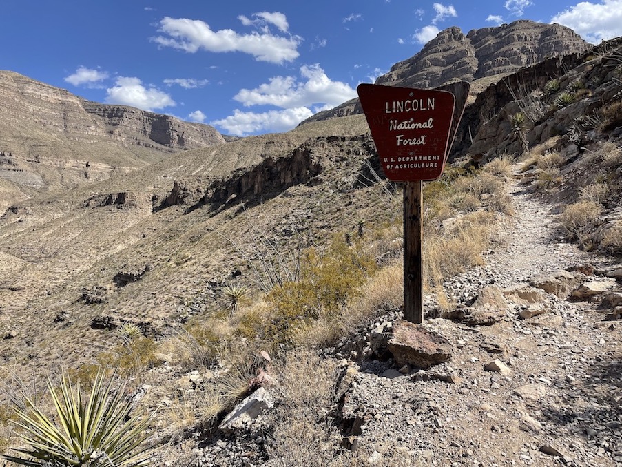
There are tons of interesting hikes and historic sites in and around Las Cruces. As an update from the future, in 2022 I worked remotely from Las Cruces for two months and explored the surrounding mountain ranges. I picked my favorite hiking trails here, plus other fun things to do in town:
Best Hikes Near Las Cruces, New Mexico
🏨 Find budget hostels in New Mexico or standard hotel options in Farmington.
🏕️ Find free or paid campsites near Bisti Badlands or Chaco Canyon.
✈️ Coming to New Mexico from further afield? Use an Airalo eSIM for affordable international cell data and don’t forget to protect your investment with travel insurance.
Have you ever road tripped in northern New Mexico? What are your favorite unique New Mexico road trip stops outside of the typical suggestions of Albuquerque or Santa Fe?
If you’re connecting your northern New Mexico road trip itinerary with Arizona stops as well, I lived in Arizona for years – don’t miss my Roadside Attractions in northern Arizona post.
Related:




Pin It:


My dream is to write travel and hiking content full-time. All of my guides and itineraries are free and my travels are self-funded. If you enjoy my site and would like to support, you can donate any amount to my Ko-fi page. Thank you!!
Thank you for this amazing piece on New Mexico; I love your writing style and feel every line of your writing.
Las Cruces is a major city. We are much bigger than Santa Fe. Plus we have a lot to offer and el paso which is huge is about 30 minutes away
Hi Natasha – indeed, I’ve enjoyed being in Las Cruces the last two months! You might enjoy the more recent post I linked to called “Best Hikes in Las Cruces” (which also has a “things to do” section).
Near Santa Fe, Kasha Katuwe (Tent Rocks) is such a great, quick and easy hike with a slot canyon, but has been closed for improvements recently. Bandelier is wonderful for hiking, and make sure you check out both portions. I’ll agree with the prior mention of Chaco Canyon.
Thanks so much for the recommendations! The slot canyon sounds cool. I hoped to spend some time in northern New Mexico on my more recent trip, but ended up staying south near Cruces. I’m excited to collect ideas like this for the next time I come back.
I have lived in New Mexico for 50 years and I have not seen everything to see here. I can add if anyone ever has the opportunity to come visit than there are a few things you should take time to see.
1) Angel peak ( the road is kinda rough and all dirt.)
2) Aztec Ruins ( Small fee to enter)
3) Chaco canyon ( Rough dirt road)
These three places are well worth the drive and time to see them.
Cool suggestions, thanks so much! It looks like those could all easily be fit into one road trip too, not too far from each other. I hope to hit up Chaco Canyon on my drive north from Las Cruces next week but we’ll see if I have enough time, fingers crossed.
You live in a beautiful state!
Your photos are gorgeous! Who knew there was so much to see in New Mexico?!? The desert looks dreamy… What and ideal place to connect with nature!
Thanks Coni! It was a really fun spot for photography. A lot of times I don’t bring my Canon with me anymore, just because my phone is so much more convenient. But on this trip I made sure to!
Wow, this is such a cool area of New Mexico! I visited recently but didn’t get the chance to visit this area. Would love to do some hiking in that region! 😁
I never knew much about it prior, had only been to major areas like Sante Fe and Albuquerque. Definitely glad I got this different perspective!
I never realized how much there is to see in New Mexico! I’m feeling so inspired now, going to have to head there ASAP. Thanks for this post.
I didn’t used to consider it much either! Now I feel like I could never see it all even if I went adventuring there every weekend
Nope, I have never been to New Mexico. I am starting to fall in love with deserts through your photos and hike descriptions though.
I have never heard of cryptobiotic soil either, so I clicked through and read about it, along with Scientific cognitivism. That is such a cool concept (and one I guess I agree with.) I honestly do find the world more fascinating and interesting when I learn more about the science that makes amazing scenery possible…
It’s a bit of a shame you had to rush through. I bet this would be even more fun with a guide.
I wasn’t aware about the soil either when I first went, but during #ParkChat on Twitter someone advised me to be careful in Bisti because despite the fact that you can "hike" pretty much wherever, you still want to be cognizant of where you step. I had no idea, it’s a good addition to my Leave No Trace arsenal!
Things like that definitely do help me enjoy my destinations more. It’s taught me to do more research in advance so I can fully enjoy what I’m looking at.
We drove through New Mexico years ago, but somehow missed the volcano and ice caves. My dad lives in Arizona, so perhaps it’s time for another NM road trip. You have inspired me (except for the wind and slippery snow).
He’s so lucky to live in Arizona, I hope to move back there soon! If you get a chance the ice cave and volcano are definitely fun. I wouldn’t make it your main destination, but if you’re already making multiple other stops on a road trip it’s a fun inclusion
I am a huge fan of road trips. The scenery of New Mexico is so inspiring. I am adding this one to my bucket list.
I haven’t been to New Mexico yet except Four Corners, but this post makes me want to get back out there. I love road trips and the western US, so this seems perfect for us!
Speaking of Four Corners, once when I was driving from AZ to CO I meant to drive right through the EXACT spot where the four state corners meet, I’d been heading towards it for hours and hours. Somehow I wasn’t paying attention and at the last second I made a right turn to follow my Google Maps suggested fastest route instead of driving 5 more minutes straight onto the corners. So mad at myself when I realized I passed it!
The scenery is unique and very different from the Montana landscape I am used to. Thanks for sharing, definitely adding this to my outdoor travel plans and road trip stops~ next time I am in that direction.
We should do a swap – I’d love to see Montana!
What a cool list! Adding to my bucket list
Wow, it’s like a whole other planet! The scenery looks so unique, I would love to visit one day.
I was lucky enough to spend many weeks in New Mexico in Las Cruces, Santa Fe, Farmington, etc. We hiked through the Bisti Badlands – my husband had mapped out all the GPS coordinates ahead of time using Gaia, it is NOT easy to find this spot and we helped several people who were trying to find it. But man is it beautiful!
That’s awesome, do you remember the name of the trail or rock feature you hiked? There are so many beautiful ones that Navajo Tours will take you to, but I didn’t find them. I thought it would be like a national park where it’s more self-evident where the turnoffs are for popular trails. I’m glad it’s not like that though, because you have to work for it! Next time I’ll come better prepared. I’d be curious what you did in Farmington, I stayed in a hotel there but found the area kind of creepy
What a unique landscape! Vast and desolate, yet so grand!
Definitely kind of sci-fi!