
Best Easy Day Hikes in the Arkansas Ozarks
Purchases made through some links on this page may provide The Detour Effect with commissions (at no extra cost to you). Thank you!
I’m spending this month based in Eureka Springs, Arkansas so I can explore the quirky northern half of the state and experience the hiking trails of the Ozarks firsthand. The beauty of this region has taken me completely by surprise; why isn’t Arkansas more widely known as the outdoorsperson’s paradise that it truly is?
I’ve encountered towering waterfalls, cave systems, sparkling turquoise blue creeks and swimming holes like I’ve seen in the North Cascades in Washington and at the Soča River in Slovenia, strange rock formations reminiscent of those I’ve scrambled over in the desert Southwest, panoramic vistas of rollings hills like you would expect in the Smoky Mountains, and deep gorges and river valleys cut by the mighty Buffalo National River and Kings River. Did you know there’s even an “Arkansas Grand Canyon”?
Since this is my first hiking-focused trip after taking a break for a couple months over winter, I have only been attempting easy and moderate day hikes in the Ozarks so that I can train to get my trail legs back. The hikes on this list provide great bang for your buck if you want to see impressive landscape features without overexerting yourself. Of course, “easy” is relative; I am generally pretty active and my opinions may not match yours. Be sure to check trail reports on websites like AllTrails to gather other opinions on difficulty level. For me, low difficulty means the mileage isn’t very long, the inclines are not steep, there is very little scrambling necessary, nothing technical, and I never feared I might fall off a cliff.
If you are interested in more challenging trails, read about Hemmed in Hollow, Centerpoint to Goat Trail, the Buffalo River Trail (or just the section from Kyle’s Landing), or even the 270-mile (when completed, it will be 320 miles) Ozark Highlands Trail thru-hike, which may one day connect to the 230-mile Ozark Trail in Missouri.
Click legend in upper lefthand corner of map for more details
Know Before You Go
Fees
None of these trails require paying a fee to park or hike – they are free. If you have an America the Beautiful Annual Parks Pass you will not need it.
However, there are some fee areas elsewhere in the Ozark-St. Francis National Forests, so if you explore beyond the trails on my list, read up about fees and permits here. Recreation areas that require a $3-5 day use fee or a $30 yearly permit include Barkshed, Blanchard Springs, Horsehead Lake, Long Pool, Mill Creek, Moccasin Gap, Redding, Shores Lake, Sorghum Hollow, Spring Lake, Syllamo Mountain Bike Trail, and Wolf Pen.
Where are the Ozarks?

Generally, the region referred to as The Ozarks encompasses southern Missouri and northern Arkansas. This includes multiple land designations like the Mark Twain National Forest and St. Francois Mountains in Missouri, and the Ozark National Forest and the Boston Mountains in Arkansas. From a geological standpoint, parts of Oklahoma and Kansas are also included in The Ozarks, but for hikers’ purposes, we’re usually looking at Missouri and Arkansas.
There’s a great two-part interview series on The Ozark Podcast where Dr. Brooks Blevins tackles the topic, “Defining the Geographical vs. the Cultural Ozarks.” He relays a funny anecdote of traveling throughout the region asking locals, “am I in the Ozarks?” and receiving vastly different answers from person to person. Ultimately he concludes that while the geographic Ozarks extends further north into Missouri and not as far south into Arkansas, culturally that map should be reversed so that more people further south into Arkansas can be considered Ozarkers.
The trails on this list are mostly in the Ozark National Forest in northern Arkansas, and mainly in and around the Upper Buffalo Wilderness, Hurricane Creek Wilderness, Richland Creek Wilderness, Boxley, and the Ponca Wilderness Area.
You may sometimes see the title “Ozark-St. Francis National Forests”; this official designation is made up of two forests, the Ozark National Forest and the St. Francis National Forest. Since the St. Francis National Forest is much too far east (near Crowley’s Ridge) to be relevant to an Ozarks region hiking post, I’ll rarely use the larger all-encompassing phrase “Ozark-St. Francis National Forest.”
When is the best time of year to hike in the Ozarks?
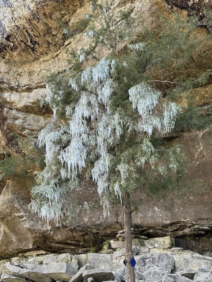
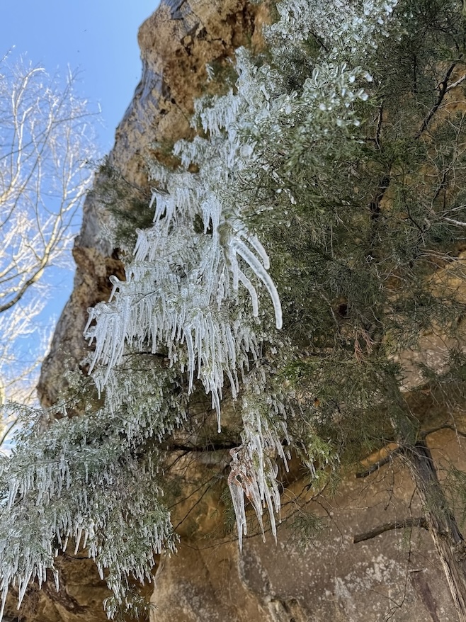
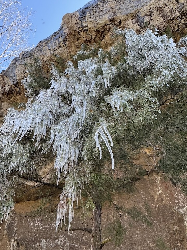
Fall is probably the most beautiful time of year to hike in the Ozark National Forest because so many of the scenic views look out over forestlands. I hiked in February and early March because I was looking for somewhere I could go in winter that would have mild temperatures and little snow, and because of this I was able to avoid humidity, heat, and bugs, but there were no leaves on the trees and multiple times I surveyed the landscape thinking, “dang, this would be so awesome in autumn.” Spring should be nice too; wildflowers will be in bloom and waterfalls should flow powerfully in rainy season.
Ticks are really bad in the summer. In fact, I asked my Eureka Springs walking tour guide about how buggy it gets in summer, and she said you almost shouldn’t even go out in the woods at all in summertime – stick to the lakes.
What are the driving conditions and gas stations like in the Ozarks?
Most of these trailheads are right off a main road or don’t require driving for very long on unpaved surfaces. However, three of the trailheads do require driving on bumpy, rutted, rocky dirt roads for a significant amount of time (I’ve noted which ones below). I was glad to have four wheel drive, although I’ve read reports of bold people making it happen in 2WD.
The roads to those three trailheads have narrow sections where you’ll hope another car isn’t coming in the opposite direction. If they do, you may have to get way over to the side or even back up to let them pass. It never felt treacherous to me though; these are not dicey mountain passes like in Colorado.
If you’re new to northern Arkansas in general, you’ll soon find out why the people from this region were called “hillfolk” or “hillbillies” and why the Ozarks are sometimes referred to as the Ozark Highlands. It’s very hilly! Everywhere you drive, even when you’re in towns and not in the national forest, you’ll be navigating curves, ascents, and descents. You’ll want to take it slow on some curves and try not to pick up too much speed on the descents.
Technically those who refer to the Ozarks as the “Ozark Mountains” are a bit off. They are not mountains, but plateaus that have been uplifted and then eroded by rivers. As you adventure in the Ozarks you will understand the difference, and likely come to characterize the region in your mind as a series of ditches, valleys, and bluffs more so than mountains.
The views are absolutely spectacular as you navigate through the rolling hills. Multiple times I frantically tried to find somewhere to pull over so I could take roadside pictures before the view changed around the next bend, knowing I wouldn’t be able to truly capture it anyway. At times I was reminded of the Peak District in England because of the vast meadowlands dotted with cows and horses, and because private ranching properties and residences are dispersed throughout the Ozarks; this is not something you’d typically see in our national parks in the United States. I had to drive through someone’s farm to reach one trailhead. It’s quite charming and makes me jealous of the locals who can refer to the Ozarks as their backyard.
Once you’re deep into Ozark National Forest, there are long stretches between gas stations. You can fill up in Kingston just before entering from the north, and once you’re in the national forest the easiest place to fill up is in Jasper. You may be able to get gas in Deer and Ponca, and there are some other small stations like Who DaThought It Arkansas, but the smaller stations are intermittently closed. It’s best to arrive with a full tank.
You will lose cell service frequently. I put my GAIA hiking app to dual use by referencing it for driving roads when I don’t have cell service.
Public transportation and guided trips in the Ozarks
There is no public transportation to get you to any of the trailheads on this list, I’m afraid. Apparently Turner Bend Outfitter runs a hiker shuttle along the Ozark Highlands Trail between Lake Fort Smith and Ozone Campground, which is further west than the trailheads I’m recommending here. Trail angels will shuttle hikers on the Ouachita Trail, but this is too far south. If you are willing to join a guided hiking tour, transportation is typically included. Check the list of tour operators licensed to run guided tours in the Ozarks. Some are also suggested on TripAdvisor.
Do you need any special equipment to hike in the Ozarks?
- Ticks are a big concern when hiking in the Ozarks, especially in summer, though they are active April-October. It’s a good idea to spray your clothes down with Permethrin before your trip and allow them time to dry, and also use an insect repellent with DEET. Wear pants instead of shorts.
- Pants are also a good idea because of thorny vines that will scratch and catch in your skin on trails like Big Creek Cave Falls.
- Trekking poles or a walking stick will help on any trails that involve inclines/declines or creek crossings. In springtime when water levels are high, you may want water shoes or sandals for creek crossings too.
- A headlamp is a great idea for trails that involve caves, and is especially necessary if you want to explore the final cave on Lost Valley Trail.
- There are black bears in the Ozarks, but sightings are very rare. Carry bear spray if it will provide peace of mind. There are also snakes, but I wouldn’t carry special equipment for this; all you can do is watch where you step, be vigilant, and not purposefully try to antagonize a snake. If you see one of the invasive wild hogs, keep your distance.
- In winter you may need microspikes for any lingering snow (in late February I did not encounter any); check recent trail reports on AllTrails and see what the conditions have been like recently. As always, check weather forecasts in case you need to pack a raincoat.
- You will not have cell service on most of these hiking trails and should plan on downloading an offline map prior to your trip using a navigation app like GAIA.
Easy day hikes in the Ozarks of northern Arkansas
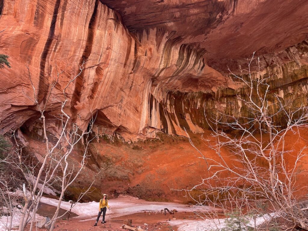
Big Creek Cave Falls
3.1 miles out-and-back
Bathroom at the trailhead: No
Special equipment: Trekking poles or walking stick for creek crossings. When water levels are high after rains, you might want water shoes or sandals for crossings. There are thorny vines on this trail; best to wear long pants instead of shorts.
Parking: There is not a designated parking area. You’ll need to just pull off onto the shoulder of the dirt road. You’ll notice places where other cars have clearly parked in the past.
Getting There: You will be driving from the rim of the Arkansas Grand Canyon down to the valley floor. When I turned off the highway onto a dirt road and realized I was about to descend into the canyon, I got a little nervous, but it actually turned out fine and wasn’t harrowing. It is windy and rocky though, so I was glad to have 4WD.
AllTrails
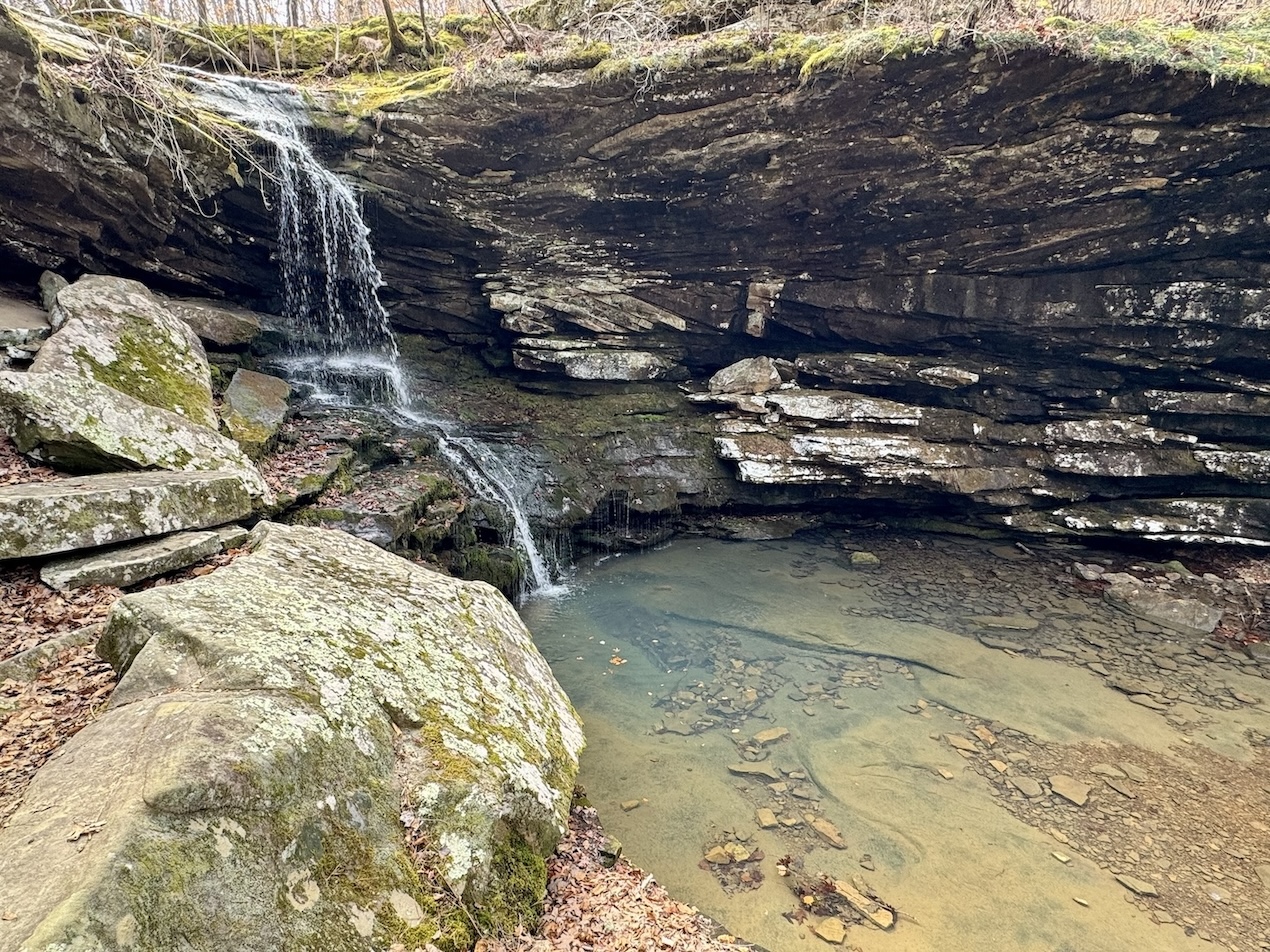
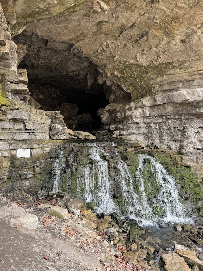
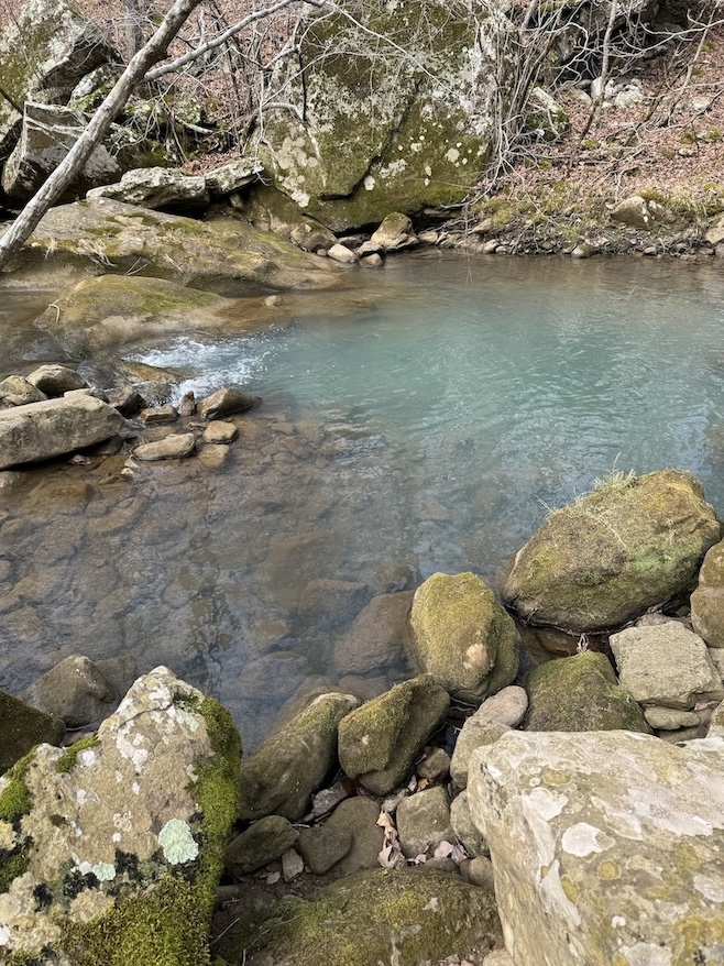
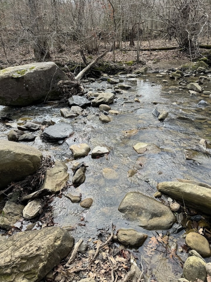
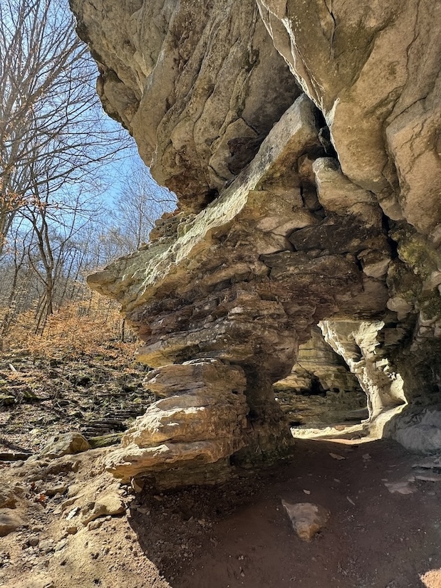
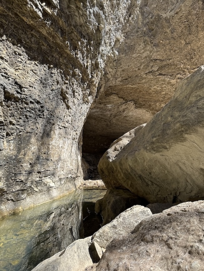
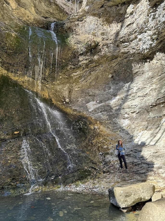
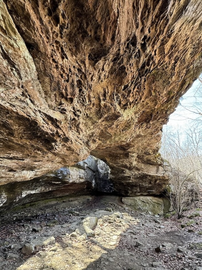
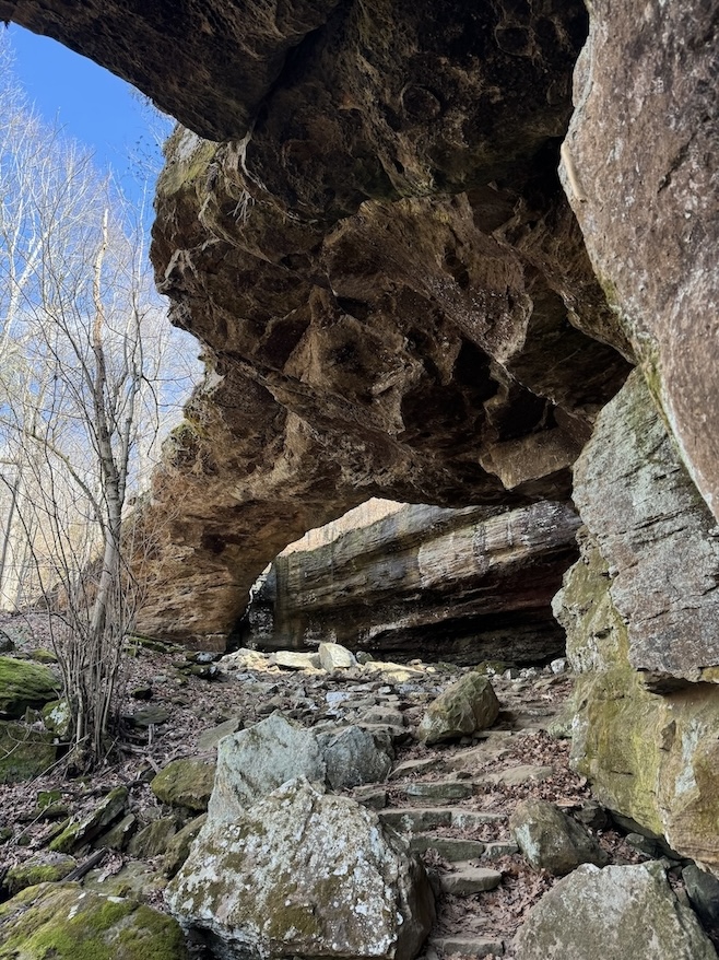
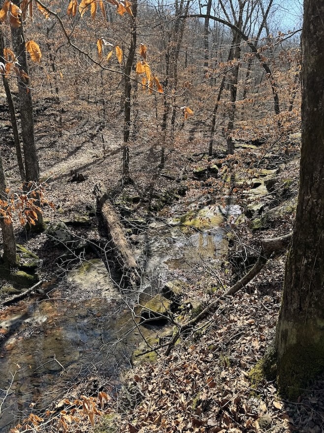
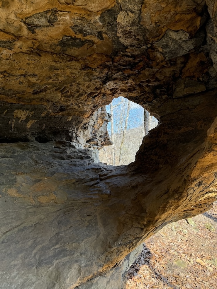
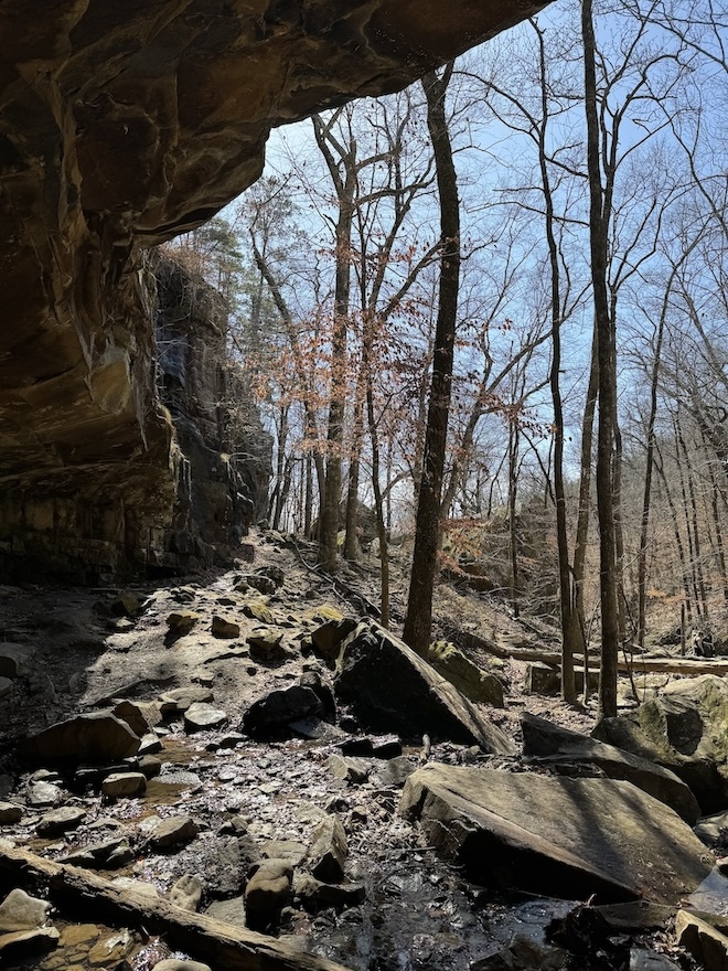
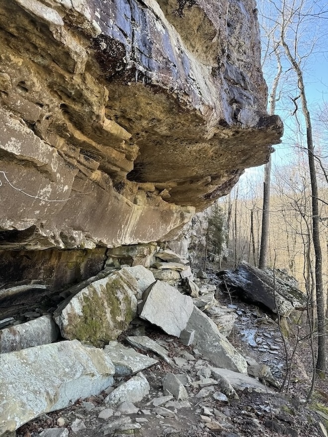
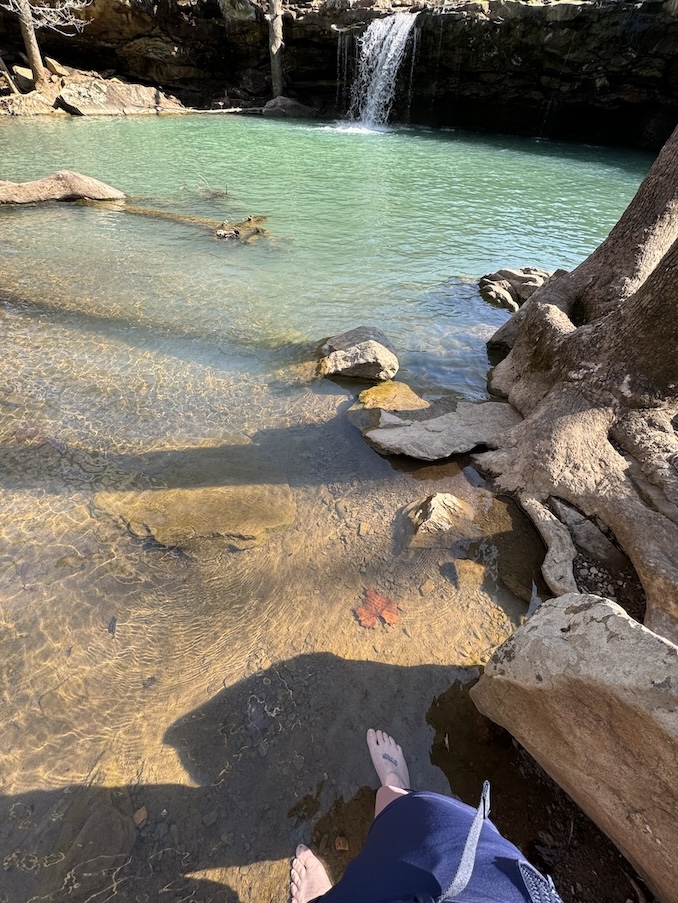
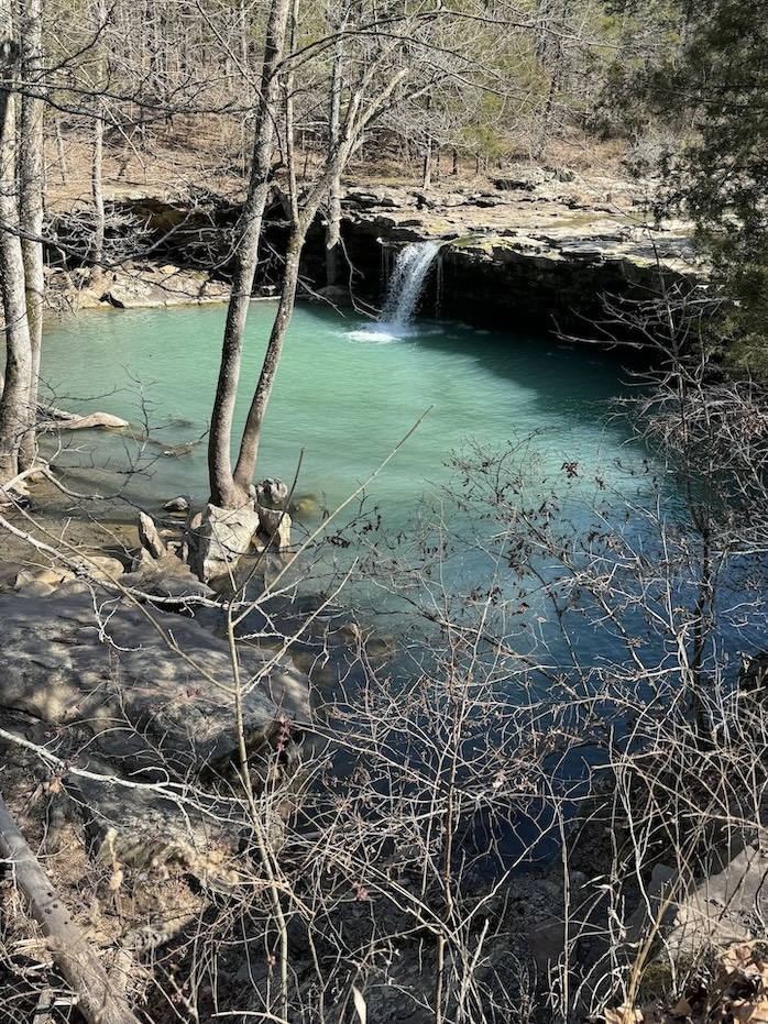
Big Creek Cave Falls is in contention for my favorite trail on the list because of the stunning turquoise blue water and Pacific Northwest-esque mossy forest features. It involves about 4-5 creek crossings one-way, but when I did the trail in February, the water was low enough that it was easy to rock hop without getting wet. I would still recommend bringing trekking poles to steady yourself. Folks who hiked the trail in spring wrote trail reports saying they would recommend bringing water shoes for the creek crossings.
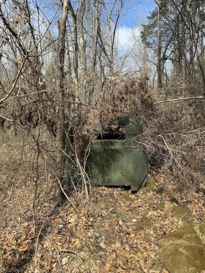
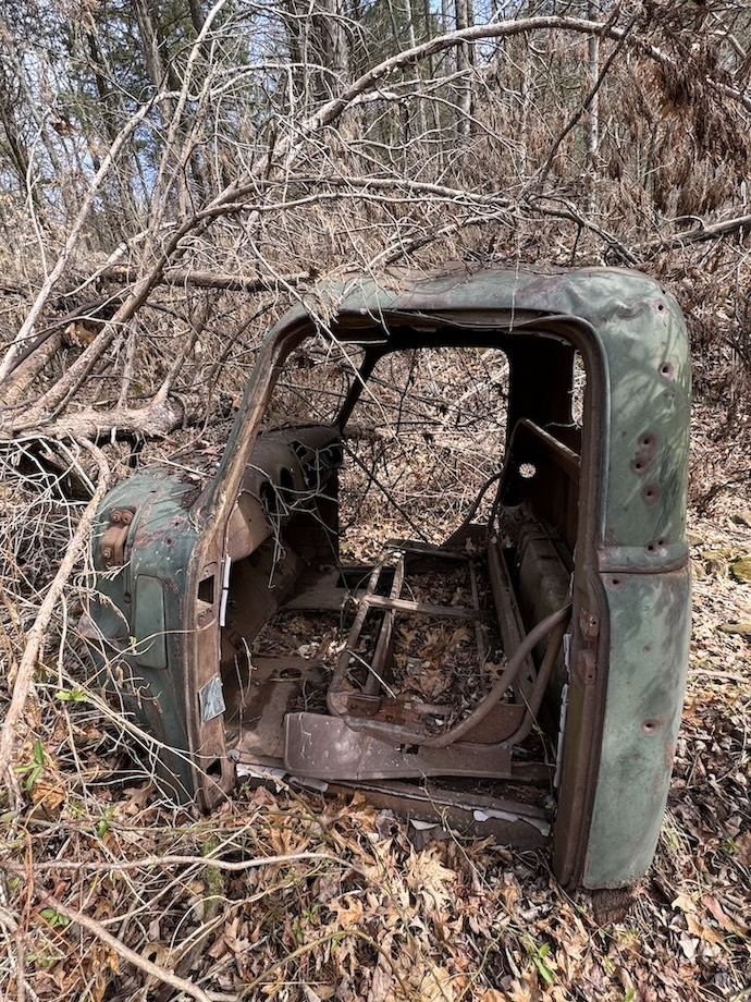
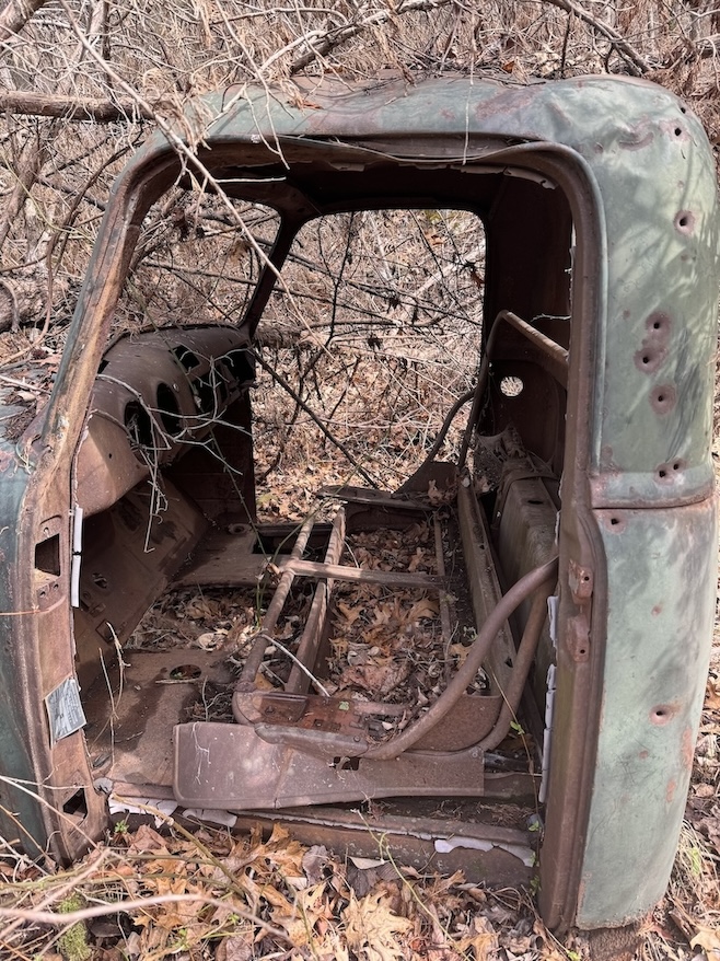
There is an abandoned old pickup truck being reclaimed by vines and branches that makes for a cool photo opportunity. If you download the route from AllTrails, there is a waypoint marking the spot of the truck. If you’re not paying attention or are looking at your feet, you might walk past it without noticing because it blends into the woods on the left of the trail.
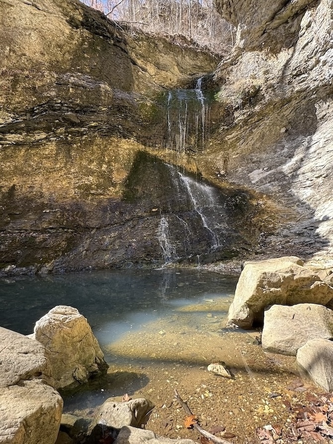
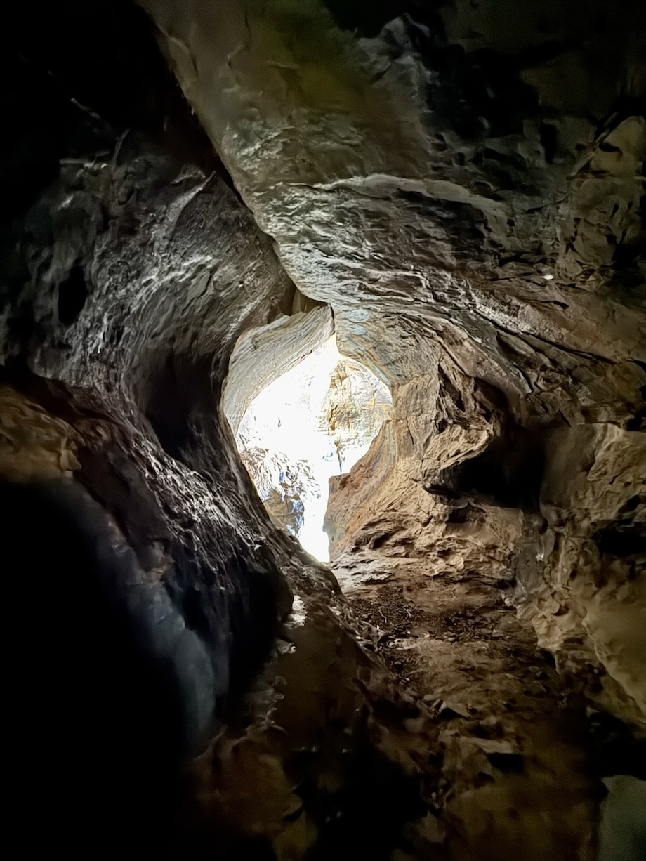
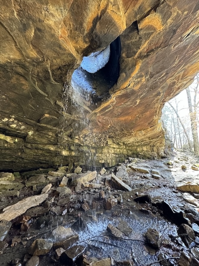
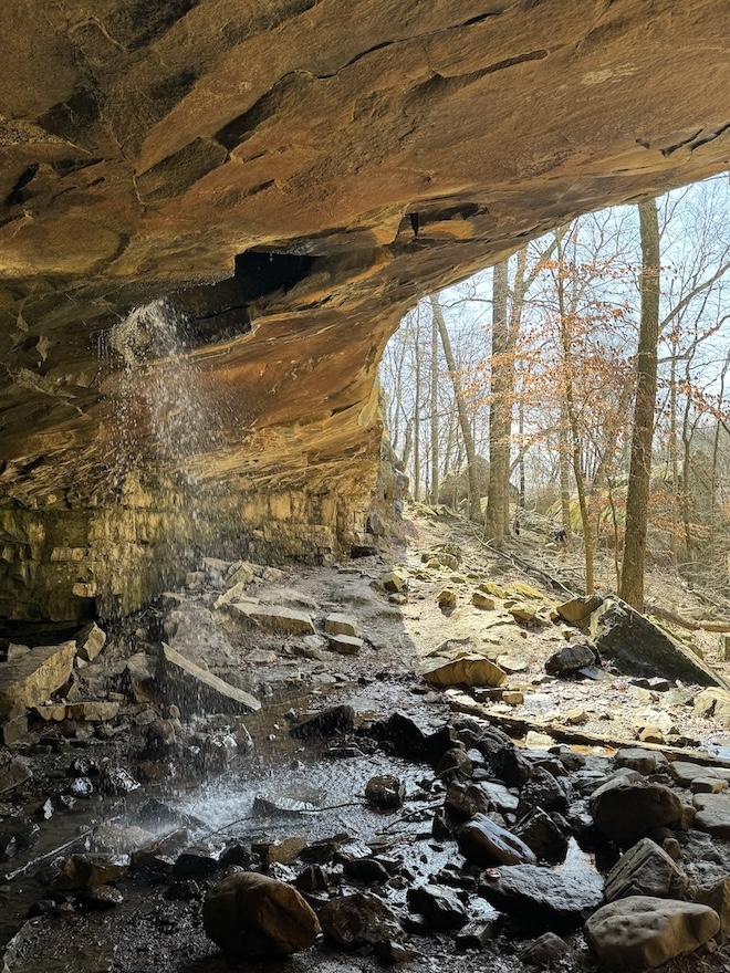
At the end of the trail is a cool waterfall that pours out of a cave, cascades down through tiers of rocks, swirls in a badass whirlpool around a cavernous rock formation, and finally empties into the creek. You can follow the trail along this entire system and admire each feature, though it’s forbidden to enter the cave so as not to endanger the bats.
Apparently there are other waterfalls and caves to explore along this trail; do read the AllTrails reports for advice about how to find them! I just followed the main trail and didn’t realize I should have been looking for spurs to other falls. It sounds like they may not have been flowing in February anyway, but the one at the end that I got to see was flowing beautifully.
Most of this trail is forested, but there are a couple stretches through wide open meadows with no tree cover. Bring a hat.
📸 As you’re driving to Big Creek Cave Falls from Jasper, you will have opportunities to pull over and view the Arkansas Grand Canyon at the Scenic Point Gift Shop, Cliff House Inn, or random roadside pull-offs. Be prepared to stop.
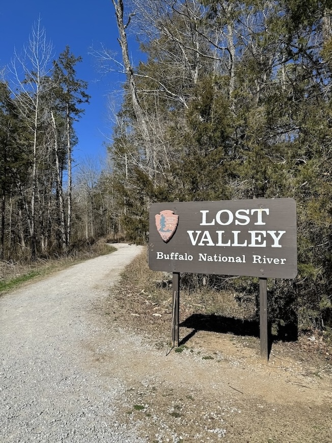
Lost Valley Trail
2.3 miles out-and-back
Bathroom at the trailhead: Yes
Special equipment: Bring a headlamp so you can find the waterfall inside the cave!
Parking: Massive gravel parking area for many cars.
Getting There: There is nothing sketchy about reaching this trailhead.
AllTrails / NPS
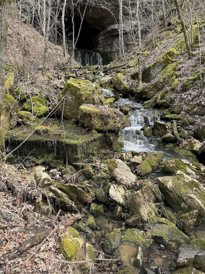
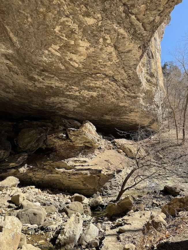
Lost Valley Trail makes it onto every “best hikes in Arkansas” list and is the most popular trail in the region, for good reason. There are multiple landscape features of interest, such as the Natural Bridge, Cob Cave, Eden Falls, and then a second hidden waterfall inside a cave, which you have to slither on your hands and knees with a headlamp to reach!
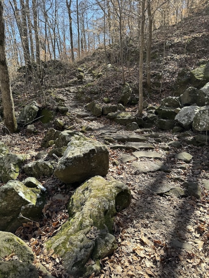
The hike starts with a long stretch of flat forest terrain, and is frankly a little boring. Hang in there! The end of the trail will get exciting.
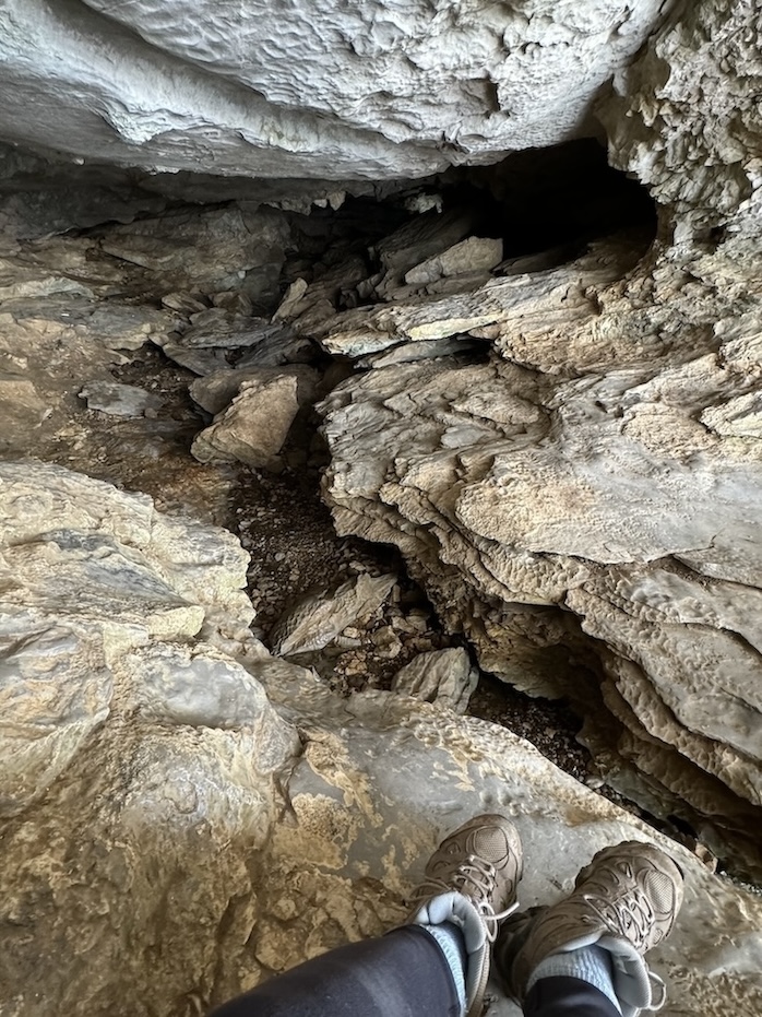
At the Natural Bridge, Clark Creek has burrowed its way through the rock and spills out of what looks like a cave. You can follow the water into this hole and come out the other side to continue, or you can avoid this by circumventing around the formation on the more maintained trail.
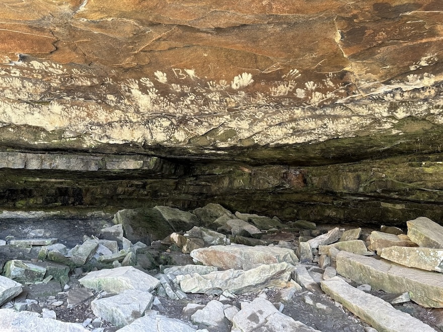
Cob Cave is a massive overhanging rock where people have taken shelter for thousands of years. It was named Cob Cave because archaeologists found 2,000 year-old corn cobs inside, as well as remnants of sandals and baskets.
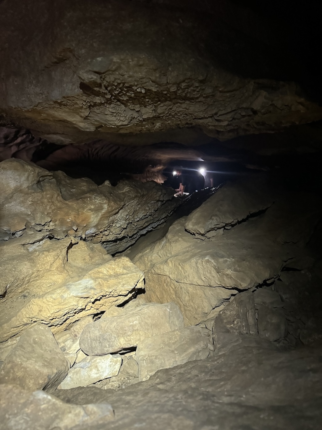
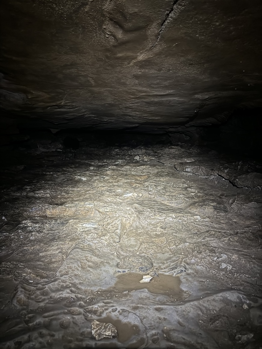
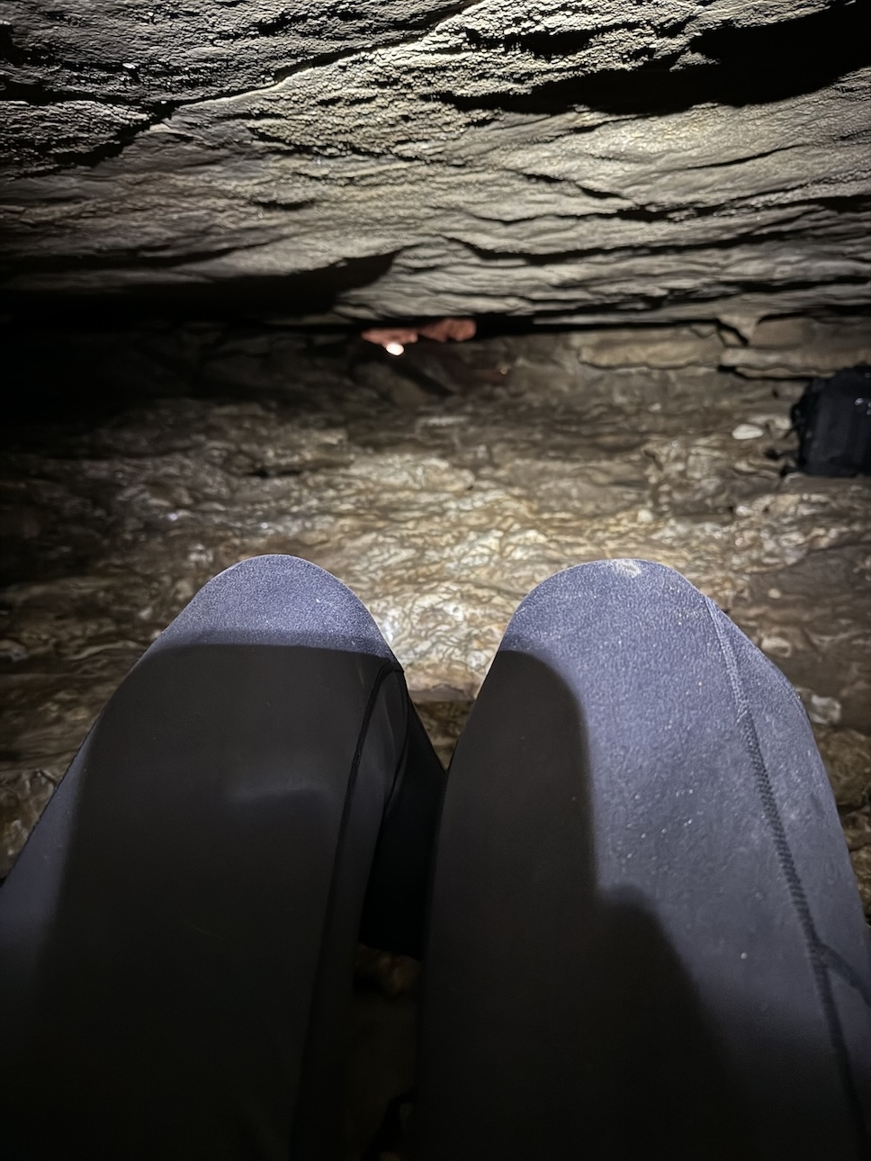
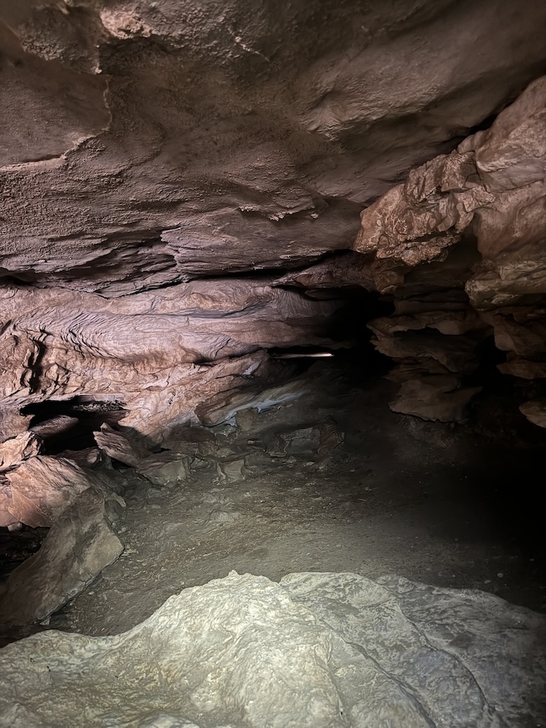
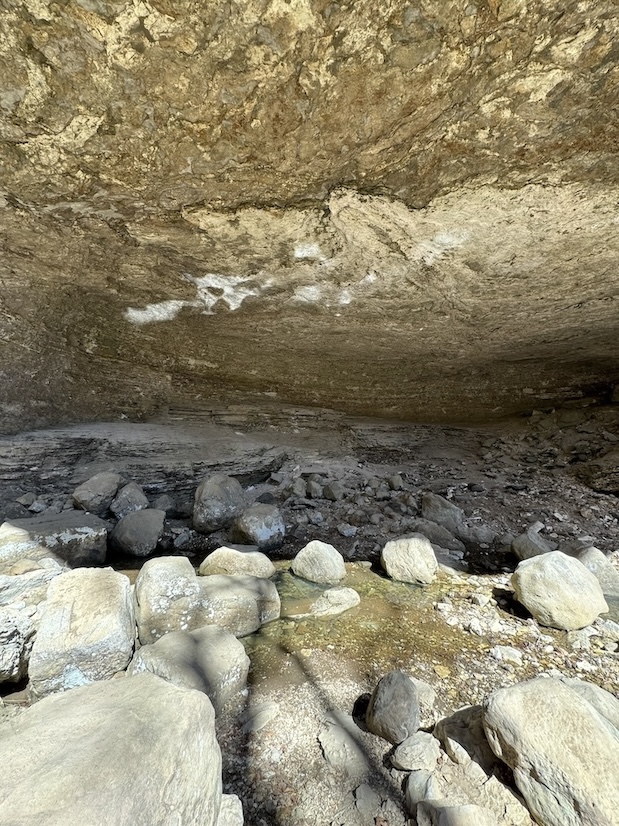
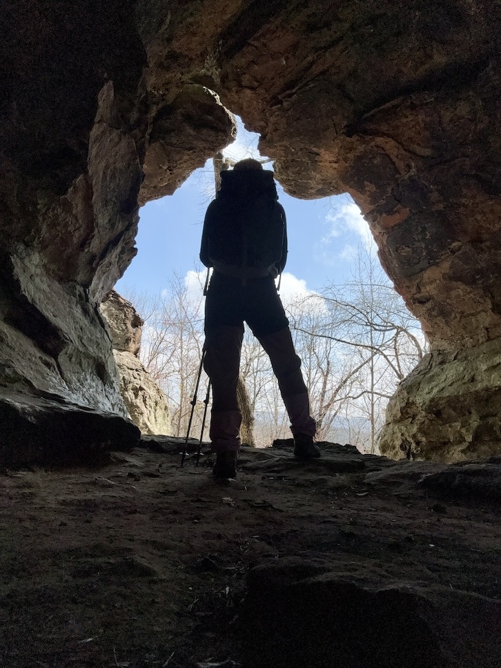
Eden Falls is a picturesque 53-foot waterfall that forms the final destination of the hike for some folks, but if you continue on by hiking to the top of Eden Falls, you will come to a full-on spelunker’s cave. Strap a headlamp on and venture into the depths of the dark cave for about 200 feet, where you will arrive at a second 25-foot waterfall that thunders down from above your head and trickles out to feed Eden Falls.
I hadn’t read much about the trail before embarking and didn’t know about the cave waterfall, so I’m glad I noticed another hiker strapping on his headlamp as I perched at the mouth of the cave. At that moment, two other hikers were returning from the darkness, further cluing me in. I asked them how to best go about the journey. They warned me that I’d need to get on my hands and knees to navigate one claustrophobic section, but assured me it was fun and not too scary. I always pack a headlamp for any hike because it’s one of the ten essentials, so I decided to go for it. It was so rewarding to reach the falls!
📸 While you’re in the Ponca area, check out the James “Beaver Jim” Villines homestead built in 1882. It’s across from the Buffalo River low water bridge, a 0.5 mile out-and-back walk. Elsewhere throughout the Ozarks you can drive to other cool ruins like the Parker-Hickman Homestead, the Rush ghost town, and the Granny Henderson Cabin. I go into more detail and list these historic sites as day trips in my “things to do in Eureka Springs” post.
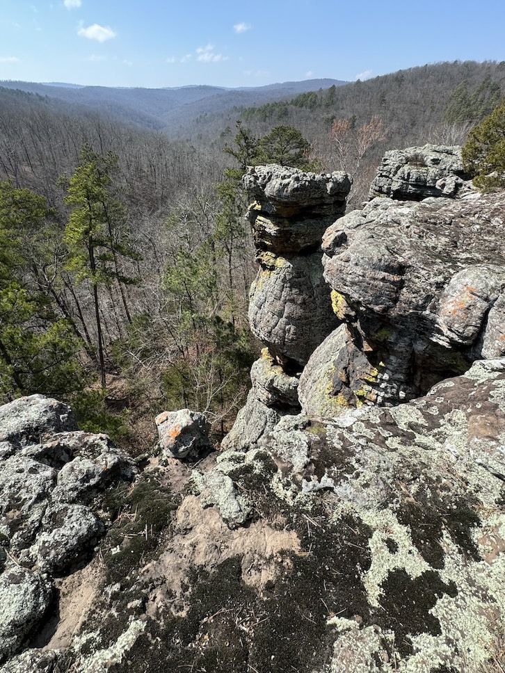
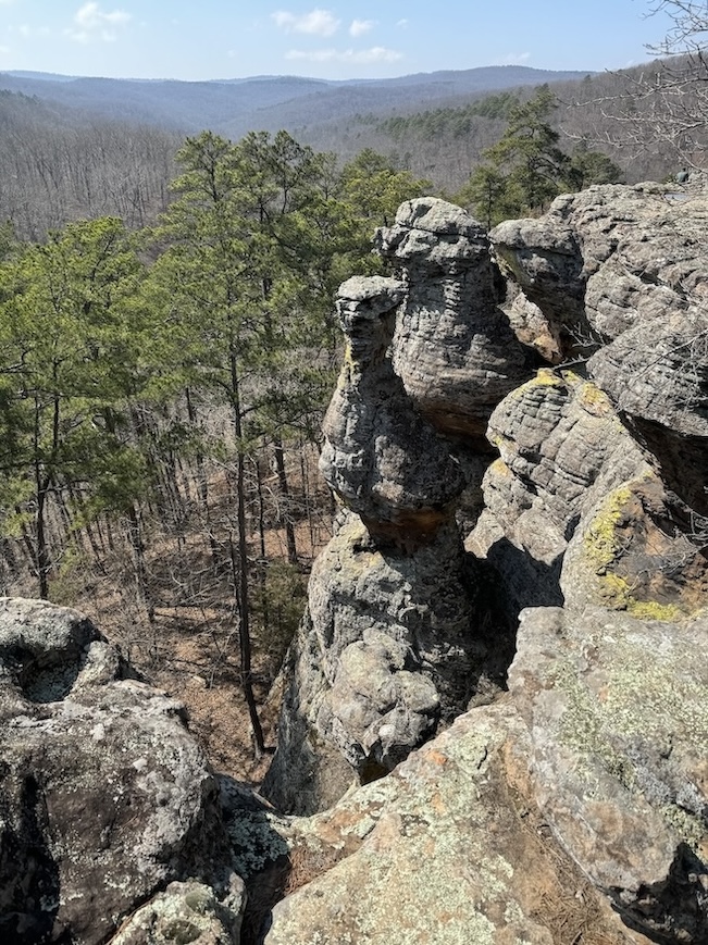
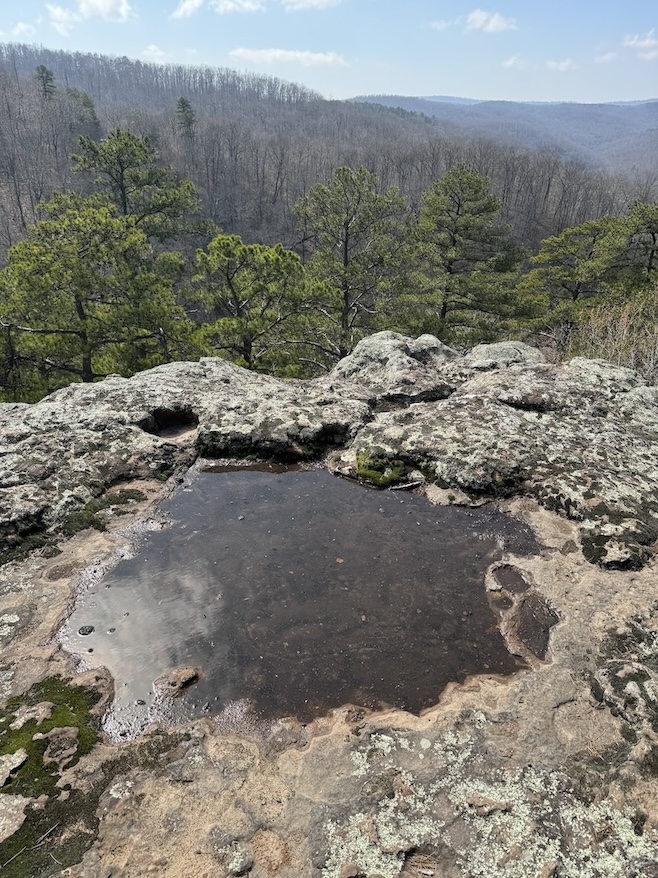
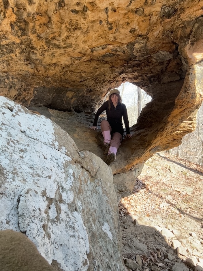
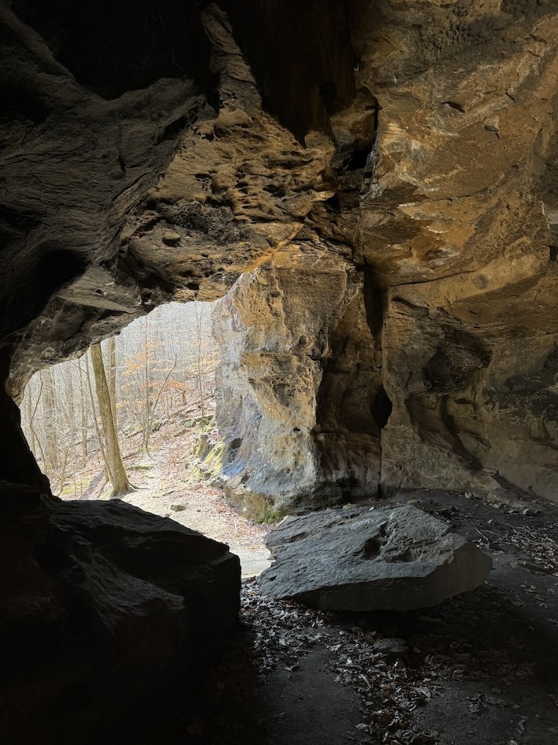
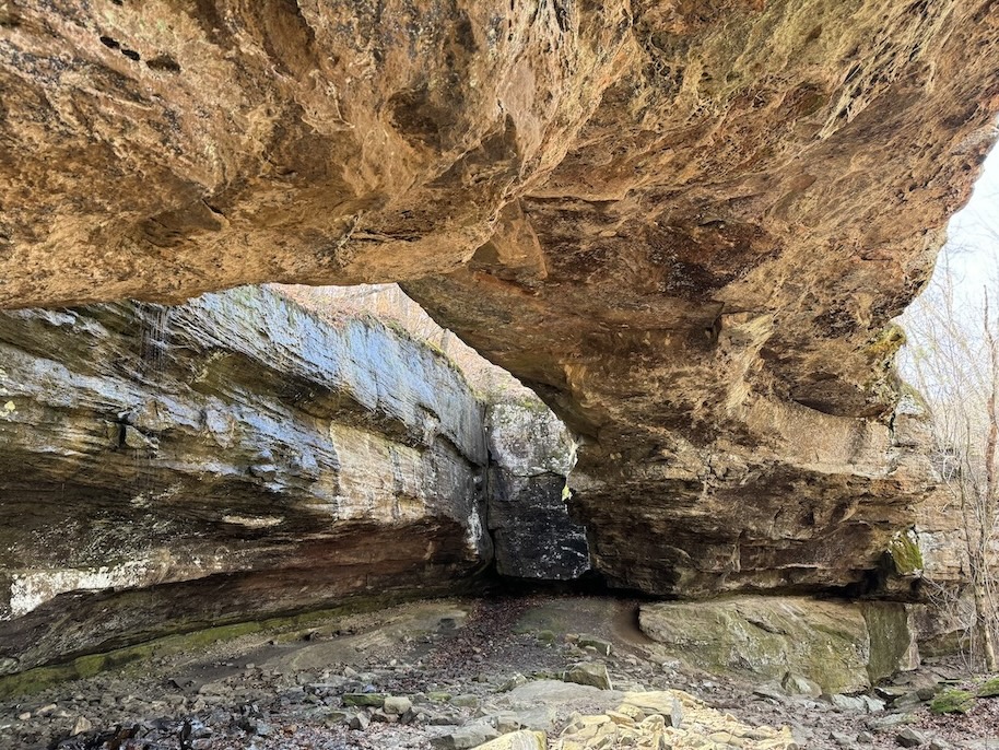
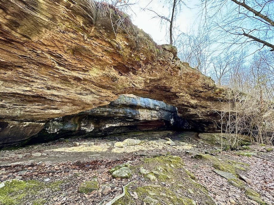
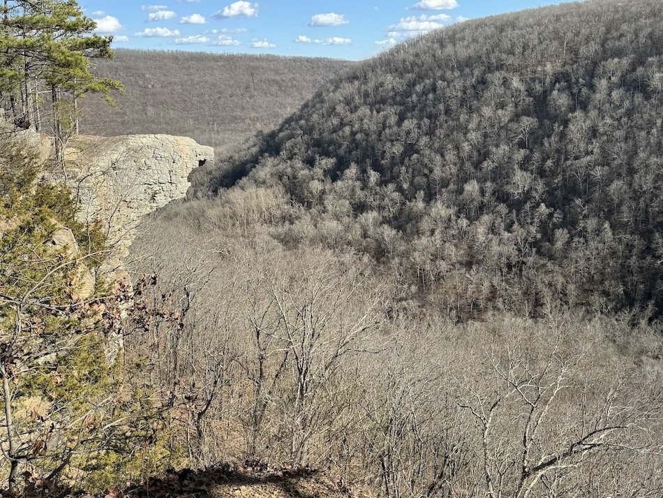
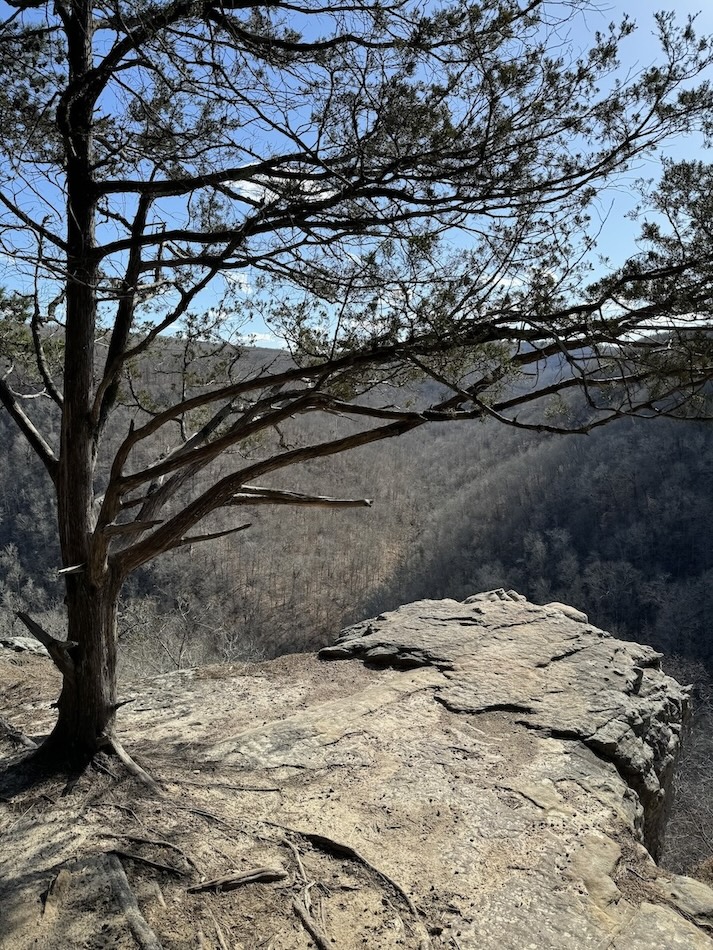
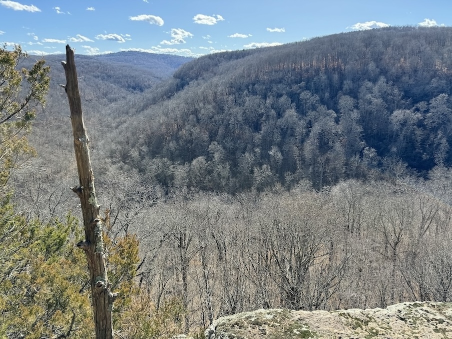
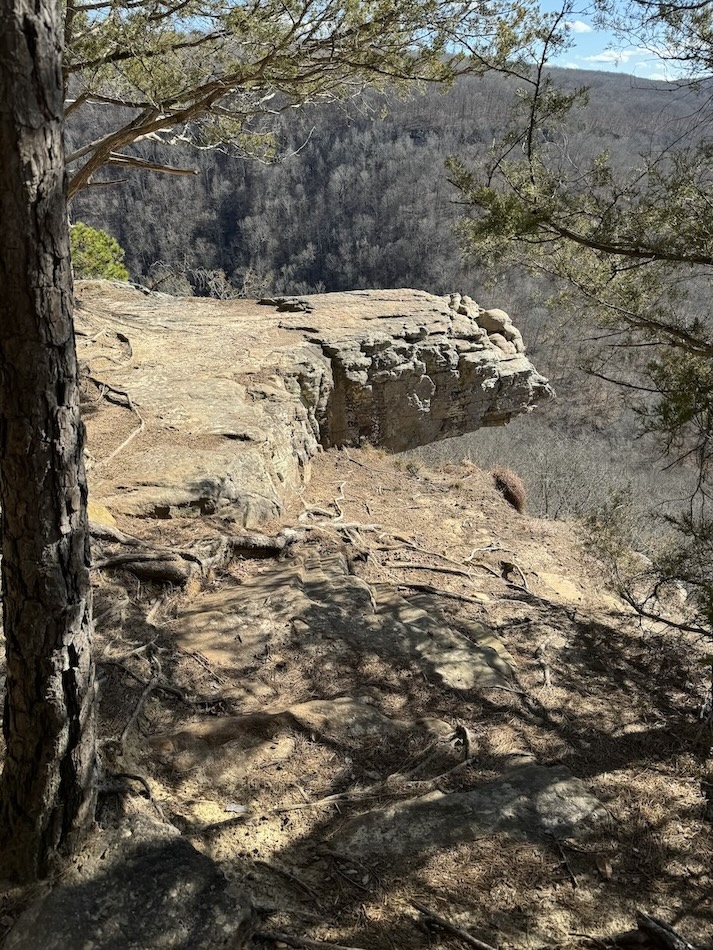
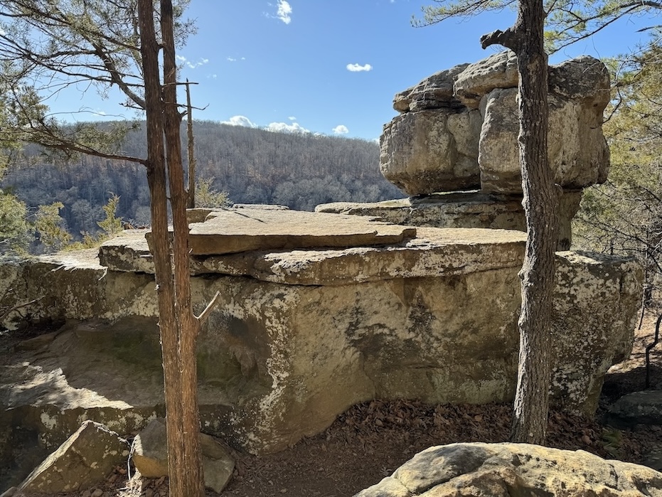
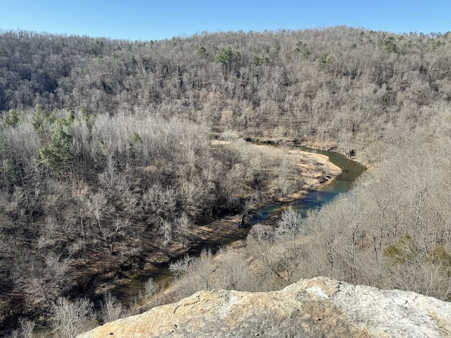
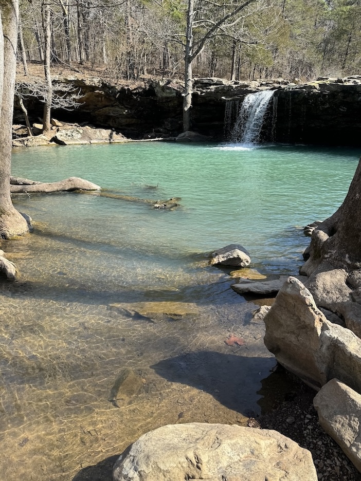
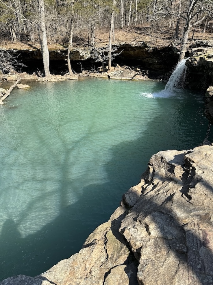
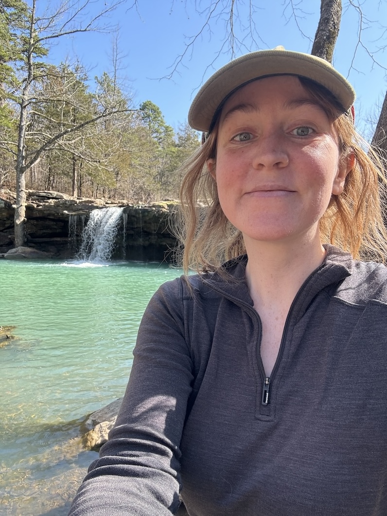
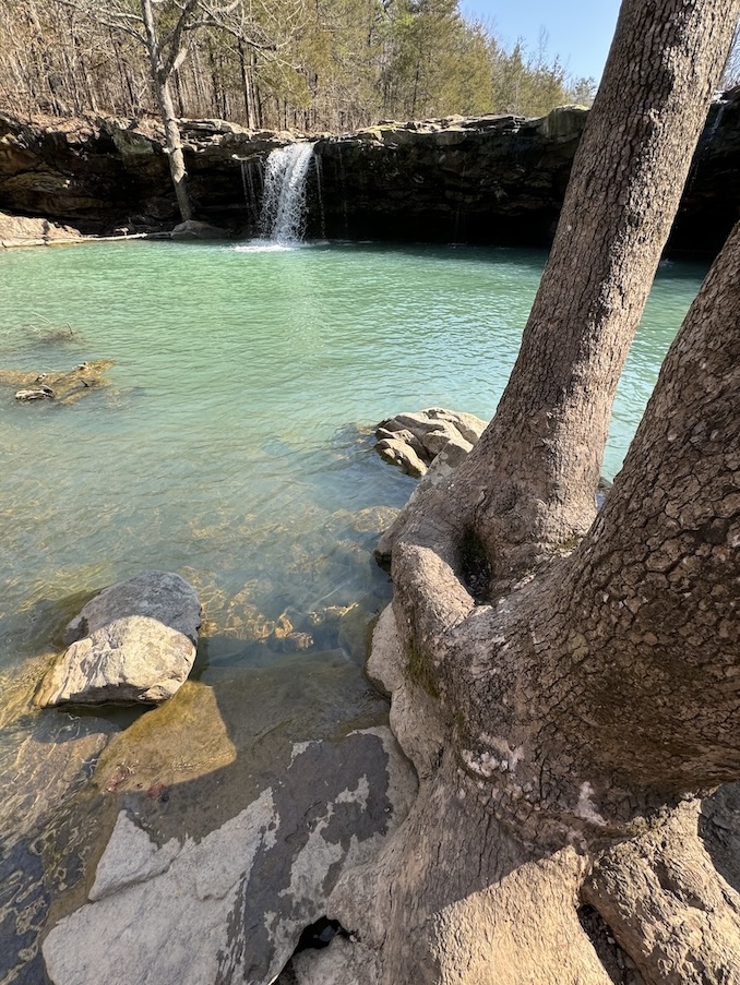
Pedestal Rocks and Kings Bluff


3.9 miles total; 2.2 mile loop for Pedestal Rocks and/or 1.7 mile loop for Kings Bluff
Bathroom at the trailhead: Yes
Special equipment: I was happy to have trekking poles for the descent to explore down on the “ground floor” of the bluffs (going down there is optional); dead leaves in winter made the trail slippery.
Parking: There is a designated parking area with a good amount of space, though some cars still end up having to park on the side of the road.
Getting There: There is nothing sketchy about reaching this trailhead.
AllTrails / USFS
Hikers can choose whether they only want to hike the Pedestal Rocks loop, only the Kings Bluff loop, or both loops. The two paths make a figure 8 shape and are totally separate from each other, but can be combined.
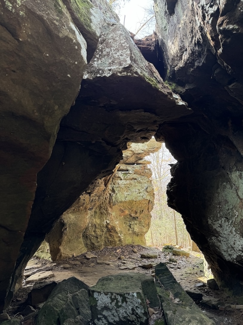
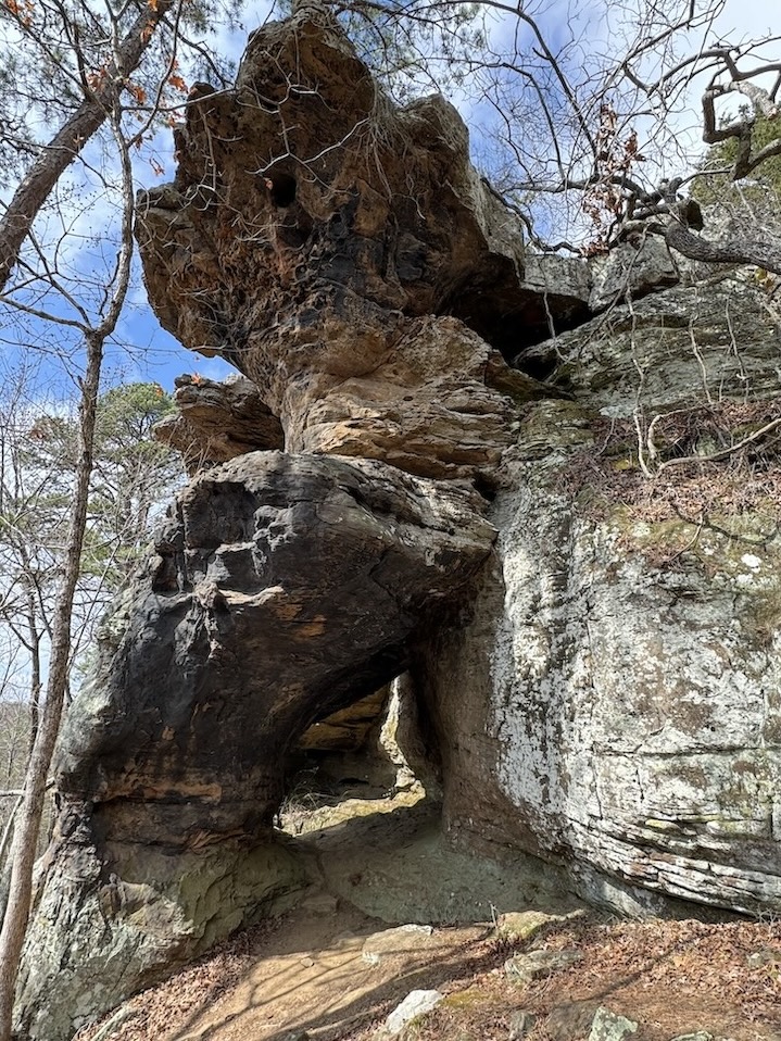
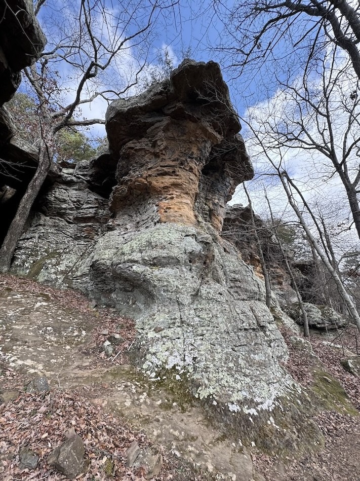
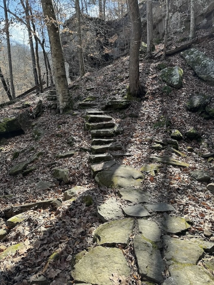
The Pedestal Rocks loop is a choose-your-own adventure experience. Once you get through the forest section and reach the rocky outcroppings, or bluffs, you can follow the mostly flat trail to stay on top of the bluffs if you’d like to look out over the landscape from above. Alternatively, you can descend down underneath the bluffs to explore the caves and rock formations that have been carved out on the “ground level.” I did a combination of both, exploring underneath and then returning to the top to walk the same stretch of trail from a different perspective.
If you want to be adventurous, you’ll end up scrambling around on rocks in order to explore the caves more thoroughly. I found some really interesting alcoves and hidden crannies, including a long trippy tunnel-like rock formation and an old fire ring made by rule-breakers – camping is not allowed below the bluffs.
If you do Pedestal Rocks clockwise, you can descend the steeper part of the trail to reach the rock formations and then walk a flat trail back to the trailhead. If you go counterclockwise like I did, you’ll get more of a workout with an incline on the way back.
Kings Bluff has better landscape views out over the surrounding hill country. For a short stretch it features towering rock formations similar to Pedestal Rocks, but you can not explore below them. There are also two waterfalls, however they were not memorable for me because they were not flowing heavily the first week of March. Apparently Kings Bluff Falls is one of the tallest waterfalls in the state.
Doing both loops was worth it to me, but if you can only choose one, I’d go with Pedestal Rocks. There are a couple moments where you are close to a cliff edge, and though they’re brief and not particularly harrowing, some folks may be hesitant about that, especially with kids or dogs. If that’s the case maybe pick Kings Bluff.
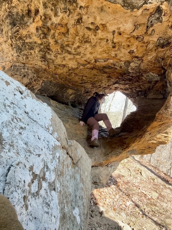
Alum Cove


1.2 mile loop
Bathroom at the trailhead: Yes
Special equipment: None
Parking: Paved and ample parking, plus a covered picnic area.
Getting There: There is nothing sketchy about reaching this trailhead.
AllTrails / USFS
Alum Cove (not to be confused with Alum Cave in the Smoky Mountains in Tennessee) is one of the easiest hikes on this list. It’s a leisurely stroll up until the last minute when there is a slight incline to get back to the trailhead.
This hike includes a “natural bridge” made of rock, and it looks more like an actual bridge than the hole in the rock at Lost Valley does. You will walk across the bridge itself, which has been made safe with the addition of fence railings, and can also go underneath the bridge to admire its shape.
There is a playground of other rock formations to explore, including some cave-like crevices that are not difficult to simply step inside of. I had fun rambling and taking photos in a leisurely, low-stakes manner.
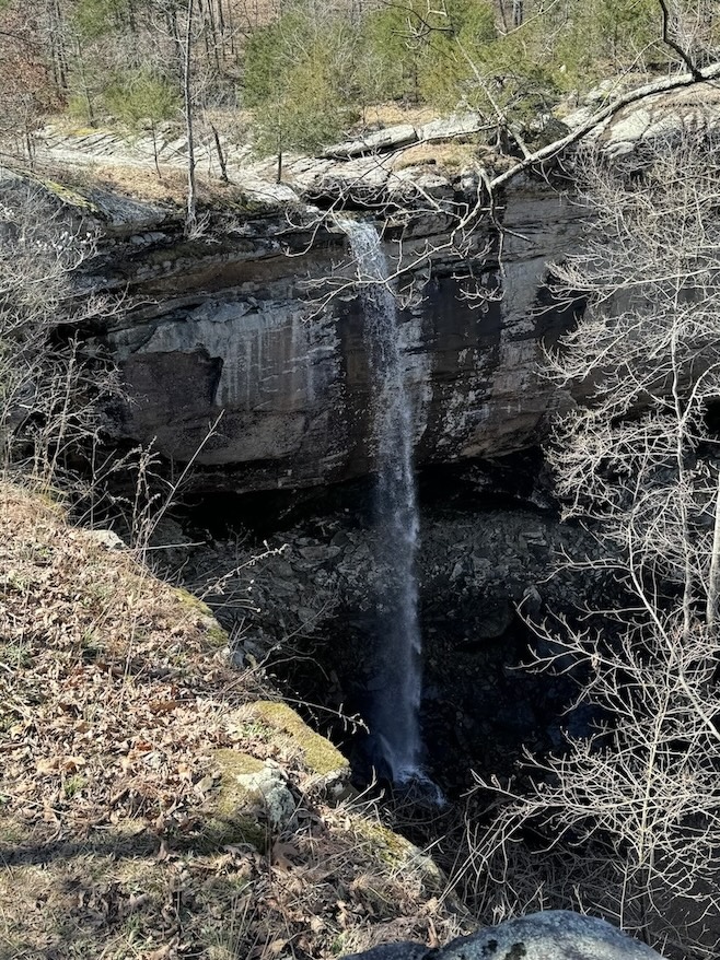
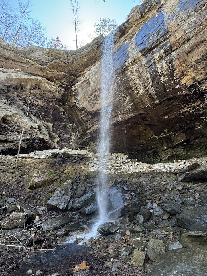
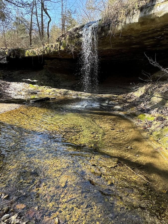
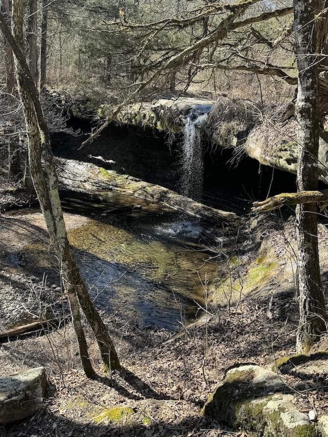
Glory Hole Falls
1.9 miles out-and-back
Bathroom at the trailhead: No
Special equipment: None
Parking: Gravel pull-off directly on the shoulder of the highway. There is room for a good number of cars as long as no-one parks parallel. Note that it’s kind of hard to see drivers coming around the bend when a lot of cars are parked and obscuring your view; be careful getting out when you’re ready to leave.
Getting There: There is nothing sketchy about reaching this trailhead, except for bad visibility when trying to leave the parking space.
AllTrails
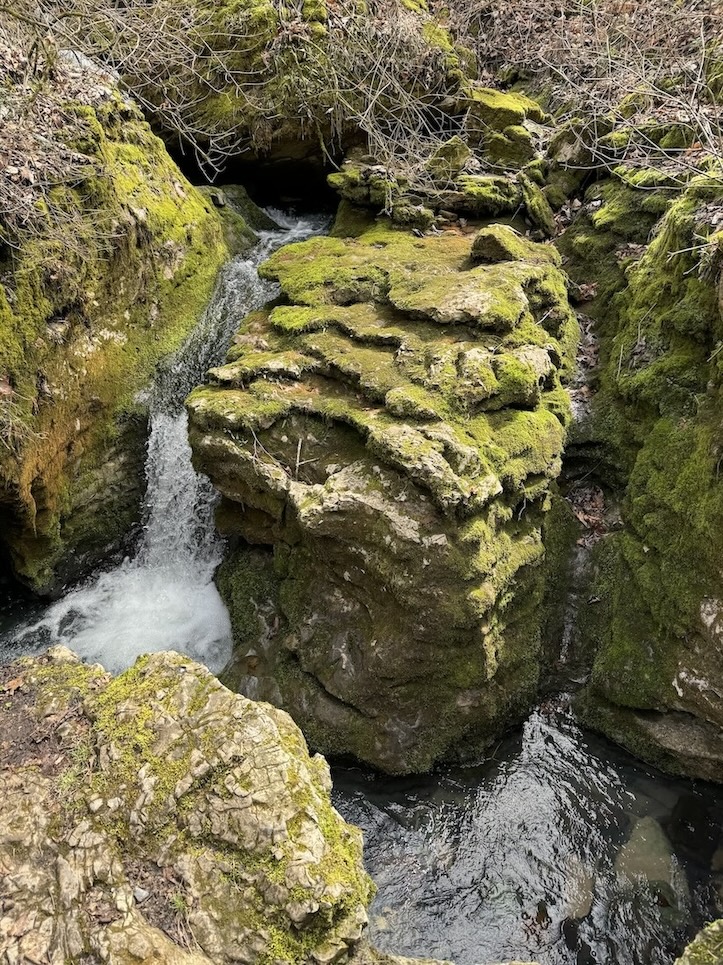
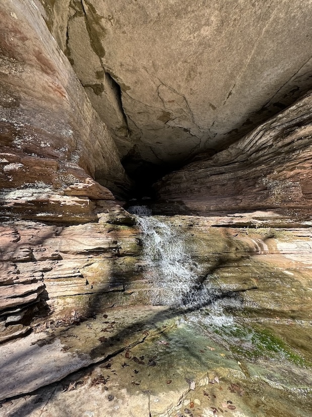
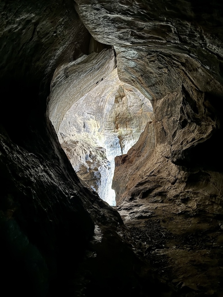
Rather than cascade over the edge of the rocky overhang that encumbers it, this waterfall has chosen a more direct route by digging a hole right out of the rock ceiling. Its liberation is really quite an odd, fantastical sight, reminiscent of a spotlight shining down on a stage, or sunlight shining through a break in the clouds.
To reach the unfortunately-named falls, you’ll follow an entirely forested trail. It starts off flat and then descends, meaning your return hike will be on an incline and may have you huffing and puffing. Once you reach the top of the falls, you’ll need to pick a way to navigate down to its base via stairstep-like rocks on your right. There isn’t one set way to do it; just take your time and pick whatever looks like the most direct route.
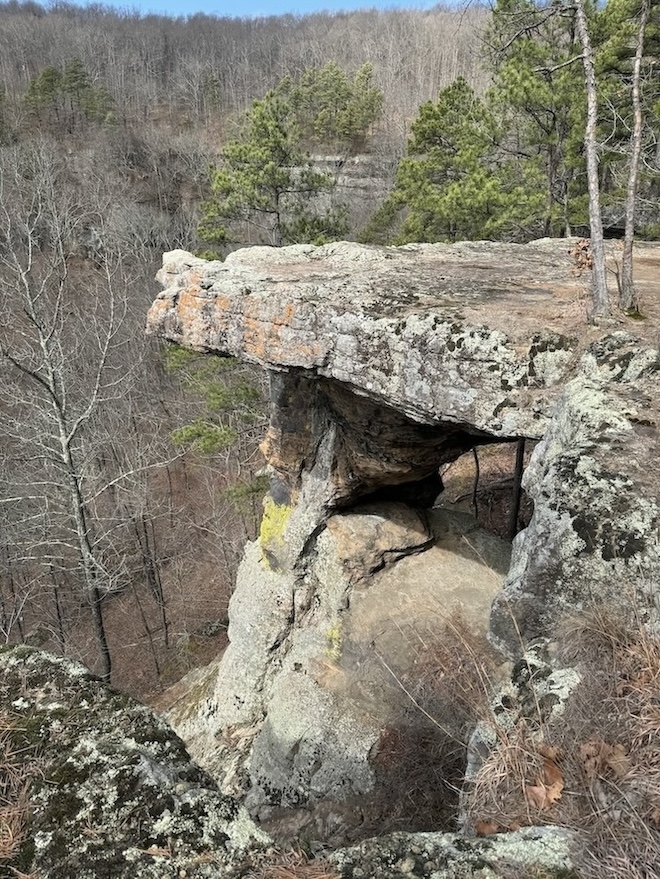
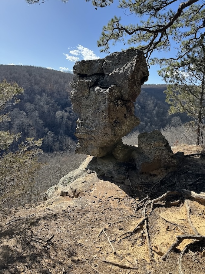
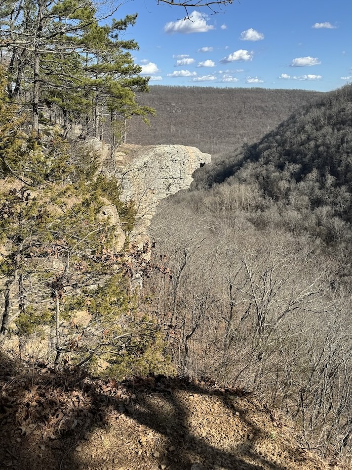
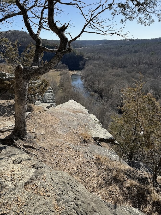
Whitaker Point (Hawksbill Crag)
2.7 miles out-and-back
Bathroom at the trailhead: No
Special equipment: None (maybe a camera tripod if you’re a solo hiker and want to get that cool photo on the crag).
Parking: Gravel area with space for plenty of cars, though on a busy day some may need to park along the road.
Getting There: Once you leave Boxley Valley you’ll turn onto the county road, which is very windy and bumpy. It takes awhile to get to the trailhead as a result. I was glad to have 4WD.
AllTrails / USFS
This is another one of the most popular hikes in the Ozarks in northern Arkansas. There are craggy bluffs jutting out over a vast canyon, and one outcropping in particular is a very prominent photo location. One person can stand on the rock which appears to hang precariously out over the canyon, and another person can take a cool photo of them from a couple hundred feet down the trail. I’m a solo hiker so I couldn’t get *the* photo, but I still enjoyed photographing the rocks. I learned that the overhang is actually not very precarious at all; when you’re standing on it you find that there is a ton of space. I also learned that there are many jutting rocks along the cliffside, not just the one everyone typically photographs.
I will say that hiking this trail in winter was not as rewarding as it must be in spring or fall when there are leaves on the trees. Part of the allure is the expansive views of the canyon, but when it’s covered in dead grey vegetation, some of the charm is gone.
This trail is entirely flat and there’s nothing difficult about it at all.
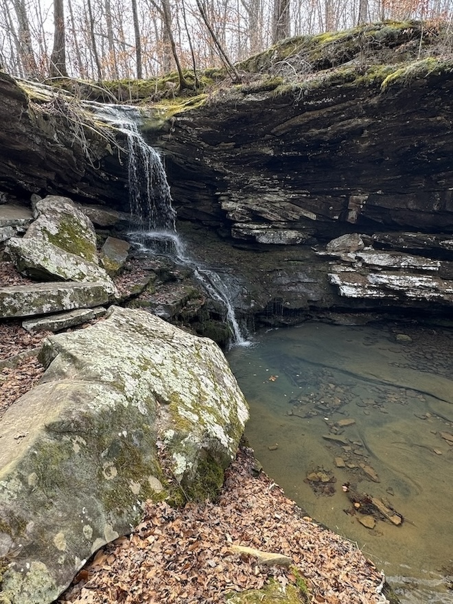
Sweden Creek Falls
1.5 miles out-and-back
Bathroom at the trailhead: No
Special equipment: None
Parking: There is a large gravel parking area.
Getting There: The road to reach the trailhead is bumpy and full of potholes, but nothing too crazy. You probably don’t need 4WD.
AllTrails
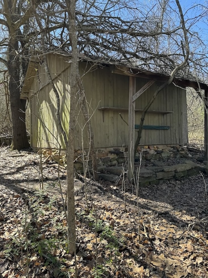
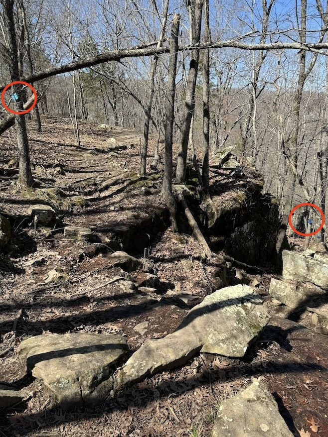
Sweden Creek Falls is one of the tallest waterfalls on this list and I felt it was a rewarding hike for such a short distance. After some forest hiking, which involves passing next to a random cabin (see gallery), you’ll come to a junction in the trail where you can either continue following the light blue trail markers to your left, or you can start following dark blue trail markers on your right. If you go left, you’ll take a flat trail to view the waterfall from above. You can walk right up to the top of the falls and find the creek-like source that feeds it.
If you take the dark blue route, you’ll descend a rocky trail that leads to the bottom of the falls. This trail can be muddy at times and require careful footing, but I still found it easy. I met a man at the bottom of the falls who said he was concerned by videos he’d seen of the trail because a couple places look treacherously narrow next to cliff edges, but the videos make it look much worse than it actually is and he didn’t have any trouble. I agreed.
Like Lost Valley, this trail is very close to Boxley Valley Historic District and the Villines homestead.
Magnolia Falls
2.1 miles out-and-back
Bathroom at the trailhead: No
Special equipment: Even if you don’t typically use an offline map like GAIA, for this trail it’s particularly helpful for finding the spur trail to the falls. There is no sign indicating the turn-off.
Parking: There is no designated parking area. You’ll pull off the side of County Road 6 and parallel park in the dirt; there is plenty of space to do so safely.
Getting There: There is nothing sketchy about reaching this trailhead.
AllTrails
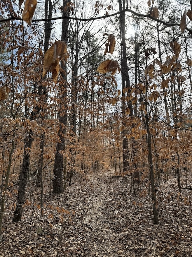
Magnolia Falls trail is mostly flat and forested, so there are not any big views, but the waterfall at the end is pretty cute. The other main feature is a stone retaining wall that follows you for part of the hike, and I have no idea when this was built or what its purpose was. It’s fodder for the imagination!
If you don’t look at an offline map, you could accidentally continue following the main obvious trail into oblivion, missing the spur trail to the waterfall. This faint spur trail is on the left and easy to overlook. If you start having to push branches out of your way as you enter denser forest, you’ve probably gone too far.
Kings River Overlook
1.2 miles out-and-back
Bathroom at the trailhead: No
Special equipment: If you want to go off-trail to find Eagle’s Nest Falls, it’s good to have an offline map with the coordinates saved.
Parking: Large gravel parking area with plenty of space.
Getting There: This hike is in the McIlroy State Game Management Area. You’ll take remote county roads to find the trailhead; I was happy to have 4WD out there.
AllTrails / AGFC
If you stay on-trail, this route is entirely flat and very easy. It features beautiful views of the Kings River from above as it twists and turns along its course, birds soaring overhead. If you’re feeling adventurous, reference the coordinates on Rick’s Hiking Blog to help you find Eagle’s Nest Falls off-trail.
I paired my trip to Kings River Overlook with separate drives to nearby Glory B Falls (photos in gallery above) and Road 299 Falls as described by Rick’s post. He provides exact coordinates for each waterfall as well as parking locations for each fall, which were spot-on and very helpful. Glory B and Road 299 Falls only require the tiniest bit of walking; they are located just off the road. I thought Glory B was particularly worth it. Eagle’s Nest and Road 299 were not flowing very much in February.
Honorable Mentions
I haven’t completed these yet but will add more information to the list after I’ve done them myself: Fuzzy Butt Falls, Hobo Falls, Indian Rock House, Long Pool Falls (Long Pool Recreation Area requires paying a $3 per vehicle day use fee).
Some popular trails in the area, such as Fern Falls and Paradise Falls, have recently been described as overgrown or slightly treacherous in trail reports, with bushwacking required. I am therefore not including them on my list of “easy” hikes, though they may be better in other seasons.
Bonus: Cool waterfall you can see without hiking
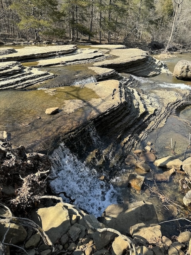
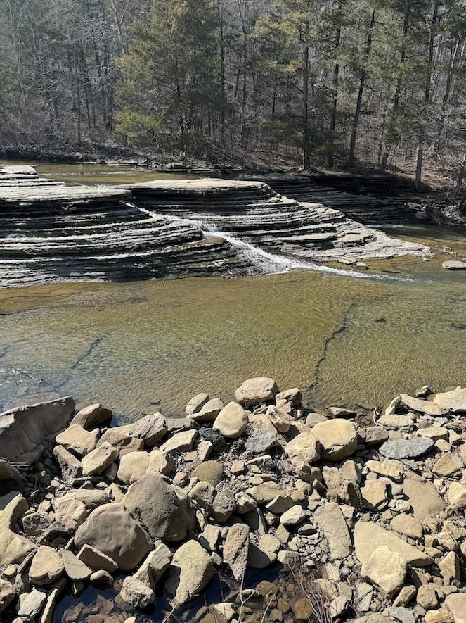
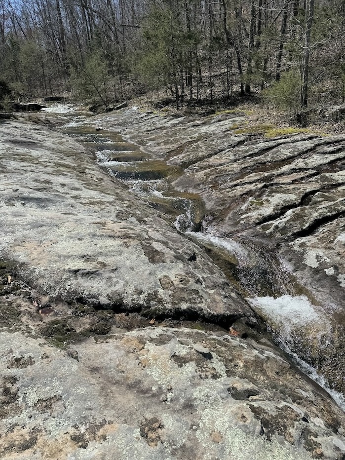
While I was driving to see Six Finger Falls, a cool pancake rocks formation with cascading water flowing over it, I noticed something called Falling Water Falls on my map (creative name). I decided to make the detour to check it out too and holy moly, what an oasis! This waterfall and swimming hole is just off the side of the road and the water is a sparkling turquoise blue. Only a couple other families were there when I arrived, and neither of them were hanging out directly next to the falls, so I had the whole pool to myself. If I lived nearby, this would be my picnic hang spot every single weekend of my life; I’d never leave.
Other falls you can reach without much hiking include Bingham Hollow Falls (0.2 miles roundtrip), High Bank Twins (0.4 mile bushwack), Triple Falls (0.4 miles roundtrip), Glory B Falls (right off the road), and Road 299 Falls (short bushwack).
🏨 Find hotels in Eureka Springs. The Basin Park Hotel or the (haunted) Crescent Hotel are the most famous, but there are also many quirky accommodations like the retro Wanderoo Lodge.
🏕️ Find free or paid campsites in Arkansas via The Dyrt. Fairview Recreation Area seems like a good free one in Ozark National Forest near Pedestal Rocks trail.
✈️ Coming to Arkansas from further afield? Use an Airalo eSIM for affordable international cell data and don’t forget to protect your investment with travel insurance.
I quickly realized when I arrived in northern Arkansas and started researching hiking trails that it would take a lifetime to see it all! Attempting to do all the best trails in the Ozarks is quite the presumptuous undertaking and this barely scratches the surface, but the hikes on my list are a great first-timer’s introduction to the region. These will get your feet wet (pun intended) and help you understand what to expect in terms of terrain and vegetation when hiking in the Ozarks, so that you can make informed choices about which moderate or strenuous trails will help you level up in the future.
Related:


Pin It:


My dream is to write travel and hiking content full-time. All of my guides and itineraries are free and my travels are self-funded. If you enjoy my site and would like to support, you can donate any amount to my Ko-fi page. Thank you!!
Oh nooo for the runner’s knee! I hope its feeling a bit better. On a similar vein, I managed to pull a muscle on our first 1000m+ (3000 ft+) hike this April.
We were doing long, flat walks through the winter and skiing…but that doesn’t seem to help our weak spring legs!
Ugh god dangit!!! We are both suffering. Are you rehabbing it? Maybe it’s just written in the stars this year, maybe 2024 is just not fated to be a great year for spring hiking. We’ll be killing it by summer, though, come hell or high water.
Oooh Claire these all look so fun! We do exactly the same thing in Feb/March – go and find the easy trails and waterfall trails while our legs are aching. These waterfall options all look they might be amaaaazing slightly later in the spring when there is even more water flowing?
I have to admit, I did not know much about the Ozarks, but I am really drawn to those craggy rocks and caves! This is all so gorgeous. Were the trails pretty quiet?
It’s so necessary, my winter legs are weak AF. Apparently this time I spent in the Ozarks wasn’t enough though because I still got runner’s knee when I tried to level up to harder hikes in April 🙁 Next winter I need to keep strong all the way through!
There were not many other people on most of these trails! Glory Hole was pretty busy, Lost Valley and Pedestal Rocks a little bit as well, but the rest provided a lot of solitude. I wasn’t well versed on the Ozarks before this either. Apparently there’s some similar terrain out in Kentucky, I’d be curious to check it out.