

Natchez Trace Parkway Highlights: 4-Day Road Trip Itinerary
Purchases made through some links on this page may provide The Detour Effect with commissions (at no extra cost to you). Thank you!
Most American travelers are familiar with famous scenic driving routes such as the Blue Ridge Parkway, Route 66, or the Beartooth Highway, but when I’ve shared stories of my experience driving the Natchez Trace Parkway, the common response has been, “what’s that?”
The Natchez Trace Parkway is a 444 mile national scenic byway through Tennessee, Alabama, and Mississippi that follows the path of the “Old Trace,” a historic walking and wagon trail developed in the 1800s. The Old Trace was roughly based on original Chickasaw and Choctaw footpaths, but was repurposed by colonists as a postal, military, and trade route. Merchants who sailed their goods down the Mississippi River would sell their boats for lumber in Natchez, Mississippi, then walk the Trace back north to get home (where they might contend with robbers or hostile run-ins with indigenous people). “Coffles” of enslaved people were marched down the Old Trace to be sold at market. Soldiers in the War of 1812 followed Andrew Jackson up and down the Trace, and used it to return home after their victory at the Battle of New Orleans.
When you drive the parkway from Nashville to Natchez today, you’ll have opportunities to pull over at historical markers, ghost towns, ancient Native American earth mounds, remnants of 1800s traveler’s “stands” or inns, waterfalls, state parks, and even recent landmarks related to rock’n’roll legends. The Natchez Trace is a tangible journey through eons of American history in the Deep South.
It’s hard to narrow down which road trip stops to choose from all the options! This Natchez Trace itinerary pinpoints the top highlights you shouldn’t miss while driving the parkway over four days, plus additional sites you could fit in depending on your interests and priorities. If you only have three days, you could easily combine days three and four of this itinerary. If you have more than four days, you could spend extra time in Nashville, Franklin, Leiper’s Fork, Jackson, Tupelo, Natchez, or take a detour to Vicksburg.
Click the icon at the top left of the map to see other map layers, such as restaurants along the Natchez Trace.
How to pronounce “Natchez”: Having been born in Texas, I really want to pronounce Natchez similar to how we would pronounce the Neches River, like “naychis,” or at the very least I’m tempted to go for “natch-ehz” with a Spanish flair on the end. Both would be wrong. A common rule of thumb is to remember that the town of Natchez, Mississippi is pronounced by local southerners as if it rhymes with “matches.” However, the indigenous Natchez tribe would pronounce it differently. “The –chez portion of Natchez was kind of a Frenchized version on paper of what the French people were hearing when they encountered the Natchez Indians. The Natchez people who are in Oklahoma pronounce it ‘Notchy.’” – Jim Barnett, director of the Grand Village of the Natchez Indians.
Getting to the Natchez Trace Parkway

Most people will drive the Natchez Trace north to south, beginning in Nashville and ending in Natchez. This is mainly because Nashville is easily accessible from most other points in the country. However, if you choose to drive south to north from Natchez to Nashville, this will mirror the journey merchants would have taken to get home after sailing their wares down the Mississippi. People would have walked the Old Trace in both directions for different purposes, so either way would be historically “correct.” It’s up to you!
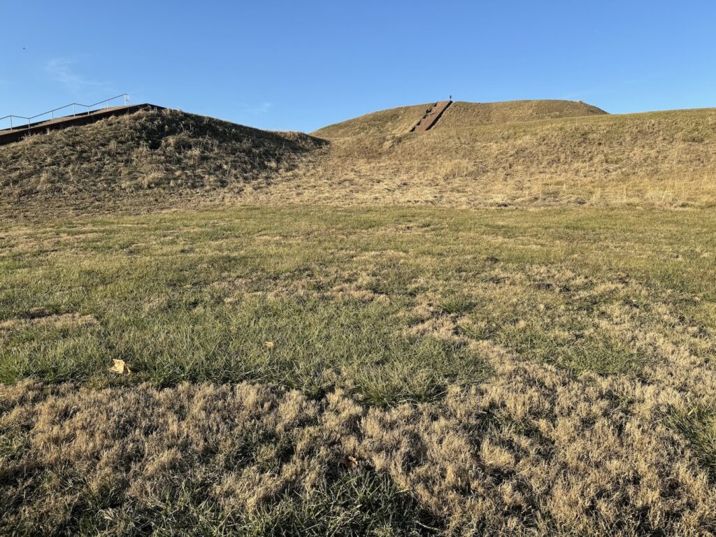
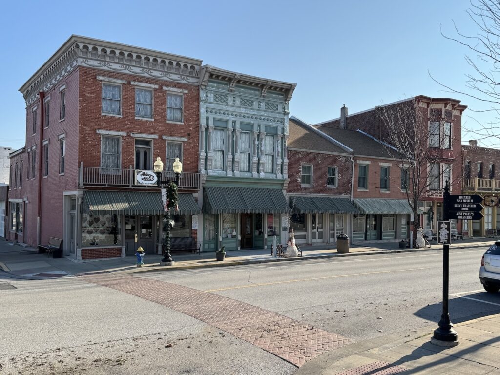
I approached the Natchez Trace from Colorado, so I paired this road trip with other fun stops in Kansas and Missouri before making my way south to begin the Trace in Tennessee. This added valuable context for me because I saw Cahokia, the largest Native American earth mound city north of Mexico. There are many earth mounds along the Natchez Trace and seeing the foremost example of such mounds, Monk’s Mound in Cahokia, really informed my understanding of them. I also visited Mark Twain’s hometown of Hannibal, MO, which lies along the Mississippi River. His books about adventures on this river have contributed to Americans’ national identity, and he undoubtedly navigated its waters to and past Natchez.
Prior to your trip, be sure to check the latest Alerts and Conditions on the Natchez Trace Parkway official website. Some historical sites or sections of roads may be temporarily closed.
When is the best time of year to drive the Natchez Trace Parkway?
Autumn is the best time of year to drive the Natchez Trace Parkway if you want to see the beautiful fall colors dominating its miles of untouched forest land. Fall is also when the Natchez Balloon Festival and Natchez Pilgrimage take place (there is a spring version of the Pilgrimage too)! The scenic drive is extremely pleasant and relaxed any time of year because it has low traffic and is heavily tree-lined and cozy, but when I drove it in winter, the lack of leaves and occasionally overcast skies gave it a slightly creepy tone. This also has its benefits; it depends on what you’re looking for.
In winter, because the leaves had fallen, I could see back behind the first rows of roadside trees in order to understand how truly deep the wilderness goes and how alone 1800s travelers must have felt while enveloped by it. If you’re someone who enjoys dark tourism, there will be plenty of ghost towns and cemeteries along the Trace to interest you, and going during a drearier time of year like winter will highlight their gravity. If you’re looking for a travel destination in the United States to escape colder climes in the winter, the Natchez Trace is a good choice, but don’t expect it to be like summertime there. It can still get cold – just not as cold as the northern states.
If you are excited about the waterfalls, you might consider spring or summer when they’ll be flowing more heavily. If you are camping, nights will be warmer in spring and summer. I was comfortable car camping on the Trace in winter, but I have a super warm 0 degree sleeping bag. The parkway might be slightly more touristed in summer than winter, but I would guess not by much. I hardly saw another soul throughout my winter trip and have heard that it’s pretty lowkey in summer too – the Natchez Trace is underrated!
Road conditions and amenities on the Natchez Trace Parkway


The road itself is smooth and in fantastic condition. There is nothing harrowing about driving the Natchez Trace, as it’s mostly flat and you will not be on precarious mountainsides. You only thing you might contend with is weather. The area can experience heavy rains and maybe even a freak snow storm and icy roads every few years.

Note that in order to maintain the integrity of the historic Trace, there are very few modern buildings or amenities directly along the road. I really enjoyed this; I can’t remember another time I’ve been able to “unplug” in this way on a road trip! I don’t recall any gas stations or cafes, though a few times I could pick out homes or farms buried back behind the trees. There are no advertisements, billboards, or stop lights, but there are wooden road signs signaling when to pull over for historic monuments and hiking trails. One thing you can rely on is that there are plenty of well maintained NPS restroom facilities all along the Trace.
You will need to get off the Trace and visit nearby towns for food and gas, which is easy to do. You may feel quite isolated and far from civilization while on the byway, but in reality it should rarely take more than 10-15 minutes to find a community if you drive off the Trace. I usually had good enough cell service for my maps app to guide me to the closest gas station, but I did lose service often enough that it’s a good idea to start thinking about where to fill up before you get into a “last minute” situation. You should also pre-download music and podcasts in case you lose service.
Camping and accommodations on the Natchez Trace Parkway


There are three free campgrounds along the Natchez Trace Parkway and they are perfectly evenly spaced so that you could stay in one each night on a four-day trip! They are the Meriwether Lewis Monument Campground, Jeff Busby Campground, and Rocky Springs Campground. In Natchez there are paid campgrounds, or you could choose a proper hotel.
These first-come first-serve free campgrounds have bathrooms, picnic tables, and potable water, but no showers, electricity, or dump stations. Campers can stay for up to 14 days.
If you prefer hotels across the board, you can stay in Hohenwald, TN or Florence, AL the first night, Tupelo, MS the second night, Jackson, MS the third night, and Natchez, MS the last night (if you’re not getting a head start on your journey home at the end of day four).
Day 1 Highlights on the Natchez Trace: Tennessee
The northern terminus of the Natchez Trace Parkway begins near Loveless Cafe in Nashville, Tennessee. This is convenient because Loveless Cafe is a very popular spot for southern comfort food – if you plan ahead. I tried to go without a reservation and it would have been an hour wait! Luckily you can grab a quick and easy bite at the Biscuit Kitchen next door instead.
Double Arch Bridge at Birdsong Hollow

Sometimes referred to simply as the Natchez Trace Bridge, this double arch architectural feat at Birdsong Hollow is the first stop that greets you soon after passing the Natchez Trace Parkway northern terminus entrance sign. Built in 1994, it received the Presidential Award for Design Excellence and is quite impressive in-person. Pedestrians can’t be on the bridge, but there is a convenient pull-off just before you drive over it where you can park and walk a short trail to a photography viewpoint.
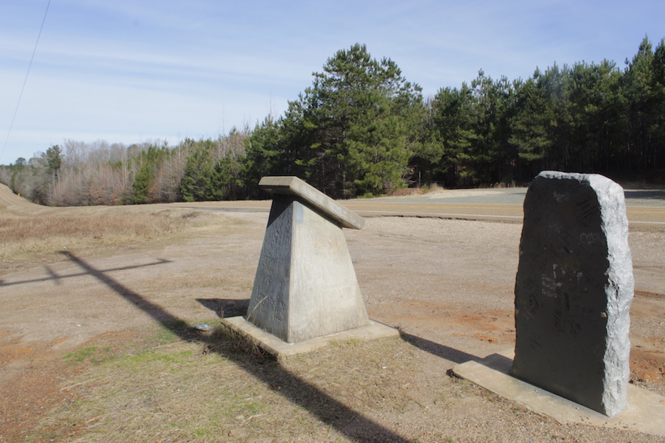
War of 1812 Monument

When I set out to begin my Natchez Trace drive, my top priorities were the Native American earth mounds and Old Trace stands/inns. I’m not typically interested in war history and have never visited any battlegrounds. That said, war related monuments along the Trace did end up luring me, starting with this stark War of 1812 monument.
It’s just a stone pillar erected to honor fallen soldiers on the Trace, but something about it struck me. I had seen no-one else on the lonely parkway yet, and I was the only person at the monument. It was very quiet, and while reading about the hardship they endured while marching along the Trace, I looked around in each direction through the trees and tried to imagine what it must have been like in their shoes. I would have this opportunity for reflection countless more times on the Trace.
Gordon House


Unlike many buildings of the time, the brick home of Captain John Gordon, built in 1818, is still standing today. It was situated directly along the Old Trace and would have been a welcome sight for travelers who needed to use Gordon’s ferry service to cross the Duck River. Gordon served in the War of 1812 and the Seminole War, and was praised by Andrew Jackson himself.
In addition to viewing the house from the outside, visitors can also walk down to the ferry site. At least, you’re supposed to be able to, but I found this walk confusing. While attempting to read the (unreadable) information sign in front of the house, there is an obvious trail to your right which goes into the woods. I went this way for awhile before realizing it wasn’t correct. While facing the information sign, it turns out your back is facing the correct direction of the trail. You need to walk down the big hill into a clearing, where you’ll find a path into the trees which leads to a creek called Fattybread Branch (map here). If you are able to cross this creek, you can continue on the Old Trace until you reach the ferry site on the Duck River. I didn’t see an obvious way to cross the creek without sloshing in the water a bit, which would have been fine and not dangerous, but I knew I’d be visiting Colbert Ferry the following day and decided not to continue searching for Gordon’s Duck River ferry. The house itself was the main draw.
Baker Bluff Overlook
Shortly after Gordon House, there is a place to pull over on your left for the Baker Bluff Overlook. This is a quick stop to take in a pretty view of the surrounding landscape. I found some of the other panoramic viewpoints throughout the Trace a bit underwhelming in wintertime (forest overlooks might be nicer when the leaves are colorful in autumn), but this one was worth it.
Fall Hollow Waterfall
Between Jackson Falls and Fall Hollow, I much preferred Fall Hollow because it had a heavier stream. Jackson was barely dripping and had frozen icicles during my visit. If you have time to do both though, there is some interest to Jackson Falls. For that one you’ll follow a paved walkway down into a deep canyon and watch the water pour into it from the rim.
After Jackson Falls, drive on to Fall Hollow. The Fall Hollow site has two different falls. When you park and begin the walking trail, you’ll pass the first trickle almost immediately. Continue past this for the more impressive one. You’ll first walk by its source, and then the trail will bring you down to the base of the fall. The descent to get there may be a bit slippery, but it’s short. Just take your time; the view from the base of the fall is cooler than from the top! Once you’re down there you’ll also have a new perspective on the first fall.
Meriwether Lewis Monument and Grave Site


If you’re camping, you’ll end your first day on the Natchez Trace at the Meriwether Lewis Monument and campground near Hohenwald, TN. Grinder’s Stand was located here, a place where weary travelers could book accommodation and a meal. It’s where Meriwether Lewis, of Lewis and Clark Expedition fame, had the last meal of his life in October of 1809. Late at night the sound of two gunshots rang out, and in one account, a cry for help, but no-one investigated. By morning, Lewis was dead in a log cabin. A replica of this cabin can be seen today. He was buried only a few hundred yards away, where a gravesite monument marks the spot.
The circumstances surrounding his death were mysterious; it was hastily ruled a suicide, but because there were two shots and his money was missing, some historians are not so sure.
A “stand” was like an inn and safe haven where traveler’s could rest, eat, and (attempt to) take sanctuary from potential dangers on the trail. As a long distance hiker myself, I know what a relief it is to arrive at a refuge or mountain hut!
Other potential stops on Day 1
- Jackson Falls: Read above in my explanation of Fall Hollow.
- Old Trace Walk: You will have many opportunities to stretch your legs and walk on surviving sections of the Old Trace throughout this entire road trip.
- Devil’s Backbone State Natural Area: A 3-mile hiking trail for nature lovers.
- Leiper’s Fork, Tennessee: A cute village for those who love shopping, antiques, and galleries.
- Franklin, Tennessee: A Civil War battle took place here and there is a lot to see in historic downtown Franklin. You can take tours of three Civil War era homes, including Carter House, Carnton, and Rippa Villa. Taking a detour to Franklin requires getting off the Natchez Trace.
- The Natchez Trace Parkway website has a list of everything you can see on the Tennessee section of the drive here.
Where to stay, end of Day 1
- Free camping at Meriwether Lewis Monument.
- Hotels in Hohenwald, TN or Florence, AL. There are some good breakfast spots in Florence and a fancy dinner place called Odette.
Day 2 Highlights on the Natchez Trace: Alabama and Mississippi
You have a couple options on how to start Day 2. You can begin by driving from your campsite at Meriwether Lewis Monument towards Sunken Trace and Colbert Ferry. After Colbert Ferry, get off the Trace in order to visit Muscle Shoals. Then retrace your “steps” back to the Trace and continue on to the Native mounds. Or, after Sunken Trace, get off the Trace and head straight into Florence, AL and Muscle Shoals, then visit Colbert Ferry afterwards. If you are planning to have breakfast in Florence/Muscle Shoals, that may decide your timing.
Sunken Trace
There are two pull-offs called “Sunken Trace”; the second one will come on Day 4. At this site, you can still make out three parallel paths where travelers tried carving different trails to get their wagons through the muddy, waterlogged, and “sunken” terrain. It’s a quick stop where you can pretty much look at the three paths, say “yup,” and then keep on your way, so not everyone may be interested in prioritizing this one. Personally, I think landscape archaeology is really cool. I get a kick out of being able to see cuts from pioneer wagon wheels still leaving their mark on the forest.
Muscle Shoals Sound Studio


Like Abbey Road, Electric Lady, and Sun Studio, the iconic Muscle Shoals Sound Studio is known to music fans around the world. Artists including The Rolling Stones, Lynyrd Skynyrd, Cher, Bob Seger, Aretha Franklin, Paul Simon, and the Staple Singers recorded there. More recently, The Black Keys and Lana Del Rey have added to its history.
Muscle Shoals was known for the iconic “swampy” sound of the studio musicians who accompanied the artists who recorded there. This backing band ultimately became known as The Swampers.

Today when you visit the studio, you can take a $20 guided tour which is offered every hour on the half hour from 10:30am to 3:30pm. The tour I took was guided by the sound engineer Chase, who provided a lot of context for the “artifacts” in the studio. I put artifacts in quotes because Muscle Shoals is still a working studio, and Chase said they don’t clear out any of the historic instruments or furniture when modern artists come in to record!
Bob Seger’s song “Old Time Rock & Roll” was recorded using that Yamaha piano pictured in my gallery. Lynyrd Skynyrd’s Billy Powell wrote the piano part on “Freebird” on that Yamaha as well, though it was ultimately recorded elsewhere. The Swampers’ bassist David Hood had a special corner of the room where he always played; can you pick out David’s corner from my gallery? In the Staple Singers song “I’ll Take You There,” Mavis repeats the phrase “little David” a handful of times, a reference to David Hood.
Colbert Ferry


George Colbert ran a stand and ferry on the Tennessee River from 1800-1819. Andrew Jackson and his soldiers crossed the river via this ferry on their return from the Battle of New Orleans. Unfortunately the stand itself no longer exists, though you can see the clearing of land where it would have been located and look out over the riverbank to imagine how useful the ferry dock would have been before the bridge was built.
Colbert had a Scottish father and a Chickasaw mother and was bilingual, so he was the perfect person to run a business that catered to many types of travelers along the Trace. When the Chickasaw people negotiated the treaty allowing the Americans to transform the Natchez Trace into a road through their lands, they did not give Americans all rights to the region. Colbert, as a member of the Chickasaw nation, retained the right to run this ferry (if you’re wondering why Gordon was allowed to establish a ferry on the Duck River despite not being Chickasaw – he came to a special agreement with Colbert).
Colbert was often referred to as a “chief speaker” representing Chickasaw interests. He traveled and met with presidents, including George Washington, to negotiate additional treaties with the US government. He even served in the Creek Wars and War of 1812. Despite all of this goodwill between cultures, ultimately he and his people were removed from their lands and forced to march towards Oklahoma on the Trail of Tears.
Pharr Mounds


The Pharr Mounds site is particularly scenic. You will look out over a large, idyllic meadow dotted with a collage of hay bales and Native American earth mounds. Eight of them, built and used about ~1-200AD during the Middle Woodland period, are spread over 90 acres. According to the National Park Service, some of them are burial mounds. You can read about the archaeological excavation of Pharr Mounds here.
For context throughout the rest of the trip, you may find this chronological timeline of all the Natchez Trace mounds or this list by milepost helpful.
Graves of 13 Unknown Confederate Soldiers


Just outside of Tupelo, pull over to embark on a short 5 minute walk into the woods where you’ll find the grave markers of 13 unknown Confederate soldiers. Their final resting place is quiet and isolated, another opportunity to imagine what life might have been like for infantry who contended with unpredictable conditions in an America yet to be fully developed. Perhaps these soldiers died of exposure, untreated injury, or disease. This is also a place to reflect on the principles this country was (or wasn’t) founded on, and on whose backs.
Civil War soldiers didn’t rely on the fading Trace as much as War of 1812 soldiers did, but they clearly found themselves on sections of it. As a result, some of them, these thirteen at least, died on the same trail that enslaved people would have been forced to march down in order to be sold at market in Natchez. Considering many Confederate soldiers fought to keep slavery alive as an institution, there’s some irony there.
After seeing evidence of beautiful indigenous villages, stops like this juxtapose and cut through the charm of the Old Trace to remind you that the subsequent societies we built on top of them and the belief systems we imposed were not much of an improvement.
Note: On my Apple Maps app, there is a site called “Confederate Gravesites and Old Trace” that sits right on the Trace, and nearby there is another site called “Old Trace Confederate Cemetery” in the woods. If you put the second one into your device, it will take you on a weird suburban backroad where you can spot the back of the cemetery through the woods but you can’t park anywhere. Choose the first option, which has a pull-off parking spot.
Unfortunately, because of European influence, Chickasaw and Choctaw people also bought, sold, and owned African slaves. They continued this practice after their removal to “Indian Territory” on the Trail of Tears and even after slavery ended with the Civil War. Owning slaves was one criteria for acknowledgement as one of the “Five Civilized Tribes.”
Elvis Presley Birthplace


Considering Tupelo, Mississippi is pretty much known for one thing and one thing only, it would be a shame to pass through without paying homage to The King!
Elvis Presley was born on January 8, 1935 in a small house built by his father, grandfather, and uncle in Tupelo. His twin brother was stillborn. His father Vernon had been loaned $180 to build the house but was not able to repay the loan, so the family was forced to move out when Elvis was 3 years old. They bounced around different residences in Mississippi until they moved to Memphis, Tennessee when Elvis was 13 years old. When he became successful, he ultimately bought Graceland in Memphis.
That first house is still standing in Tupelo, and you can actually go inside. With only two rooms, it reminded me of the historic 1800s stands that used to dot the Trace, which threw my sense of chronology for a loop. Elvis’ heyday was really not that long after the removal of Native American tribes from their ancestral homelands, and not that long after the end of slavery. In the other direction, Elvis died only 15 years before I was born, so I suppose my own lifetime is not that far removed from these events either.
There is also a museum on the grounds featuring stage clothes and casual clothes that Elvis wore, concert ticket stubs, artifacts that speak to the technology of the time, and contextual information about what it would have been like for their family to live “on the wrong side of the tracks” in Tupelo in the early 1900s. It is a small museum, so perhaps if you’ve already been to other Elvis-themed tourist attractions you might find it redundant, but as an Elvis “newb” I thought it was a great collection and very informative.
You can also visit the church the family would have worshiped at. Since the ticket is more expensive if you visit all three buildings, I opted out of including the church. It’s $10 to visit one site, $15 to visit two sites, and $20 to visit all three. I chose the house and the museum.

Other potential stops on Day 2
- Alabama Music Hall of Fame: I was satisfied with my visit to Muscle Shoals, but if you want to dig deeper into regional music history, this museum is highly rated.
- Bear Creek Mound: This mound sits right on the border of Alabama and Mississippi and is one of the later examples from about 1100 CE. Prior to the mound, this was a village site with history dating back to 8000 BC. I think every mound is worth a stop, but this one is quite small compared to the others, and partly reconstructed after excavations. If you are trying to prioritize only a few Native American mounds, I would pick Emerald Mound, Pharr Mounds, and Bynum Mounds.
- Tishomingo State Park: Tishomingo was the last Chickasaw chief and war leader before the tribe’s removal to Oklahoma.
- Chickasaw Village Site: A Chickasaw village once stood here, but there is little remaining evidence. It is more of an interpretive site with some informational signs and depressions in the earth where we can assume structures once stood. They’ve been paved over to highlight the outlines, which seems like an odd choice from a preservation standpoint.
- Natchez Trace Parkway Visitor Center.
- Woodall Mountain: If you are a peakbagger, this is the tallest peak in Mississippi at 806 feet.
- Rock Spring Nature Trail: This is just over the river on the opposite bank from Colbert Ferry. After stopping so long for Muscle Shoals, I wasn’t in the mood to do a walk and wanted to put some driving mileage under my belt to get back on the Trace. I skipped this one, but the peaceful pictures make me regret that a little.
- Tupelo National Battlefield and Brices Cross Roads National Battlefield.
- The Natchez Trace Parkway website has a list of everything you can see from milepost 341.7-249.6 in Alabama and Mississippi here.
Where to stay, end of Day 2
- Free camping at Jeff Busby Campground. There is a nice lookout point called “Little Mountain” that you can check out at Jeff Busby even if you don’t plan on staying to camp, though I think the forested view is probably more impressive when there are leaves on the trees. If you camp at Jeff Busby tonight, then you will pass by Bynum Mounds on the way and I would recommend adding that to your list of stops for today instead of tomorrow.
- Hotels in Tupelo, MS.
As you leave Tupelo behind, you are making your way out of ancestral Chickasaw lands and into Choctaw territory.
Day 3 Highlights on the Natchez Trace: Mississippi
Bynum Mounds


If you stayed in Tupelo last night instead of camping at Jeff Busby, then the Bynum Mounds are your first stop on morning three. The two surviving Bynum Mounds are the earliest examples of Native American earth mounds that you’ll find along the Natchez Trace, dating to the Middle Woodland Period between 100 BCE-100 CE. Human remains were found in the mounds they excavated on this site. I enjoyed this site because you can take a paved walkway up close to the mounds.
French Camp Historic Village


French Camp is so named because it was established in 1812 by Frenchman Louis LeFleur, who ran a stand to accommodate travelers on the Natchez Trace. More businesses set up shop around him, and soon there was a small village. Today about 200 people live at French Camp, in more modern homes of course, but some historic buildings are still standing. Drive or walk a loop road to visit the old blacksmith shop, Colonel James Drane House, the Alumni Museum with Natchez Trace memorabilia, and some kind of barn building that has cute miniature ponies outside! With no-one around to explain, I was confused as to why a seemingly working and active stable was mixed in with the old 1800s log cabins.
Make sure you time your trip so that you aren’t visiting French Camp on a Sunday! I really messed up in this regard. Gift shops and other buildings are closed on Sundays. The quaint Council House restaurant with its consistently well-rated cuisine is a main draw of French Camp, and it’s also closed on Sundays. It’s attached to an 1840s building so that you feel as if you’re experiencing the same hospitality you might have enjoyed in LeFleur’s day. The problem is that the two museums in Jackson are free on Sundays, so if you’re trying to see French Camp and the Jackson museums on the same day, Sunday is both good and bad. You might time it so that you visit French Camp on a Saturday, stay in Jackson overnight, and visit the Jackson museums first thing Sunday morning.
“LeFleur married a Choctaw woman. Their famous son who changed his name to Greenwood Leflore, became a Choctaw chief and a Mississippi State Senator. Named after him are the city of Greenwood and the county of Leflore.”
NPS
Cole Creek and Cypress Swamp


The swamps were some of my favorite stops along the entire Natchez Trace Parkway! Having grown up in southeast Texas, I’ve contended with my fair share of mosquito-ridden, hurricane-ravished, smelly swamplands, but the baldcypress and water tupelo swamps at Cole Creek and Cypress Swamp were something else entirely. Rather than rotting, decaying cesspools, these water forests were pristine and elegant. The trees twist and turn like artful sculptures, and the water reflects rainbow color palettes.
There are two separate swamp stops, each with boardwalks that allow you to venture on short interpretive nature trails. The first and shorter stop is Cole Creek, and about an hour’s drive later you’ll come to the longer Cypress Swamp stop. Since I was particularly enchanted by these walks, I would recommend stopping at both, but if you want to prioritize one over the other, go with Cypress Swamp.
As you make your way into Jackson, Mississippi, don’t forget to cue up Johnny Cash and June Carter’s “Jackson” on your radio!
Mississippi Civil Rights Museum and Museum of Mississippi History
These two museums in Jackson are brand new and immaculate.
The Mississippi Civil Rights Museum’s mission is to “document, exhibit the history of, and educate the public about the American Civil Rights Movement in the U.S. state of Mississippi between 1945 and 1970.” Touring the museum’s eight galleries will teach visitors about Jim Crow Laws, Brown vs. Board of Education, the murders of Vernon Dahmer, Medgar Evers, and Emmett Till, the practice of lynching, the formation of the KKK, the Freedom Riders, the Biloxi Wade-In, and more. The museum also looks back on the experiences of the first enslaved Africans shipped to Virginia in 1619 and Caribbeans brought to Mississippi in 1721.
You could spend hours in this museum, and most people pair it with visiting the Museum of Mississippi History, which covers 15,000 years from the mound-builders to present day. This really puts a lot of what you’ve been seeing along the Natchez Trace into context. Some travelers on the Natchez Trace may want to dedicate an extra day to staying around Jackson to experience both museums fully.
Both museums are closed on Mondays but have FREE entrance on Sundays! Otherwise, general admission includes both museums for $15 per adult.
Jackson is also a good place to stop for lunch. Check out the restaurant layer on my Google Map above.
Rocky Springs Townsite


If you are camping, you’ll end Day 3 at the Rocky Springs ghost town and campground. There is also a hiking trail here if you need to stretch your legs. If you spent a lot of time in Jackson at the museums, you might arrive at your campsite after dark and decide to check out the ghost town in the morning. If you decided to get a hotel in Jackson, then Rocky Springs will be your first stop on morning 4.
Rocky Springs was first settled in the 1790s along the creek that gave it its name. According to the Park Service, 2,616 citizens plus 2,000 slaves lived there by 1860. It ultimately declined for multiple reasons, including crop failure due to a boll weevil infestation, a yellow fever epidemic, and the Civil War.
The only building still standing at Rocky Springs is the old church, which apparently still holds services for surrounding communities (after I posted my pictures of it on Instagram, a friend from Mississippi told me he got married there!). If unlocked, you are welcome to go inside. Behind the church is a cemetery with graves dating throughout the 1800s. I assume some of the people buried there were victims of yellow fever.
Across the trail from the church is a loop walk with information plaques about Rocky Springs. Along this loop you’ll find two metal safe deposit vaults, left behind because they were too heavy to move, I presume, and the remnants of a cistern. One of the safes is the only remaining evidence of the Rocky Springs post office.
Other potential stops on Day 3
- Boyd Mounds: Again, I made an effort to stop at every single mound site, but if I had to recommend visiting only the most impressive, Boyd would not be on that list since it’s quite small.
- Detour to Vicksburg: You’ll need to get off the Trace to visit the U.S.S. Cairo Museum and Old Courthouse Museum. Thoroughly exploring here could add an extra day to your Natchez Trace itinerary. If you do go, check out a self-guided audio tour of Vicksburg here.
- Raymond Military Park: A Civil War battlefield where the Battle of Raymond took place.
- The Natchez Trace Parkway website has a list of everything you can see from milepost 131-249.6 in central Mississippi here.
Where to stay, end of Day 3
- Free camping at Rocky Springs Campground.
- Hotels in Jackson, MS.
Day 4 Highlights on the Natchez Trace: Mississippi
Sunken Trace


This stop really drives home the meaning of the word “sunken” more than the other “Sunken Trace” stop from Day 2. Where the Old Trace path was soft with loess soil, thousands of walkers, wagons, and riders wore a deep fissure into the ground. I didn’t realize that was the case when I made this stop. At Rocky Springs the night before, signs explained how similar features at the ghost town were caused by erosion, so I thought it was the same situation here. I only parked and took a quick look, but you can join walkers of years past by strolling on this section of the Old Trace.
Windsor Ruins


The Windsor Ruins are not listed on the National Park Service’s official Natchez Trace Parkway website under “things to do” in southern Mississippi, so I’m glad I heard about it elsewhere and was able to work it into my trip!
Construction on Smith Coffee Daniel II’s Greek Revival-style 23-roomed mansion was completed in 1861. This opinion may be in bad taste considering a tragic 1890 fire left only these ruins, but the main draw of Windsor Ruins is how gorgeous the charred and slowly decaying 45-foot pillars look as they tower above your head. As I arrived early in the morning, sunshine glinted through the trees and highlighted the columns from behind, casting long shadows over the grounds. It’s a photographer’s dream.
Mount Locust Stand


Mount Locust is the only surviving stand along the Natchez Trace. By the time you arrive here, you’ve really earned it after seeing so many empty plots of land that require you to squint to imagine where an inn once stood.
Unfortunately, Mount Locust was also a cotton plantation that kept slaves; there is a cemetery behind the stand where 43 enslaved people are buried in unmarked graves. Some of these slaves were likely bought at Forks of the Road market in Natchez, which we’ll visit when we arrive at the southern terminus of the Trace later today.
There is also a cemetery onsite for the white family that ran Mount Locust, featuring much nicer headstones. The same Ferguson-Chamberlain family continued to live on the grounds until 1944. Rick Chamberlain was the last member of the family buried here, and he was the first interpretive Park Ranger at Mount Locust.
When I visited in January of 2024, this alert was on the NPS website: “Due to storm damage the visitor center and restrooms are closed. The grounds, and historic inn and stand will be open intermittently throughout the winter.” I didn’t understand what exactly “intermittent” meant or how to plan around it. When I arrived, the gate to the parking area was closed and I couldn’t drive in. I parked outside of the closure and walked the rest of the way in. I avoided the cordoned off visitor center and restroom block, but continued on to Mount Locust and the cemeteries. I was the only one there. Signs indicated that visitors can enter the stand through the back door, so I walked around back and tried all four doors. I struggled to open three of them and didn’t want to force it. The fourth door opened onto a bedroom with creepy dolls inside. I shut it pretty quickly.
As I made my way back towards my car, two volunteer rangers were walking their dog and found me. I thought I would get in trouble for trespassing, but instead they took me on a private tour of the stand and opened all of the locked doors for me to go fully inside! They taught me more about the history, letting me know the background about Rick Chamberlain, that some travelers would actually sleep underneath the stand, that the high chair in the dining room is thought to be original and passed down through the Ferguson-Chamberlain family for generations, and that some historians belief Mount Locust was built on top of a Native American mound.
Emerald Mound


Emerald Mound is the second largest Mississippian Period Native American temple mound after Monk’s Mound at Cahokia in St Louis. If you only visit one mound on the Natchez Trace, make it Emerald Mound! This one is absolutely massive and has a paved walkway that you can climb to actually get up on top of the first square-shaped flat-topped tier. Once atop this tier, please do not climb up onto the smaller rounded mounds.
Emerald was built and used around ~1300-1600 AD (some sources date the beginning at around 1350 AD and the end as late as 1750. It was built over a prior Mississippian village that existed c. 1200 AD). Cahokia was abandoned circa ~1350 AD. This made me wonder if perhaps Cahokians migrated south and went on to build Emerald? Like Monk’s Mound at Cahokia, Emerald has smaller temple mounds on top of a giant platform mound. Of course, as we’ve learned throughout our Natchez Trace road trip, other mounds were being built all along the Mississippi River Valley since before Cahokia’s emergence.
Grand Village of the Natchez


As travelers arrive at the southern terminus of the Natchez Trace Parkway, they’ll finally enter the town of Natchez, Mississippi.
The National Park Service believes the Natchez are descendants of the Native Americans who built Emerald Mound; when they abandoned Emerald in the 1600s, they established their new capital at the Grand Village site in modern day Natchez. If my theory about Cahokian connections to Emerald is correct, then this was the latest in a long line of southward migration before the Natchez were ultimately removed to Oklahoma reservations, or sold into slavery in the USA and Haiti.
A massive, thunderous storm poured buckets over Natchez on the day I arrived, so I wasn’t able to wander the grounds to check out the mounds, but the indoor museum was free. Here I learned how the Natchez tribe battled against French colonists in the 1700s to protect their homelands. I was also enthralled by accounts of Natchez cultural practices and societal hierarchies written by French ethnographer Antoine-Simon Le Page du Pratz.
The chief of the Natchez was called the Great Sun, and the war chief was the Tattooed Serpent. The person who held the office of Tattooed Serpent was always the younger brother of whoever held the position of Great Sun. The Tattooed Serpent during the time of Le Page du Pratz died in 1725. At his funeral, many of his family members and servants were voluntarily sacrificed along with him, strangled at a temple atop a platform mound. The war chief’s body was carried to this temple on a palanquin, and everyone was buried within and around it.
Forks of the Road


Forks in the Road slave trade “market” operated in Natchez from 1833 to 1863 and was the second largest domestic slave market in the Deep South. Enslaved people were brought here from Virginia, Maryland, Kentucky, and the Carolinas. Shackles and chains embedded in cement on the ground serve to mark the location of Forks in the Road, a particularly heinous reminder of our country’s past.
There is a lot of charm throughout the Natchez Trace Parkway, but by the time I got to Natchez, I struggled to see it anymore. I had no interest in visiting the stately, genteel Old South mansions built from slave labor that are advertised as pretty tourist attractions. They are mixed in with poverty that’s been passed down over generations.
I found the final day on the Trace to be extremely somber. Throughout the Parkway, travelers are physically confronted at every milepost with eons of history, and that history is often traumatic more than celebratory. You watch as beautiful Native mounds stop being inhabited, as enslaved people are forced to build new towns on top of them, and as tombstones of soldiers begin to dot the forest. It made me look around and wonder, “…and for what? So this could take its place? People had to die so that towns like Natchez could exist?” I feel bad talking down on what is many people’s hometown today, but Natchez is quite gloomy. A lot of towns that colonists created in Alabama and Mississippi did not turn out to be some grand wonderland.
While this may sound like a downer of a wrap-up to my Natchez Trace Parkway road trip itinerary, I think it’s appropriate. Elements of this road trip should feel unsettling. We are pilgrimaging through American history, which was not always noble.
Other potential stops on Day 4
- Owens Creek “Waterfall”: This spring would have once been important to the Rocky Springs community, but today it’s just a small trickle. It’s still a pleasant little stop, but a very quick one.
- Mangum Mound: This mound is rather large, and before I got to Emerald Mound, I figured this would probably be the largest example on the Trace. Since Emerald is bigger and you can’t walk on top of Mangum, this one takes a backseat as my second favorite mound of the day.
- Antebellum homes: There are tons of old buildings in Natchez, a few of which you can take tours of. Check out Rosalie Mansion, Melrose Mansion, The Burn, Longwood, Stanton Hall, and St. Mary Basilica. During the Natchez Pilgrimage event held in spring and fall, additional homes are open for tours. Third-party operators also offer history tours in Natchez.
- Natchez Balloon Festival: If you’re in Natchez in autumn, you might be in time for the festival!
- The Natchez Trace Parkway website has a list of everything you can see from milepost 0-131 in southern Mississippi here.
Where to stay, end of Day 4
- Hotels in Natchez, MS.
- There are free campsites 30-60 minutes from Natchez but they aren’t particularly well rated. Staying at one of the paid campgrounds nearby is more convenient.
Driving the Natchez Trace Parkway is so affecting because it’s relatively untouched by modernity and allows visitors to experience history as authentically as possible. There is rarely anyone else around to remind you what decade you’re in. It’s easy to imagine yourself traversing this route in the 1800s, concerned about robbers and the distance to the next stand.
Even if you never step foot in any of the curated museums along the Trace to look at artifacts behind glass enclosures, the roadside pull-offs teach you the same lessons more viscerally. If following my four-day Natchez Trace Parkway itinerary, I guarantee even the most studied historian or ecologist will come away with new perspectives on the peoples and places of the American southeast.
Related:






Pin It:

My dream is to write travel and hiking content full-time. All of my guides and itineraries are free and my travels are self-funded. If you enjoy my site and would like to support, you can donate any amount to my Ko-fi page. Thank you!!
Lots of good information! But would be more helpful if you had included the approximate milepost marker number for
stop.
Hi John, thanks for the feedback, maybe I will add that. For now, that info is readily available on the official Natchez Trace website if you’re looking to cross reference some of these places with mile markers
Are there bike routes along the Natchez Trace Parkway, or can you only hike? And can you travel here with kids easily?
Hi Trisha, there’s not separate bike lanes or mountain biking trails, but people bicycle on the main driving road. Since it’s not busy most times of year and the road is in awesome shape, I bet it feels pretty safe.
Should be an easy trip with kids since there’s lots of places to pull off and take breaks to stretch your legs and use a bathroom etc! But I guess it depends on the kid; the attractions are mainly historical sites which might be a little boring for some.
This looks so cool, I honestly felt like I had already stepped back in time looking at the photos! Seeing Elvis Presley’s birthplace would be cool too – I feel like he had such an interesting life.
I’ve never heard of this place before reading your article! It sounds like an underrated place to explore. Thanks for sharing your recommendations for this area!