Things to Do in Southern Utah After Bad Weather
Purchases made through some links on this page may provide The Detour Effect with commissions (at no extra cost to you). Thank you!
Because I am a nomadic traveler and outdoor adventure enthusiast, everyone implores me to spend more time in Southern Utah. With its “Mighty Five” national parks – Zion, Bryce, Arches, Canyonlands, and Capitol Reef – plus less advertised wilderness areas like Paria Canyon, Snow Canyon, Fishlake National Forest, and Grand Staircase-Escalante, Utah is supposed to be a hiker’s paradise. I prefer the desert to any other landscape, so the dramatic red hues and strange rock formations of Southern Utah should be right up my alley.
The problem, besides the overcrowding, is that Southern Utah is prone to flash floods. Rushing water is what created Utah’s spectacular slot canyons to begin with, including Buckskin Gulch, the longest slot canyon in the world. We have to appreciate these forces of nature if we’re to be thankful for the state’s beauty, but flash floods are extremely dangerous. The slickrock canyons can’t absorb water easily, so even a moderate amount of rain or melting snow can create flood conditions. A couple weeks ago, two hikers tragically died in Buckskin Gulch and eleven more had to be airlifted out because of flooding after recent rains. As of this writing, the famous Narrows in Zion National Park is also currently closed to hikers because of flood danger.
Another issue is that even flatlands can become inaccessible in Southern Utah after rains because unpaved roads turn into clay. Cars can easily become stuck and need towing, which happens regularly on the road to White Pocket. Cars can also be washed off the road entirely, like what happened in the summer of 2022 in Capitol Reef.
The most likely season when flash flooding could occur in Southern Utah is monsoon in late summer, but springtime can be a problem depending on how much snow the area received over winter. Winter of 2022/2023 has been a record year for snowfall around the United States. Typically mid-March and April would be great times to visit Southern Utah, but this year snow is melting off into the canyons in record volumes and precipitation continues to pummel Kanab.
If you’ve planned a trip to Southern Utah and are met with dangerous weather conditions, depending on your itinerary it might be a good idea to research alternative activities. I’ve been forced to get creative on my recent trip, but as my tagline suggests, sometimes unexpected detours end up being better than the original plan. The following hiking trails and activities in Southern Utah are likely to be safe after heavy rains, but please check current conditions before you head out.
Safe Utah Hiking Trails After Bad Weather
On the below hiking trails in Southern Utah, you typically should not run into issues with flooding, ice (except in the dead of winter), or getting your car stuck on the way to the trailhead. The rules of thumb are to consider elevation (lower elevation parks should be warmer and less snowy, though snow from higher elevations may be melting off into the lower canyons to create wet conditions), avoid slot canyons completely (such as Spooky and Peekaboo in Grand Staircase, Virgin River Narrows in Zion, or Buckskin Gulch in Paria), and take into consideration whether the driving roads are paved or rutted. Please also research up-to-date conditions for each hiking trail before you embark. Web pages for the National Park Service, Bureau of Land Management, or even trail report websites like AllTrails have regular updates and anecdotes, and you can always stop by a visitor center to ask a ranger about recent conditions.
Read Park Service and Bureau of Land Management tips about how to look out for flash floods. “Even if it is not raining where you are there is still a chance of flooding from rain upstream.”
Zion, Capitol Reef, Arches, Canyonlands, Snow Canyon, and Grand Staircase are generally at lower elevations, and Bryce Canyon, Cedar Breaks, and Fishlake National Forest are at higher elevations where it’s likely to be snowy late in the season.
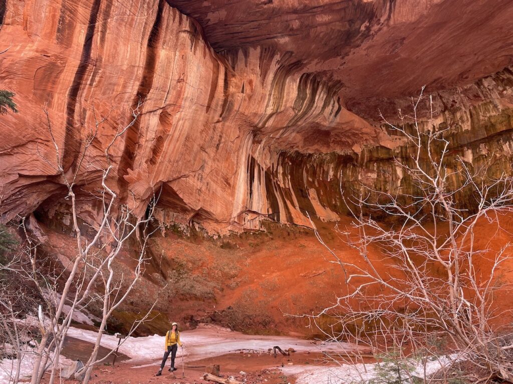
Toadstool Hoodoos Trail (Paria/Kanab)


The short Toadstool Hoodoos Trail is a fantastic alternative to The Wave if you can’t get a permit, and to White Pocket when driving conditions are suboptimal, because the colorful rock layers swirl around each other and create a similar paint palette effect. You’ll be gradually hiking upwards in elevation and getting away from the canyon floor. When I completed this hike, it was only a couple days after the accidents in nearby Buckskin Gulch and that area was still flooded. As you can see from my photo gallery, by contrast the Toadstools hike was completely dry.
The towering toadstool formation in my gallery is considered the main attraction, but I was even more impressed by the final viewpoint at the end of the trail. You’ll look out over expansive distant landscapes from on high.
To get there, you’ll drive on a paved highway and pull over into a parking lot that sits just off the side of the road. There’s no fear of getting your car stuck and there is no fee to park.
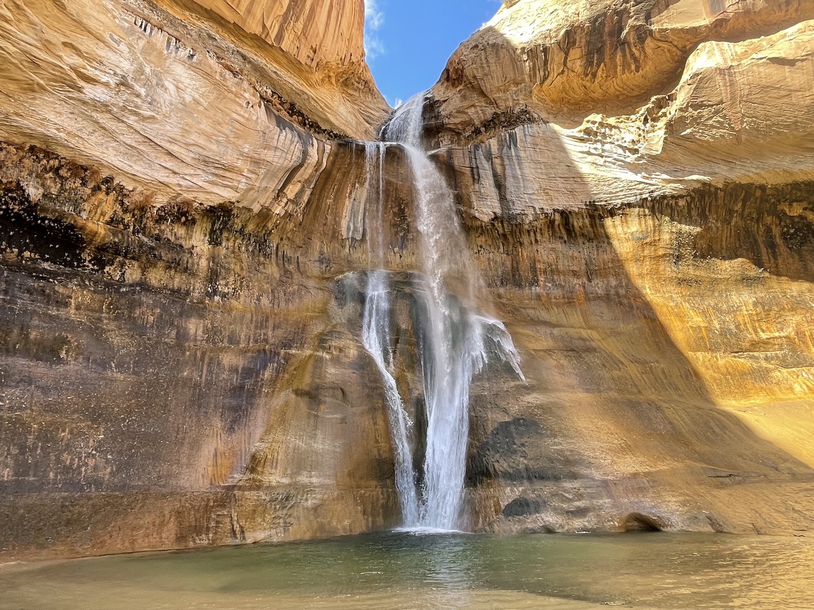
Lower Calf Creek Falls (Escalante/Boulder)


After a few weeks of on-and-off rain and snow throughout Southern Utah, I knew that my only hope was to look to lower elevation parks such as Grand Staircase-Escalante National Monument and Capitol Reef National Park. My hunch was correct!
On a Thursday, it snowed all day in the Kanab area. On Friday, I began my drive towards Grand Staircase-Escalante. For the first few hours, everything was snow-covered and I wondered if I would need to break out my microspikes for the hike. But as I left Bryce Canyon behind me and approached the town of Escalante, Utah, the landscape completely dried up. By the time I parked at the trailhead for Lower Calf Creek Falls, the snow was a distant memory.
Throughout the trail, you would never know there had been recent rains. There weren’t even any puddles to muddy my shoes. The waterfall itself was rushing and nourishing the peaceful creek that hikers follow for the length of the 6 mile out-and-back trail. Even if there had been some ice, I still would have felt comfortable on this path with my microspikes because a slip would not result in a thousand foot fall off of a cliff.
There is a $5 per vehicle day use fee to park at the Lower Calf Creek Falls trailhead, or you can display your America the Beautiful Annual Parks Pass.
In Grand Staircase-Escalante there are many popular slot canyon trails that I would be worried about after bad weather because of flooding. Plus, if you’re solo like me, note that it’s advisable to have a hiking partner for Spooky and Peekaboo slot canyons because people often need a boost to get up some of the scrambles. If Park Rangers suggest that the trails are safe from flooding but you’re not feeling confident solo, consider booking a guided tour. It could be a good idea for Zebra slot canyon too.
Petrified Dunes Trail (St. George/Snow Canyon)


Some of the coolest features of Snow Canyon State Park are the lava tubes, which are underground caves that were formed by lava flow 27,000 years ago. Throughout the park, blackened rock serves as a clue to what lies beneath, but on the Lava Flow Trail you can actually descend down into three different caves to explore with a headlamp. Of course, after heavy rains the caves could be difficult to explore safely. It’s important to carefully watch your step when descending down the rocky slopes into the caves, so I would be worried about losing my footing if the rocks were wet. Once you’re underground, I imagine water could pool inside so that it’s really more of a swim than a hike.


When hikers visit the lava tubes, they usually connect the Lava Flow Trail to the Petrified Dunes Trail to make a loop. After bad weather, the Petrified Dunes Trail should still be a great option! The trail traverses sandstone that appears frozen in time as if the ancient dunes are still in motion being blown by the wind, a snapshot of what they would have looked like before they became compressed and cemented. Today they are hardened slickrock. Water does not get absorbed into slickrock to create mud, although it may create beautiful pools to enhance your photography.
The Petrified Dunes Trail does involve hiking up steep slopes if you want to reach the best viewpoints, but there is great traction and I never worried about slipping. Immediately after rain the slickrock will likely be slick, as the name hints, but it should dry quickly. You can also stay very far away from any edges so that if you did slip, you wouldn’t be falling off a cliff; you’d just hit your knees. Once you’re at the top, you’ve reached a massive playground. You don’t have to continue following any particular “trail” when exploring atop the dunes. I saw children running in every direction haphazardly.
You can still hike the entire loop without having to go down into the lava tubes. However, some parts of the loop involve hiking in sand, so those areas might not be very fun after bad weather. For this reason you might prefer to park at the Petrified Sand Dunes trailhead instead of the Lava Flow trailhead. Both will allow you to reach the loop, but the Petrified Sand Dunes trailhead will bring you almost immediately to the slickrock and then you could do an out-and-back.
It costs $15 to enter Snow Canyon State Park for a day if you’re not a Utah resident and don’t have a Utah State Parks Pass.
Hickman Bridge (Fruita/Capitol Reef)


The Fruita Historic District and surrounding trailheads in the central part of Capitol Reef National Park are at about 5000-5500ft, so the hope is that the lower elevation means this area may be warm and dry even when other nearby parks in Southern Utah are snowy. That said, Capitol Reef is full of canyons that are ripe for flooding. For example, when you turn off the Scenic Road onto the unpaved dirt road that brings you to the Cassidy Arch trailhead, you will be driving at the bottom of a narrow canyon with towering rock walls on either side. I remember thinking this looked like the last place you’d ever want to be during bad weather. If you’re trying to hit up Capitol Reef in subpar conditions, you’ll want to stick to trailheads that are situated just off of Utah State Route 24, such as Hickman Bridge, or maybe an out-and-back to Chimney Rock overlook, which will keep you on higher ground instead of doing the full Chimney Rock loop.
However, I was underwhelmed by these trails in comparison to Cassidy Arch, which is spectacular and probably the best day hike in Capitol Reef National Park. If you have some flexibility to give the road to Cassidy Arch a couple days to dry out, try to prioritize this trail. Get there early in the morning to find parking, as it fills up fast. The hike begins with a steep ascent as you quickly gain elevation. When the trail levels, you’ll turn a bend and spot Cassidy Arch in all its glory awaiting in the distance. Cairns will help you navigate the slickrock as you make your way to the arch.
The rock formation was named for outlaw Butch Cassidy, though I doubt he ever saw it. He especially wouldn’t have seen the arch as close up as the climbers who rappelled from it in the early morning hours on the day I arrived – the true Wild Bunch.


Many Pools Trail (Springdale/Zion National Park)
When nasty weather hits Zion National Park, the two most famous day hikes in the park are the first to become treacherous – Angels Landing and The Narrows. The Narrows are vulnerable to flash flooding in monsoon season in late summer, and sometimes in the springtime after heavy snow melt. The Park Service sometimes closes the route completely. Angels Landing, where you hold onto chains as you hobble across the spine of a rocky ridge with cliff drops on either side, is already treacherous enough even in perfect weather. It could become quite slippery after rain or snow.
That said, you could likely still hike the West Rim Trail to Scout Lookout in bad weather if you just want to set eyes, not feet, on Angels Landing. Despite it being one of the more strenuous day hikes in the park, it’s actually entirely paved up to Scout Lookout. I really enjoyed taking the West Rim Trail past that viewpoint; within about 15 minutes you arrive at a vast slickrock plateau from which you’ll have incredible views out over the park.
“The Wiggles” section of the West Rim Trail is a series of steep switchbacks that I imagine could get pretty icy and slippery, so microspikes are a good idea. Most people seem to manage it just fine, but a fall could still be dicey from some exposed sections of the West Rim Trail.
Zion Hikes to Do Instead of Angels Landing or Narrows
The classic route to Observation Point, one of the best viewpoints in the park, has been closed since 2019 due to rockfall. You may still be able to reach it from the other direction via the East Mesa Trail, but the road to that trailhead is difficult to drive in bad weather conditions.
The next most popular day hikes in Zion include the Riverside Walk, Watchman Trail, and the Emerald Pools either via the Emerald Pools Trail or Kayenta Trail (or a loop of both). These could all be possibilities after bad weather, with precautions. I hiked these on a sunny day, but the paved area beneath the Emerald Pools waterfalls was still very wet just by nature of the mist spraying from the falls. I made sure to step carefully and didn’t want to slip, but if I had slipped, it would not have been death defying and I would have just taken a tumble. The Watchman Trail has beautiful views and is one of my favorites, but I could see evidence of how rains had churned up the now compacted dirt in the past. I thought that it must get quite muddy after bad weather conditions. AllTrails reports attest to this; some people opt to turn back once the mud becomes too much.
Trail extremely muddy! We had to turn back about .7 miles in.
AllTrails user on March 30, 2023
Too muddy. Turned around. Better another day
AllTrails user on March 30, 2023
The Riverside Walk is very gentle, flat, and paved, so this is a good option as well. The end of the Riverside Walk brings you to the start of the Narrows, so the closer you get to that area the more you will start to see evidence of any flood conditions that are overtaking the slot canyon. In my opinion, the Riverside Walk is a bit boring, so thankfully that’s not the only option.


Maybe the coolest alternative trail option to hike in Zion after rainy weather is the Many Pools Trail. This trailhead is located just outside of the east entrance to the park as you leave Canyon Junction through the tunnel and head towards Mount Carmel Junction. The hike is another slickrock situation, similar to the Petrified Dunes trail mentioned above in Snow Canyon. This means it’s unlikely to absorb water or get muddy (though it could be a bit slippery when wet). Potholes create the photogenic “many pools” the trail is named for, which will be prettiest after recent rains. Be sure to get there as early as possible to find a parking space in the small pull-off on the side of the road. You’d think the east canyon would be less crowded than the main Scenic Drive trails, but that’s not been my experience.
Looking to join a guided hiking tour in Zion, Bryce, Snow Canyon, Capitol Reef, Arches, Canyonlands, or Grand Staircase-Escalante? Wildland Trekking offers day hikes and overnight backpacking or lodge-based trips throughout Southern Utah.
It costs $20 per vehicle to enter Capitol Reef National Park. This allows you 7 days of entry. Alternatively, you can show your America the Beautiful Annual Parks Pass. If you don’t order a pass in advance, they can be purchased from a ranger at the Visitor Center.
The same goes for Zion National Park, except it’s $35 per vehicle for 7 days. Annual passes can be purchased at the Zion entrance station. In Zion, after you park DO NOT forget to bring your pass with you. You’ll need it to board the shuttle.
Museums in Southern Utah
If getting outside is just not in the cards and you’re looking for true rainy day activities in Southern Utah, then museums, monuments, and ghost towns will provide a hands-on way to discover local history. Once the more remote roads and trails become safer, you’ll be able to approach them with new knowledge and perspective about their significance.
I’m not including the Zion Human History Museum on this list because it’s a pretty quick visit. I wouldn’t bother with the whole ordeal of trying to enter the crowded park just to see that museum, but if you’re already going to Zion, it’s a cool little stop on your way to a hike.
Pipe Spring National Monument (Cane Beds/Kanab)


Pipe Spring National Monument is actually on the Arizona Strip (the northernmost portion of Arizona above the Colorado River that borders Utah), but in my mind it’s all the same area and the National Monument is only a 20 minute drive from Kanab, Utah.
Remember that Arizona, with the exception of the Navajo Nation, doesn’t do Daylight Savings. As you drive between these states your clock will change frequently.
The Kaibab Paiute people lived in a dispersed manner among small family groups, as opposed to congregating as one larger band like their neighbors who lived in the Mesa Verde cliff dwellings or Chacoan great houses. Water sources dictated their movements, and one important source was Pipe Spring. When Mormons occupied the spring for themselves and started ranching around it, this cut off water access for indigenous people and was, to put it simply, a jerk move. Native people in this area were also being squeezed by Navajo raids from the south, and the Black Hawk War waged between settlers and many of the Utah and Arizona tribes, so struggle was inevitable.
During the winter of 1865-66, natives raided Pipe Spring for sheep and cattle. When two ranchers went after them, the ranchers were killed. Natives were then killed in retaliation – possibly innocents mistaken for the culprits. This was the backdrop to the slayings of Jacob, Robert, and Mary Isabelle Berry at Short Creek (now known as Berry Knoll) on April 2, 1866. These settlers were warned that if they traveled from Grafton through Short Creek valley, they may be attacked due to the recent unrest, but they persisted. Shortly after their deaths, Mormon leaders encouraged their community to move to larger cities.
Pipe Spring has a museum for learning about the Southern Paiute people, and outdoor re-creations of their traditional wickiups made of willow frame and covered in brush. You can also enter the fort and surrounding work cabins to see what life might have been like for LDS church members and their hired guns (cowboys) in the mid- to late-1800s.
I was sad to learn that this area would have been covered in tall grasses prior to the mid-1800s, but a combination of drought and overgrazing by cattle created the brushy desert we know today and further contributed to the Paiute’s inability to forage food.
Nearby you might also check out the Red Pueblo Museum, Little Hollywood Museum, Kanab Heritage House, or Kanab Heritage Museum.
Grafton Ghost Town (Virgin/Springdale)


Grafton was a Mormon settlement built just outside of modern day Zion National Park in 1859. In 1862 the original town was destroyed by a flood of the Virgin River (are we seeing a pattern yet?) so they rebuilt a mile upstream. They grew for a few decades but continued to suffer from setbacks related to their choice of location, particular nearby Native American attacks throughout the Black Hawk War and the conflict at Short Creek that killed Joseph, Robert, and Mary Isabelle Berry, who are buried at Grafton cemetery. As the town did not keep up with modern amenities like electricity, the last residents left Grafton in 1945. Since then, movies such as Butch Cassidy and the Sundance Kid have been filmed at Grafton:


There are other ghost towns in Southern Utah you might add to your list as well, such as the Paria Townsite near the Toadstools hiking trail, though the road to Paria Townsite is not advisable when washed out. The road to Grafton is only a little rugged, but mostly fine. The Silver Reef ghost town and museum just north of La Verkin should be easily accessible in any weather.
Anasazi State Park Museum (Boulder)


The Anasazi State Park Museum in Boulder, Utah features outdoor pueblo ruins and impressive artifacts left behind by the people of the “Fremont culture” who were indigenous to the area, although if it was up to them, they wouldn’t have named themselves after Utah pioneer explorer John C. Fremont. They wouldn’t refer to themselves as Anasazi either. “Anasazi” should never be used to refer to any group of people, as it means “ancient enemy”.
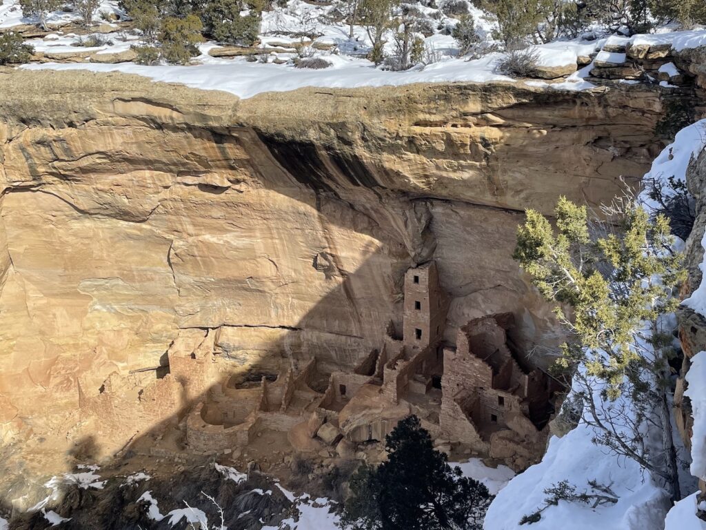
It was interesting for me to learn about the Native Americans in this area of Utah because I recently visited Ancestral Puebloan heritage sites in southwestern Colorado and northwestern New Mexico. There, I learned about pit houses, cliff dwellings, and materials the Ancestral Puebloan people would have used to create tools and clothing. The Fremont culture had some similarities and differences that stuck out to me. For instance, they would have worn moccasins instead of the yucca fiber sandals worn by Ancestral Puebloans. They would have continued building pit houses long after Ancestral Puebloans started building above-ground cliff dwellings. And while experts believe Ancestral Puebloan people migrated from North to South, it’s likely the Fremont people migrated from South (perhaps Mexico) to North.
Museum entrance is $5 per adult or $10 for families with children, if you don’t have a Utah State Parks Pass.
Gifford Homestead and Museum (Fruita/Capitol Reef)


Gorgeous rock formations, remote wilderness, and Butch Cassidy legends aside, Capitol Reef National Park is arguably best known for the fruit pies you can buy at Gifford Homestead and Museum in the historic Fruita district!
Orchards in Capitol Reef still produce fruit and nuts today. You may pick and eat from the apple, peach, cherry, plum, pear, apricot, and almond trees for free, or pay a nominal fee to bring any home with you. Flowering typically occurs from March to May and harvest would be June to October, though of course it varies. Inside the Gifford House, mini pies are sold for $8.50. Not all of the pies are made from fruit harvested onsite, but they are all made from fruit produced locally in the state of Utah.
The museum also features pioneer artifacts and photographs of the original Fruita residents from the 1800s. For some reason all the residents were super attractive, check out the photos in my gallery of the young family and the strapping man on the horse! Maybe it’s something in the pie.
Nearby the Gifford House, visitors to Capitol Reef National Park can also check out the historic Fruita schoolhouse, which doubled as a church and event space for the Mormon pioneers, and a large petroglyph panel.
Dinosaur Discovery Site (St. George)
There are more remote wilderness locations in Southern Utah that you can drive to in order to see dinosaur tracks in their original habitat, such as the Warner Valley dinosaur tracks or Mill Canyon dinosaur tracks, but they require chancing the clay, rutted, muddy backroads. After bad weather, it’s safer to visit the tracks located at the St. George Dinosaur Discovery Site at Johnson Farm instead. It’s an indoor natural history museum built right over the discovery site.
The museum is open Wednesday through Monday 10:00AM – 5:00PM and is closed on Tuesdays. Admission is $10 per adult and $5 per child.
In a similar vein, you might also enjoy the Moab Giants Museum & Dinosaur Park.
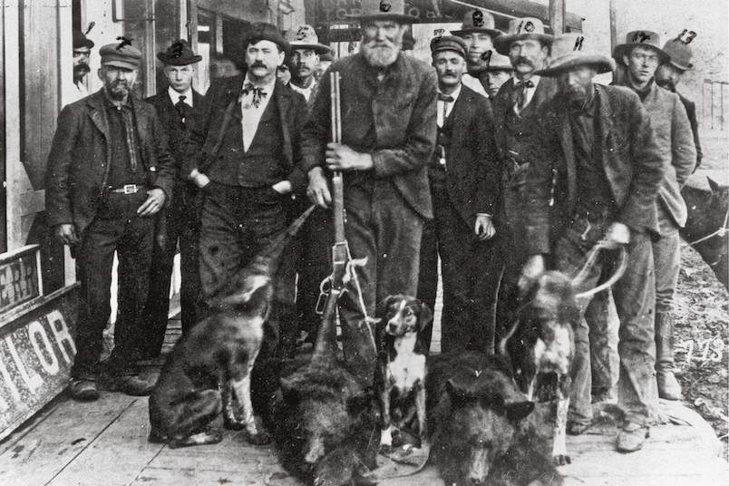
Butch Cassidy’s Childhood Home (Circleville/Panguitch)


I am obsessed with outlaw history and can’t get enough of Wild West lore. I wrote about Billy the Kid in my Las Cruces post, Bonnie & Clyde in my Louisiana post, Wyatt Earp in my Bisbee/Tombstone post, and I created a roundup of Flagstaff, Arizona outlaw folklore. Now in Utah, I have the privilege of visiting sites related to the infamous Butch Cassidy.
In addition to Cassidy Arch in Capitol Reef National Park and Grafton Ghost Town where the Robert Redford/Paul Newman movie was filmed, you can also visit Butch Cassidy’s childhood home in Circleville and search out Robber’s Roost near Hanksville.
While finding the alleged Robber’s Roost hideout location is a fun goal, I don’t know whether it’s worth it. Today, there is only a stone fireplace to mark the spot where the cabin supposedly stood. I have tried to research why exactly people think the fireplace is a relevant clue. Couldn’t this just be any old fireplace? I know the hideout existed in general, but is there any documentation or archaeological research to prove that this spot really is The Robber’s Roost from the stories? Who was the first to finally find it, since the lawmen never could in the 1800s? Did someone just assemble it ten years ago for tourism and start a rumor about its significance?
Butch Cassidy’s childhood home is legit, though. We have the census documentation to prove he lived at the cabin in Circleville at least between the ages of 14-18yo. Stopping at this historic site is a quick and easy detour on your way to Bryce Canyon, or for me, on the drive between Colorado City, AZ and Moab, UT.
Moab Museum and Moab Museum of Film (Moab)

The Moab Museum is dedicated to the history of the Canyonlands and Moab region of Southern Utah, from the indigenous peoples to the settlers. They also hold temporary exhibitions such as “Spirit and Grit: Ranching in the Canyonlands” and “Butch Cassidy Was Here: Historic Inscriptions of the Colorado Plateau”. Be sure to check their event calendar in case anything special is coming up while you’re in the Moab area. Entry is $10 for adults or $8 for seniors (62+), students, children, and active duty military. They’re open Tuesdays through Saturdays 10am-6pm.
Also in Moab you’ll find the Moab Museum of Film and Western Heritage at the Red Cliffs Ranch. They’re open 7 days a week from 8am-10pm and admission is free.
“In the late 1940s, the legendary John Ford discovered the rugged beauty of Moab’s Canyonlands and filmed the first of many movies here. The first major motion pictures filmed in the Moab area were set on Red Cliffs Ranch. Wagon Master, Rio Grande, Son of Cochise, Warlock, The Commancheros, Cheyenne Autumn and many others used the ranch and its magnificent scenery as a backdrop. John Wayne, Maureen O’Hara, Ben Johnson, Rock Hudson, Henry Fonda, Anthony Quinn, Lee Marvin, Richard Widmark, James Stewart and Richard Boone have all worked on location here at Red Cliffs Ranch. More recently, Geronimo, City Slickers and Thelma and Louise – along with other movies and more than 100 commercials – have all used the Moab area as a location.”
Moab Museum of Film and Western Heritage
Edge of the Cedars State Park Museum (Blanding)
Edge of the Cedars is similar to the Anasazi State Park Museum in Boulder, Utah in that it features Ancestral Puebloan ruins and a museum of artifacts, but this site in Blanding is more extensive. Here, you can “climb down a ladder to enter the 1,000-year-old kiva [and] view the largest collection of Ancestral Puebloan pottery on display in the Four Corners area.” I’m disappointed that I didn’t know about this site prior to my own trip through Blanding; thanks to John Meyer for the heads up about this one!
Safe Utah Sightseeing Destinations After Bad Weather
Rock Art Hunting (Everywhere)


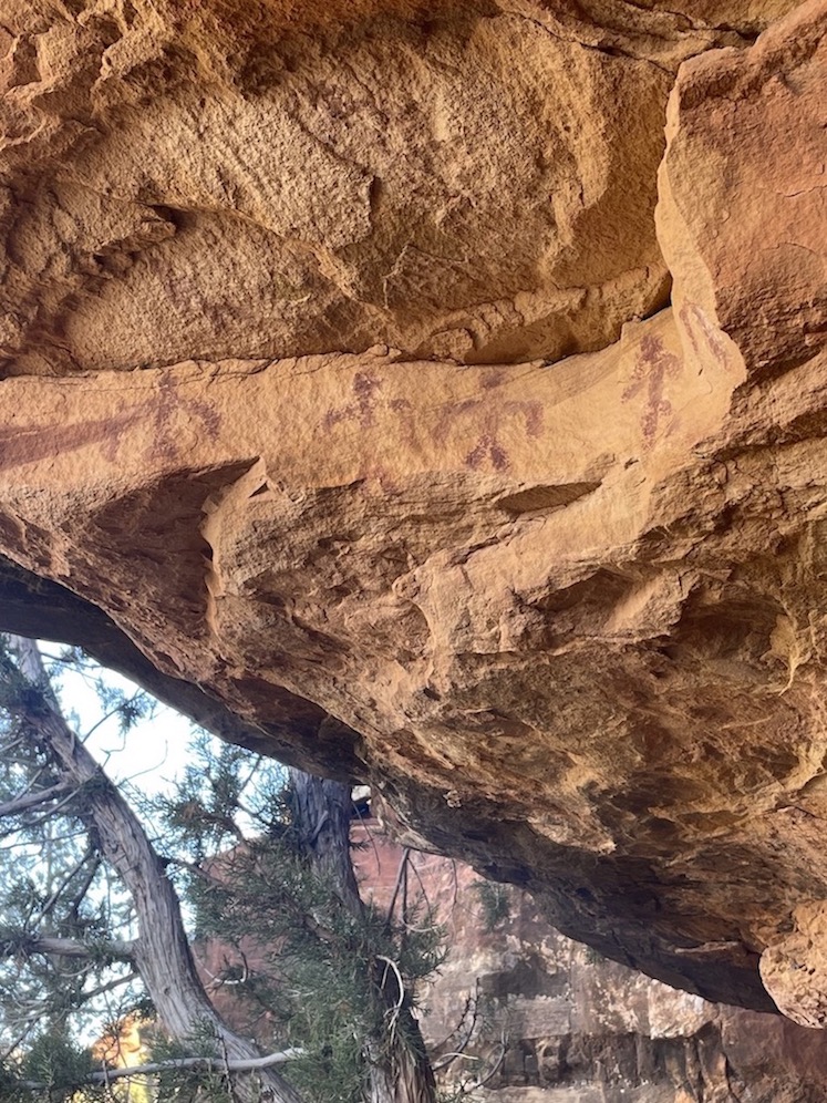


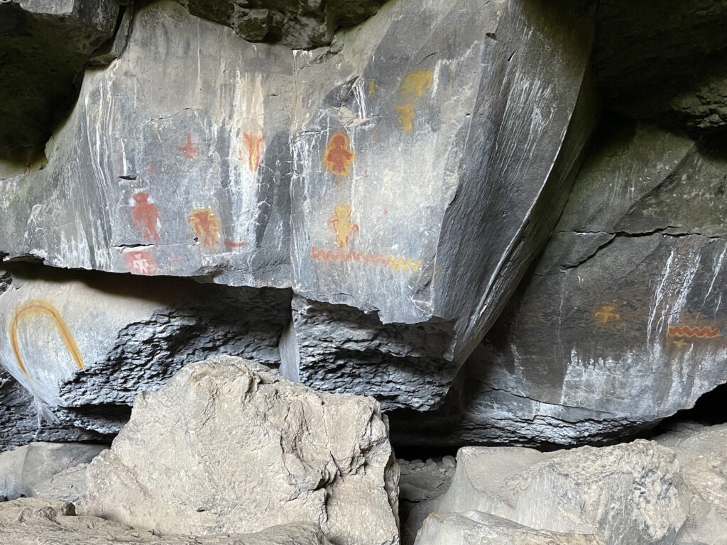
There are Native American petroglyphs (carvings) and pictographs (drawings) all throughout the desert Southwest. Many of them are featured on accessible and famous trails, so it doesn’t take a lot of effort to find them. In Southern Utah, one such site is the Potash Road dinosaur tracks and petroglyphs just off the road near Moab. Others are less conspicuous and require dedicated sleuthing to search them out. That’s where the fun lies!
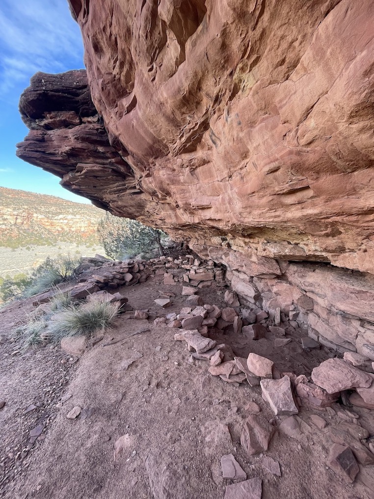
There was no trail to the petroglyph site in the gallery above, so I needed to scale a mountainside near Colorado City looking for coordinates. It was extremely rewarding to find the cliff dwelling under a rocky overhang alongside glyphs depicting people, animals, and dozens of baskets. Can you see the bow and arrow?
Beware that some petroglyph sites in Southern Utah will be located in remote areas down unmaintained roads, so you may still run into washouts after recent rains. I encountered this on my way to one site and decided to turn back and give it a few more days to dry out, but I lucked out finding the glyphs in the above photo gallery instead.
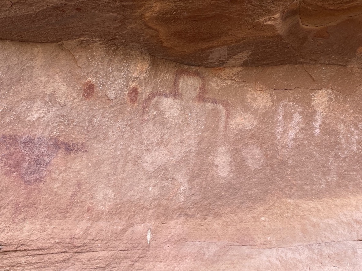
The gallery below shows a different site in Escalante, Utah, including a pictograph of many handprints side-by-side.


Moqui Sand Caves (Kanab)


The Sand Caves are listed online as being easily accessible by toddlers and families, so I thought surely getting to them would be no big deal. It turns out that you have to scale a slippery rock wall to reach the short trail to the caves. I should have taken a photo of the area where hikers ascend. Instead I snapped the vantage points in my gallery because the colors were pretty, but they make it look like you have a lot of traction, which you don’t. When I say slippery, I don’t mean because of rainfall (the rock face should dry quickly after rains), but because of lack of texture on the rock face. Maybe at one time there was more friction, but thousands of people have worn the rock down into a slip-n-slide by climbing it over the years. As a result, there are two spots that might be worrisome if you are afraid of heights; I saw a few people get “stuck” at each of these, uncertain how to continue forward. That said, I did also see a lot of families, young children, and people of all shapes and sizes, and distance-wise this is a very short trail that’s unlikely to exhaust anyone.
The caves are manmade and a crowded Instagram photo spot, so I thought I wouldn’t be able to get a photo without other people in it and thus didn’t feel like peer pressuring myself into scaling the slippery wall this particular day. If you do go for it, read a more thorough rundown about how to visit the Moqui Caverns Kanab Sand Caves.
Grosvenor Arch (Cannonville)
Grosvenor Arch is a towering rock formation in Grand Staircase-Escalante that is accessible on a very short, paved walkway after you park your car. If you’re jonesing to see Utah’s unique natural landscapes but the weather is not cooperating to allow a hike, thankfully there are sites like this to scratch the itch. Trail reports attest that the dirt road to get there from Kodachrome Basin State Park is generally in great condition, though you may encounter a small washout and prefer 4WD. Of course, it’s better to heed Park Service warnings over AllTrails user reports.
“At the turnoff to Kodachrome, the map said to continue straight but the highway turns to dirt. There was a sign saying ‘Road Closed’ due to recent precipitation. We thought, ‘what do they know?’ and pressed forward. Other than a small creek that we had to cross (1-2″ deep), it was ten miles of the best dirt road I’ve ever been on. Very smooth and wide.”
AllTrails user
“From Kodachrome State Park, it’s a 10 mile drive on a dirt road. There’s a sign that says ‘impassable when wet’. There was one section that you did drop down to a river crossing. Overall the road is in good condition.”
Alltrails user
Monument Valley and Valley of the Gods (Mexican Hat)


The dramatic sandstone buttes of Monument Valley overlap southeastern Utah and northern Arizona. Valley of the Gods in Utah, a 17-mile scenic driving loop, is known as a “miniature Monument Valley” and could be visited in the same day. The Bureau of Land Management says the Valley of the Gods loop “is suitable for passenger cars when the road conditions are dry. However, road conditions vary throughout the year with regional weather conditions. Local inquiry should be made during and after periods of inclement weather.” Between the two, Monument Valley is likely the safer bet in bad conditions. The town of Mexican Hat is also quite scenic to drive through, though there’s nothing much to do there besides checking out the scenic vista as Goosenecks State Park.
Most people simply drive through Monument Valley to admire the landscape, as I casually did while briefly passing through in 2019; please forgive the grainy out-the-window pictures. A snowstorm brewed over Monument Valley as the sun rose. If you’re there during strange weather, you can expect to take some moody shots. If you’re interested in a more immersive experience, Navajo Nation Parks & Recreation keeps a list of tour operators you can hire for guided trips in Monument Valley.
Coral Pink Sand Dunes (Kanab)
I waffled back and forth about including Coral Pink Sand Dunes as a bad weather activity suggestion. At first, I thought this state park ought to be relatively safe after heavy rains because the idea is to play in the sand, not to teeter on the edge of slippery cliffside hiking trails or wedge yourself between rock walls while torrents of water pool around you. The rainy day came where I planned to visit the park myself, and I realized that trying to sled down dunes that have turned into mud sounds incredibly unappealing, so I didn’t go. Finally, I noticed on the Kanab website that Coral Pink Sand Dunes is listed by the city as a good rainy day activity. They suggest taking the scenic drive and “between breaks in the clouds, build sand castles and take advantage of Kodak Moments with fog looming over the red sands!” The locals know best, so on the list it goes!
The day use fee to visit Coral Pink Sand Dunes State Park is $10 per vehicle if you don’t have a Utah State Parks Pass.
🏨 Search budget hostels in Utah or standard hotel options in St. George. Better yet, embrace the wet in a safe environment by staying at St George hotels with indoor pools!
✈️ Coming to Utah from further afield? Use an Airalo eSIM for affordable international cell data and don’t forget to protect your investment with travel insurance.
There are so many things to do in Southern Utah that I expect to update this post regularly as I continue to scout the area and make repeated visits. Over the next few weeks I hope to add more rainy weather hiking trail suggestions in Arches and Canyonlands. While I personally like to make cautious choices during and after bad weather and prefer to avoid icy trails when possible, I know other people grab the bull by the horns and enjoy the extra dose of risk and adventure associated with adverse weather. To that end, your own list of things to do in Southern Utah after bad weather might look very different from mine. Have you experienced any fun rainy day activities in Utah?
Related:


Pin It:

My dream is to write travel and hiking content full-time. All of my guides and itineraries are free and my travels are self-funded. If you enjoy my site and would like to support, you can donate any amount to my Ko-fi page. Thank you!!
Super breakdown here; many of use forget to plan when it comes to hiking, especially after rough weather. Muddy trails, dangerous inclines and general tough terrain needs to be taken into account when hiking through spots….especially when in rural or remote areas like Southern Utah.
Ryan
Thanks Ryan! Yeah every wilderness area has its own issues when it comes to climate and terrain. I think people forget that strange weather events they’re not used to planning for in their home environment can create hiccups, especially on hiking trips.
These are excellent ideas even if it isn’t raining. I wish I would’ve known about a few of them when I visited Kanab. You give so much useful information about each place, it will be easy to explore.
I love searching for petroglyphs in Utah, so it was great to hear your story about them.
These are excellent ideas even if it isn’t raining. I wish I would’ve known about a few of them. When I visited Kanab you give so much useful information about each place, it will be easy to explore.
I love searching for petroglyphs in Utah, so it was great to hear your story about them.
Wow! Obviously you don’t want bad weather on vacation but you sure found a lot to do. You’ve made me add Utah to my bucket list.
Very cool places to explore! I’d love to check out that ghost town.
Grafton is in such an idyllic looking location too (if we didn’t know any better) – aside from the floods it’s like paradise, I can see why they wanted to live there!
Blooming ‘eck Claire! When you get writing you reeeeally get writing. There is soooo much here! Every single one of these trails looks incredible – it’s kind of mad that you might have missed out on them if the weather was better – I guess that is the true joy of being open to detours.
I LOVED following your adventures finding the petroglyphs on insta and your descriptions are really helpful. You make me enthusiastic for desert scenery.
P.s. I am glad you can acknowledge you can peer pressure yourself into dangerous situations sometimes. I think it is really important to acknowledge some detours are just better to save for other safer days. It’s always okay to turn back due to mud/slip and slides or when you see dodgy weather in the forecast.
Thanks Josy! Yeah I figured if people are needing a rainy weather itinerary, they might need a whole lengthy multi-day itinerary in case the rain doesn’t stop lol. Or depending on what part of Utah they’re in – Moab is so far from St George!
Agreed, that’s a great point about peer pressure. Especially in cases where people won a permit in a lottery and can only hike on the exact day they got the permit for, and then the date rolls around and the weather is bad, it can be hard to forego the opportunity. But better safe than sorry.